MyTopo
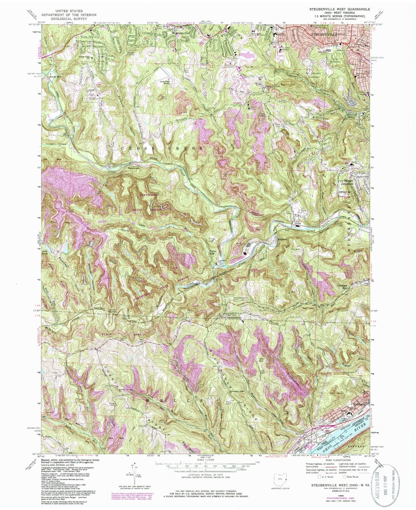
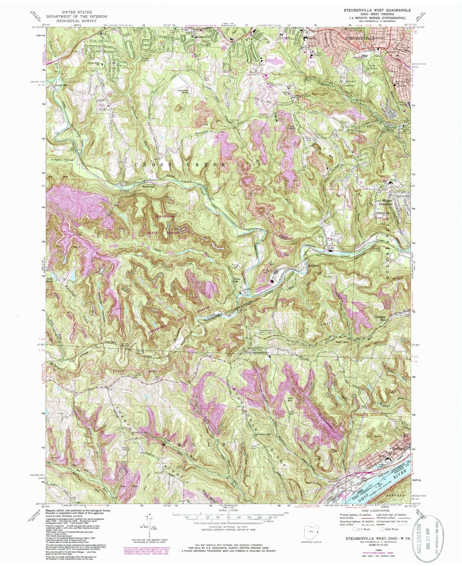
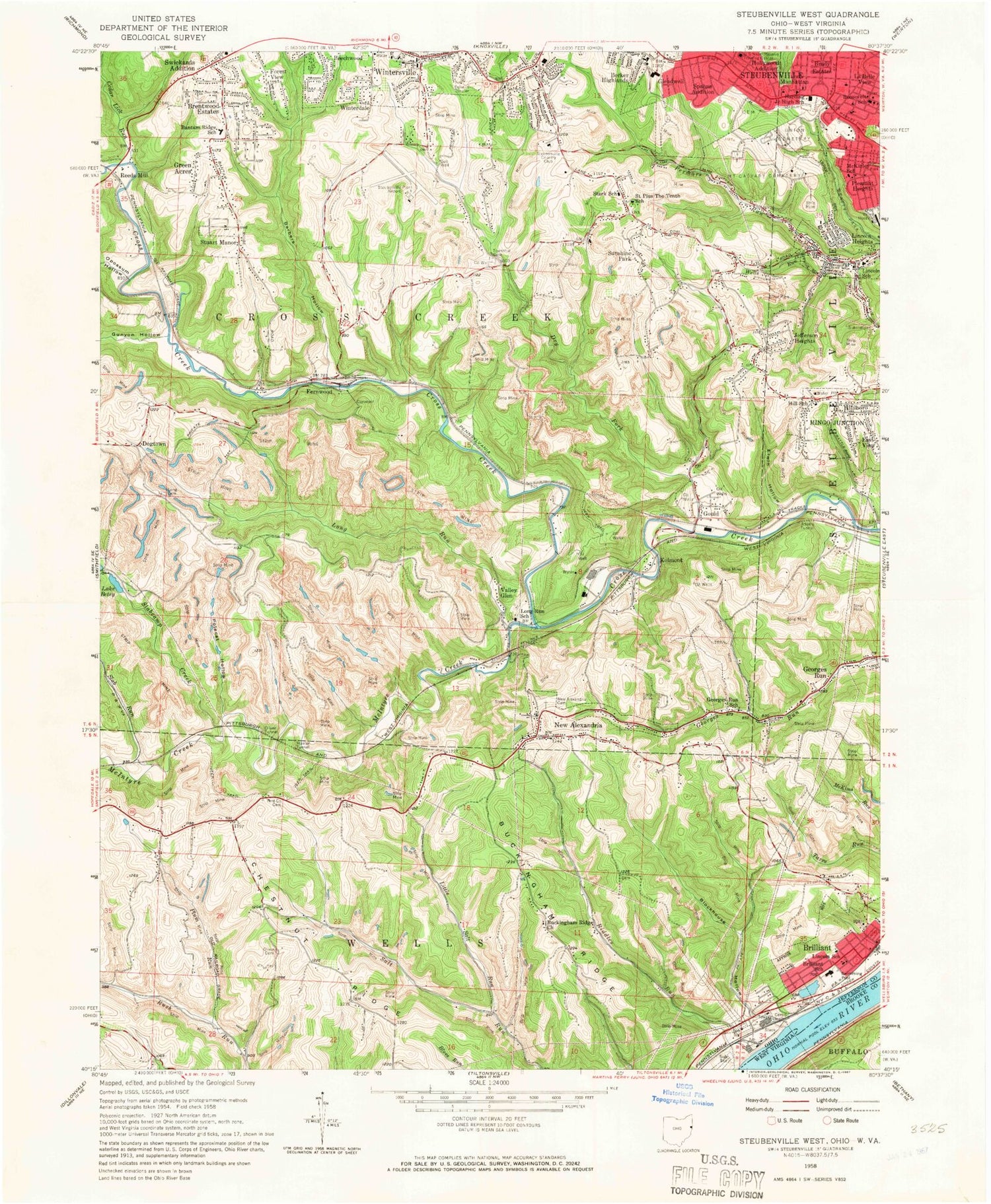
Classic USGS Steubenville West Ohio 7.5'x7.5' Topo Map
Couldn't load pickup availability
Historical USGS topographic quad map of Steubenville West in the state of Ohio. Typical map scale is 1:24,000, but may vary for certain years, if available. Print size: 24" x 27"
This quadrangle is in the following counties: Brooke, Jefferson.
The map contains contour lines, roads, rivers, towns, and lakes. Printed on high-quality waterproof paper with UV fade-resistant inks, and shipped rolled.
Contains the following named places: Adams Tunnel, Barbers Hollow, Lake Betsy, Blockhouse Hollow, Buckingham Ridge, Buckingham Ridge Church, Central High School, Erwin Hollow, Gould Tunnel, Gunyon Hollow, Hunter Tunnel, Lincoln School Number 2, Long Run, Long Run School, Mount Calvary Cemetery, New Alexandria, New Alexandria Cemetery, Trinity Medical Center East, Oliver Cemetery, Oliver Tunnel, Plum Run, Polecat Hollow, Roosevelt School, Slabcamp Creek, Tent Church Cemetery, Union Cemetery, Georges Run, Kolmont, Valley Glen, Possum Hollow Run, Gungeon Hollow Run, Fernwood State Forest, Barbers Run, New Alexandria Elementary School, Fort Steuben Mall Shopping Center, Schiappa Memorial Library, Wintersville Elementary School, Blockhouse Run, Holy Rosary School, Bnai Israel Cemetery, Saint John Community Arena, Harding Stadium, McKinley Elementary School, Harding Middle School, Hollywood Shopping Center, Lincoln School Number 1, Little Salt Run, Trinity Medical Center West, Slab Run, Stark School, Saint Pius the Tenth School, Reeds Mill, Brentwood Estates, Fells (historical), Sunshine Park, Stuart Manor, Fernwood, Pleasant Heights, Becker Highlands, Church of the United Brethren in Christ, East View, First Baptist Church of Steubenville, First Church of the Nazarene, Fishersville, Forest View, Gospel Hall Church, Grace Evangelical Lutheran Church, Green Acres, Harts Shopping Center, Hillsboro, Holy Rosary Catholic Church, Jefferson Heights, Kolmont Community Church, La Belle View Church of Christ, La Belle View United Methodist Church, Starkdale Presbyterian Church, Steubenville Seventh Day Adventist Church, Wintersville Baptist Temple, Wintersville United Methodist Church, Brilliant, Gould, Raynes Church, Steubenville, Lincoln Heights, Cedar Lick Run, Chestnut Ridge, Dry Fork, Riddles Run, Wells Run, McIntyre Creek, Malabu Lake Dam, Malabu Lake, Mingo Sportsmens Club Lake Number, Cardinal Fly Ash Retention Dam, Cardinal Fly Ash Retention Reservoir, Beatty Park Number 1, Steubenville Country Club, Bantam Ridge Elementary School, Brilliant Elementary School, Hills Elementary School, Brilliant Post Office, Jefferson County Airpark, Saint John Medical Center Heliport, McCollough Childrens Home, Brady Estates, Dogtown (historical), Georges Run School (historical), Glendwell, Hollywood Addition, Spahns Addition, Swickards Addition, Winterdale, Township of Cross Creek, City of Steubenville, Township of Steubenville, Township of Wells, Buckingham Cemetery, Cross Creek Presbyterian Cemetery, Hill Cemetery, Long Cemetery, Fernwood Post Office (historical), Fells Post Office (historical), Georges Run Post Office (historical), Gould Post Office (historical), New Alexandria Post Office (historical), Reeds Mills Post Office (historical), Cardinal Power Plant, Brilliant Census Designated Place, Village of New Alexandria, Steubenville Fire Department Pleasant Heights Station 3, Hillndale Volunteer Fire Department, New Alexandria Volunteer Fire Department, Brilliant Volunteer Fire Department, Ambulance Service, Wintersville Wastewater Treatment Plant, Ohio State Highway Patrol - Steubenville Patrol Post, Life Line Hospital, Acuity Specialty Hospital - Ohio Valley at Steubenville