MyTopo
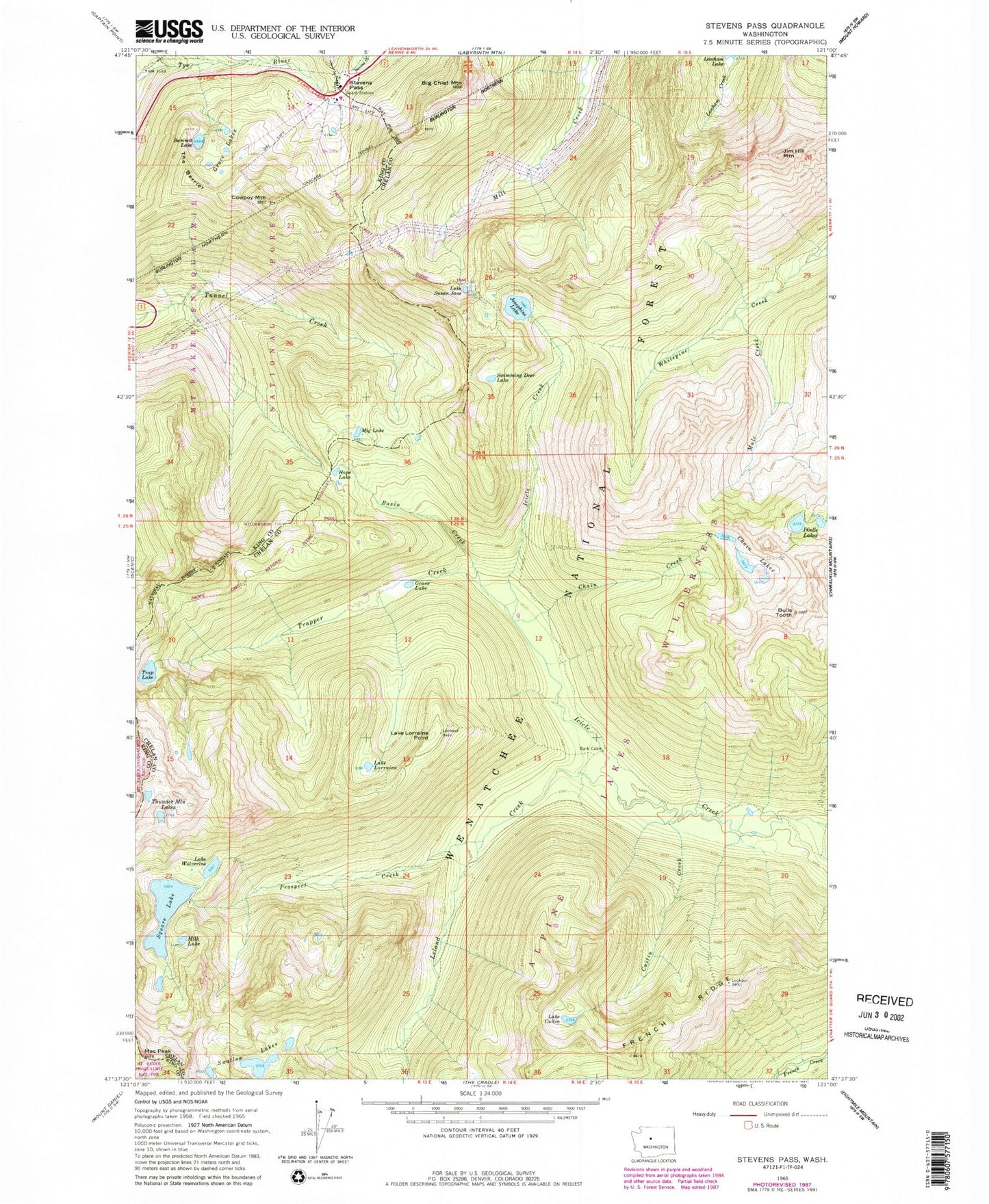
Classic USGS Stevens Pass Washington 7.5'x7.5' Topo Map
Couldn't load pickup availability
Historical USGS topographic quad map of Stevens Pass in the state of Washington. Typical map scale is 1:24,000, but may vary for certain years, if available. Print size: 24" x 27"
This quadrangle is in the following counties: Chelan, King.
The map contains contour lines, roads, rivers, towns, and lakes. Printed on high-quality waterproof paper with UV fade-resistant inks, and shipped rolled.
Contains the following named places: Bark Cabin, Basin Creek, Big Chief Mountain, Bulls Tooth, Cascade Tunnel, Chain Creek, Chain Lakes, Cowboy Mountain, Cuitin Creek, Lake Cuitin, Doelle Lakes, Doughgod Creek, Grace Lakes, Grass Lake, Hope Lake, Jim Hill Mountain, Josephine Lake, Lake Lorraine Point, Leland Creek, Lake Lorraine, Mac Peak, Mig Lake, Milk Lake, Mule Creek, Prospect Creek, Square Lake, Stevens Pass, Summit Lake, Lake Susan Jane, Swallow Lakes, Swimming Deer Lake, The Barrier, Thunder Mountain Lakes, Trap Lake, Trapper Creek, Lake Wolverine, Steven Pass Org Site, Stevens Pass Guard Station, Pacific Crest Trailhead, Tye, Square Lake Dam, Stevens Pass Recreation Area, New Cascade Tunnel