MyTopo
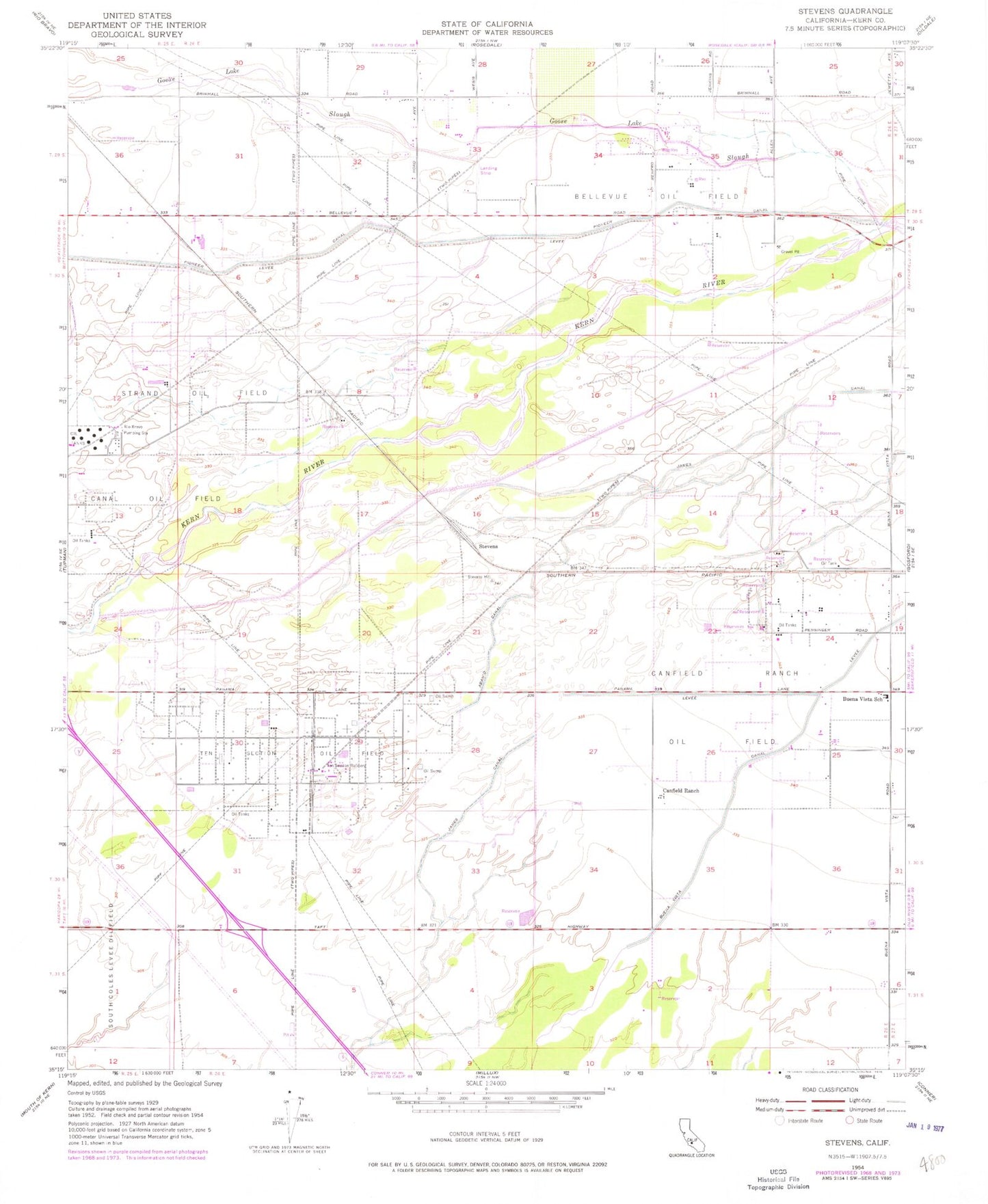
Classic USGS Stevens California 7.5'x7.5' Topo Map
Couldn't load pickup availability
Historical USGS topographic quad map of Stevens in the state of California. Map scale may vary for some years, but is generally around 1:24,000. Print size is approximately 24" x 27"
This quadrangle is in the following counties: Kern.
The map contains contour lines, roads, rivers, towns, and lakes. Printed on high-quality waterproof paper with UV fade-resistant inks, and shipped rolled.
Contains the following named places: Bakersfield Fire Department Station 15, Bakersfield Police Department West Side Substation, Bellevue Oil Field, Buena Vista Canal, Buena Vista Elementary School, Canal Oil Field, Canfield Ranch, Canfield Ranch Oil Field, Cross Valley Canal, James Canal, Joe Gottlieb Field Airport, Kern County Fire Department Station 67 Rosedale, Munzer School, Pioneer Canal, Rio Bravo Pumping Station, Stevens, Strand, Strand Oil Field, Ten Section Oil Field, Ten Section Refinery