
MyTopo
Classic USGS Stevenson Alabama 7.5'x7.5' Topo Map
Couldn't load pickup availability
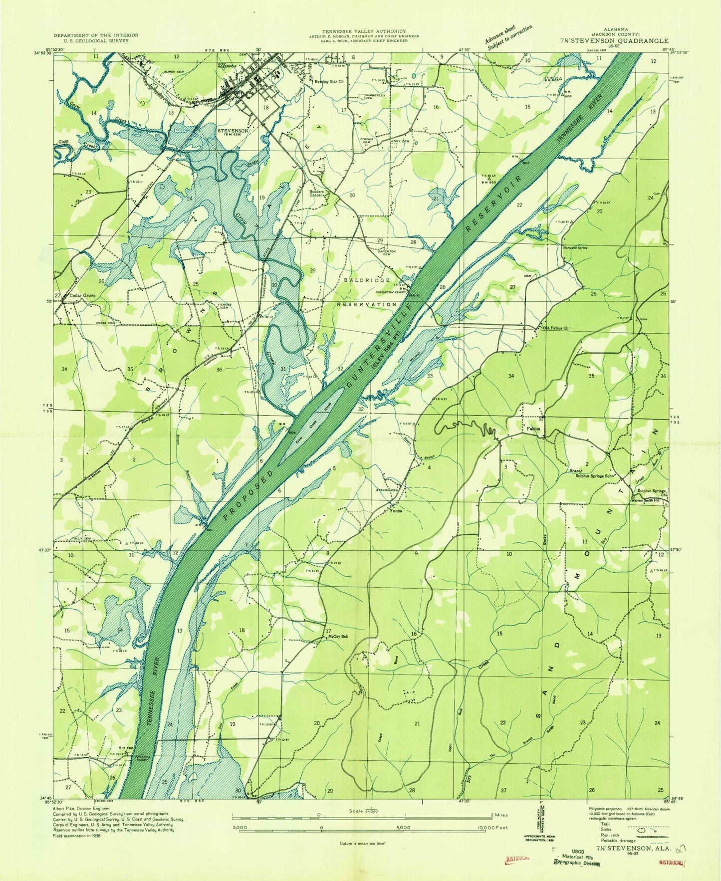
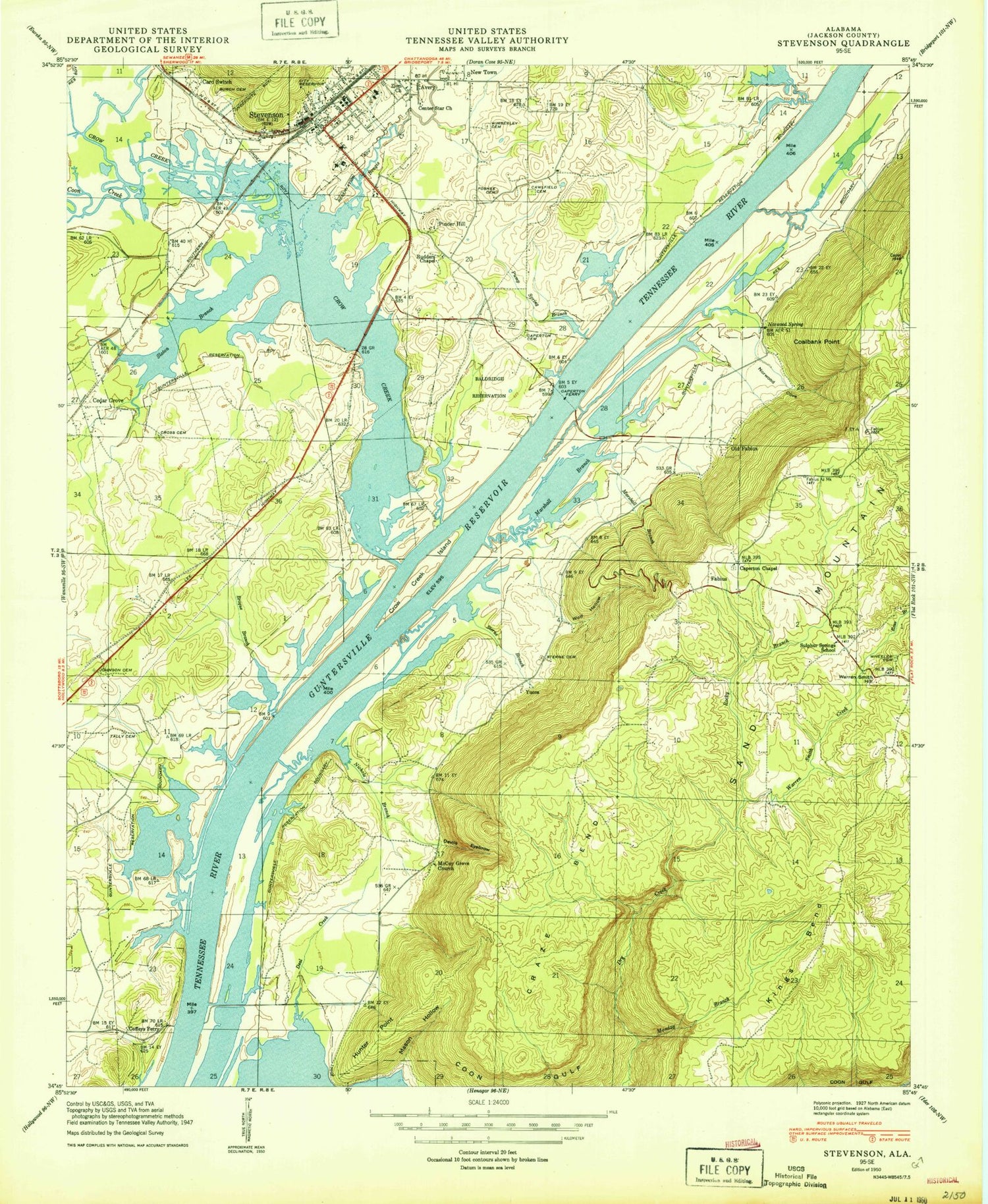
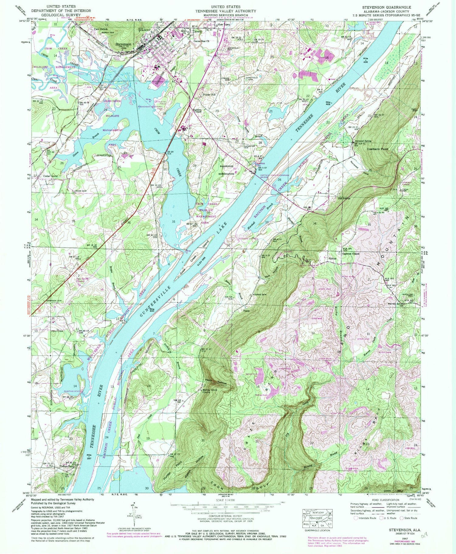
Historical USGS topographic quad map of Stevenson in the state of Alabama. Map scale may vary for some years, but is generally around 1:24,000. Print size is approximately 24" x 27"
This quadrangle is in the following counties: Jackson.
The map contains contour lines, roads, rivers, towns, and lakes. Printed on high-quality waterproof paper with UV fade-resistant inks, and shipped rolled.
Contains the following named places: Baldridge Reservation, Bengis Creek, Brogue Branch, Burch Cemetery, Cameronsville School, Campbell Chapel, Caperton Cemetery, Caperton Chapel, Caperton Ferry, Captain John Snodgrass Bridge, Card Switch, Cawlfield Cemetery, Cedar Grove, Center Star Missionary Baptist Church, Church of Christ, Coalbank Point, Coffee Bend Bar, Coffey Cemetery, Coffeys Ferry, Coon Creek, Craze Bend, Cross Cemetery, Crow Bar, Crow Creek, Crow Creek Island, Crow Creek Wildlife Management Area, Cumberland Church, Deal Creek, Devils Hollow, Fabius, First United Methodist Church of Stevenson, Foshee Cemetery, Hunter Point, Hymer, Johnson Cemetery, Kings Bend, Marshall Branch, Mason Hollow, McCoy Grove Church, McCoy School, Monday Branch, Mud Creek Public Shooting Area, New Town, Nichols Branch, Norwood Cove, Norwood Spring, Oak Grove Church, Old Fabius, Old Fabius Church, Pinder Hill, Pump Spring Branch, Raccoon Creek Public Hunting Area, Rocky Branch, Ross Branch, Rudders Chapel, Rudders Ferry, Slaton Branch, Sterne Branch, Sterne Cemetery, Stevenson, Stevenson High School, Stevenson Historic District, Stevenson Municipal Park, Stevenson Police Department, Stevenson Post Office, Stevenson Volunteer Fire Department Station 2, Stevenson Volunteer Fire Department Station 3, Sulphur Springs Church, Sulphur Springs School, Tally Cemetery, Warren Smith Creek, Warren Smith Hill, Wheeler Cemetery, Wimberley Cemetery, Wolf Hollow, WVSV-FM (Stevenson), Yucca, Zion Church