MyTopo
Classic USGS Steverson Lake Nebraska 7.5'x7.5' Topo Map
Couldn't load pickup availability
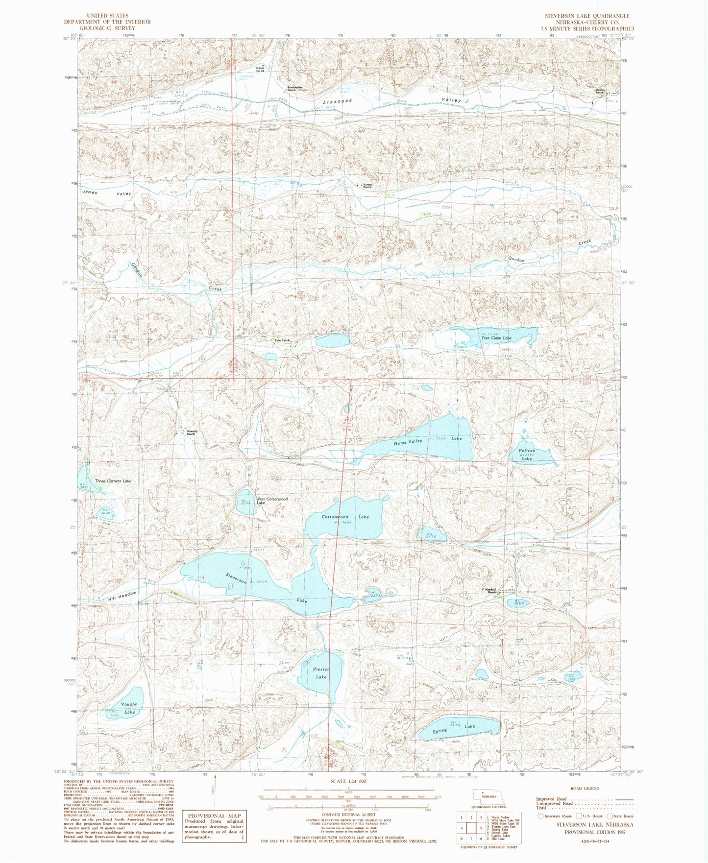
Historical USGS topographic quad map of Steverson Lake in the state of Nebraska. Map scale may vary for some years, but is generally around 1:24,000. Print size is approximately 24" x 27"
This quadrangle is in the following counties: Cherry.
The map contains contour lines, roads, rivers, towns, and lakes. Printed on high-quality waterproof paper with UV fade-resistant inks, and shipped rolled.
Contains the following named places: Arkansas Valley, Brockmoller Ranch, Cole Ranch, Cottonwood Lake, Downing Ranch, F Marshall Ranch, Hill Meadow, Home Valley Lake, Knudsen Ranch, Kramer Ranch, Pelican Lake, Piester Lake, Saults Ranch, School Number 21, School Number 94, Sively Lake, South School Number 135, Spring Lake, Steverson Lake, Three Corners Lake, Tree Claim Lake, Vaughn Lake, West Cottonwood Lake