MyTopo
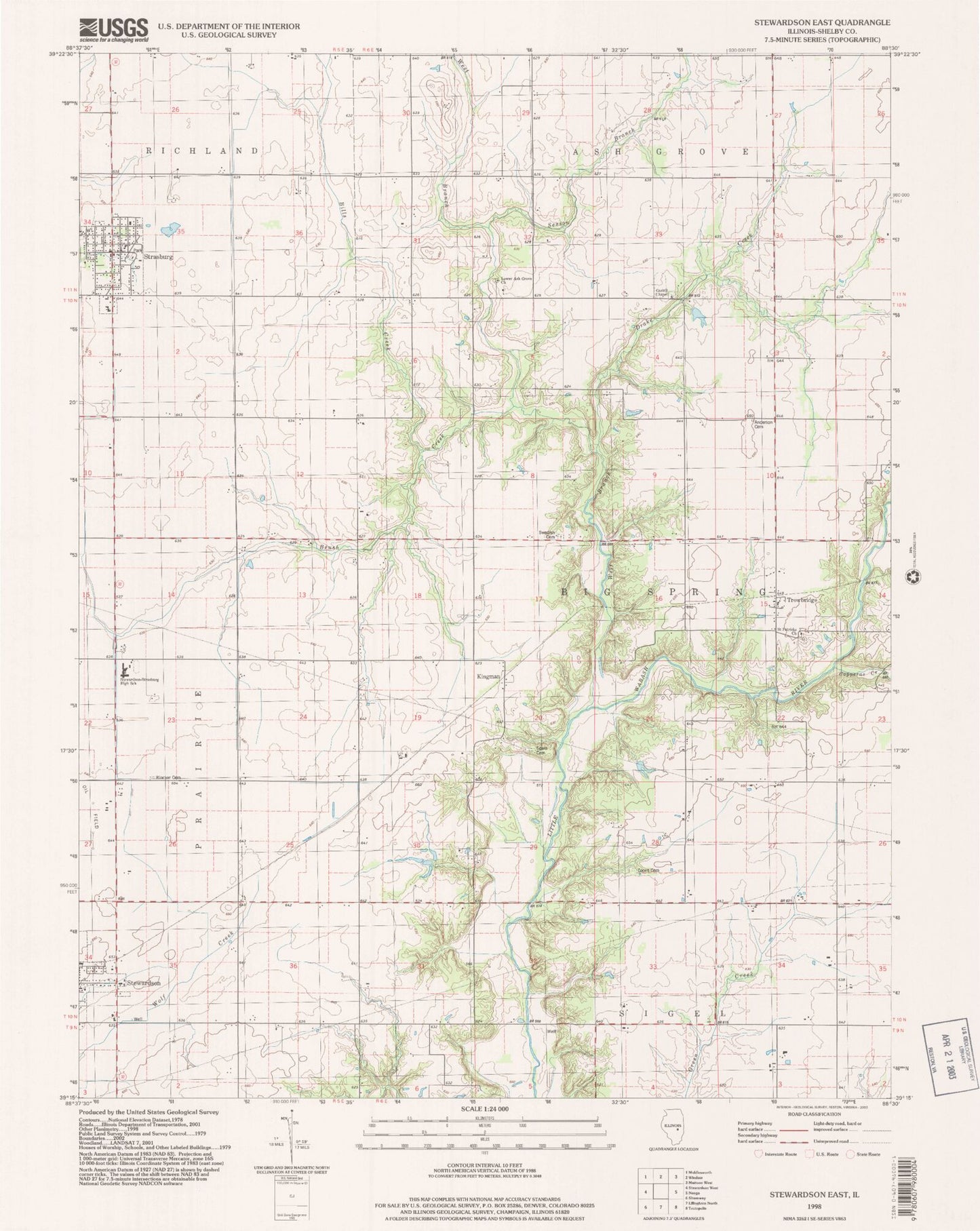
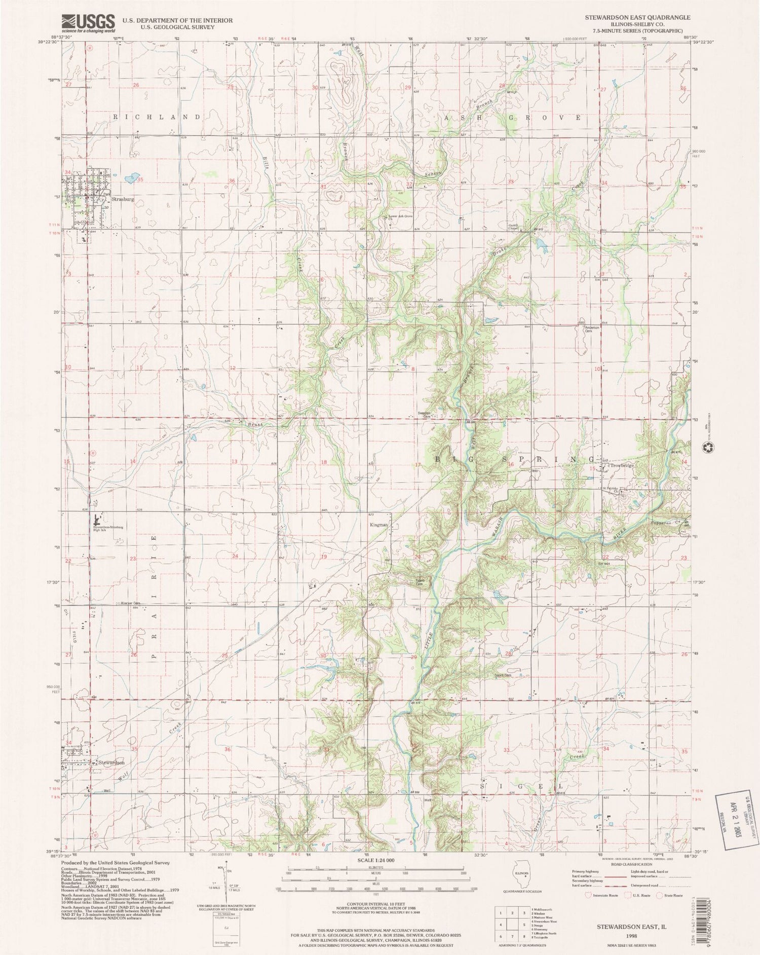
Classic USGS Stewardson East Illinois 7.5'x7.5' Topo Map
Couldn't load pickup availability
Historical USGS topographic quad map of Stewardson East in the state of Illinois. Map scale may vary for some years, but is generally around 1:24,000. Print size is approximately 24" x 27"
This quadrangle is in the following counties: Shelby.
The map contains contour lines, roads, rivers, towns, and lakes. Printed on high-quality waterproof paper with UV fade-resistant inks, and shipped rolled.
Contains the following named places: Anderson Cemetery, Big Spring Post Office, Bills Creek, Brush Creek, Center School, Coons Cemetery, Copperas Creek, Drake Creek, Gaskill Cemetery, Gaskill Chapel, Grace Lutheran Church, Hiatt School, Kingman, Liberty Church, Lower Ash Grove Cemetery, Lower Ash Grove Church, Neoga Church, Rincker Cemetery, Saint Patricks Cemetery, Saint Patricks Church, Sexson Branch, South Strasburg, Spain Cemetery, Stewardson-Strasburg High School, Strasburg, Strasburg Fire Protection District, Strasburg Post Office, Strasburg United Methodist Church, Swedish Lutheran Cemetery, Township of Big Spring, Trinity Lutheran Church, Trinity Lutheran School, Trowbridge, Union School, Village of Strasburg, Wabash School, West Branch Little Wabash River, Wittenberg Airport, ZIP Code: 62463