MyTopo
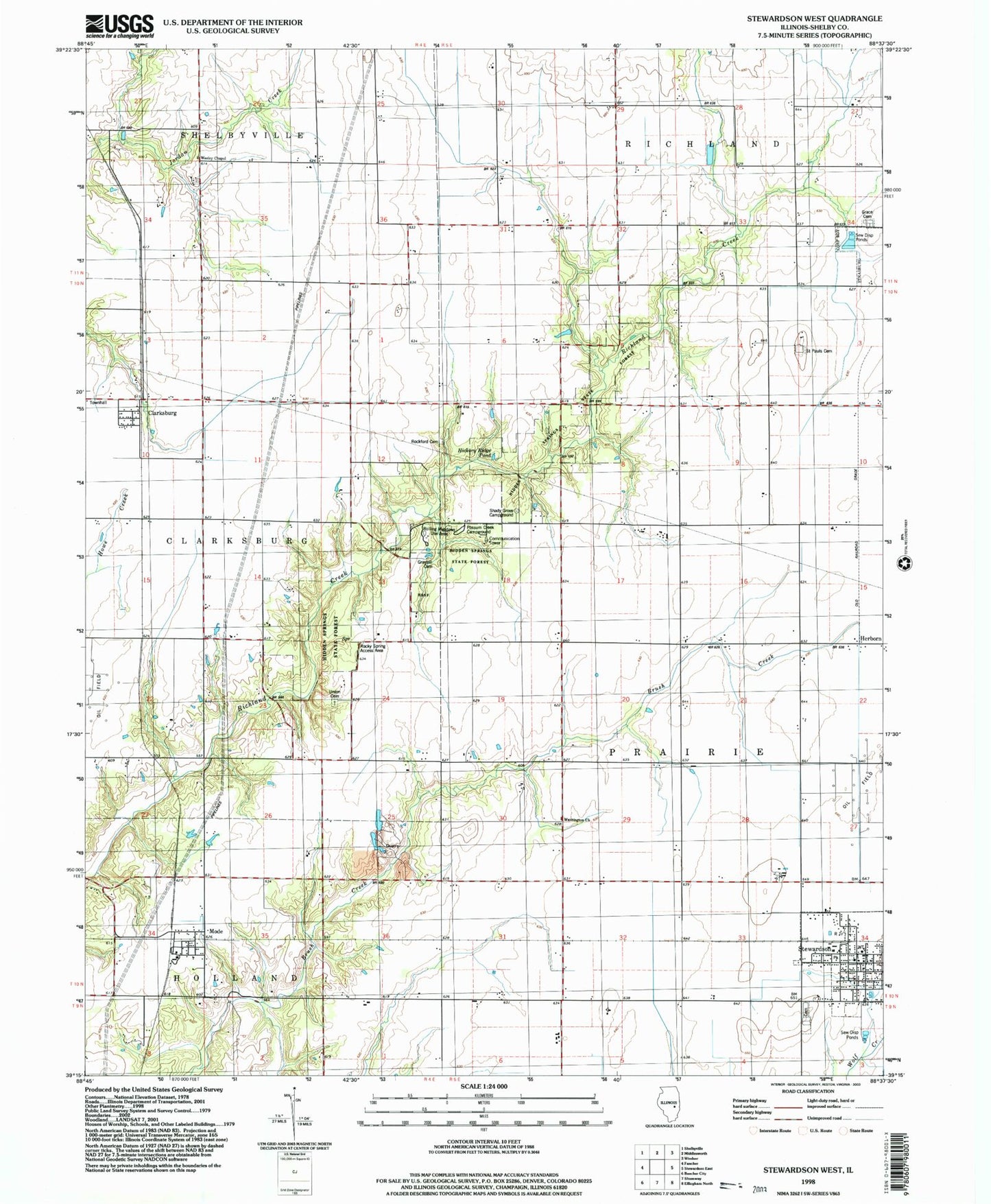
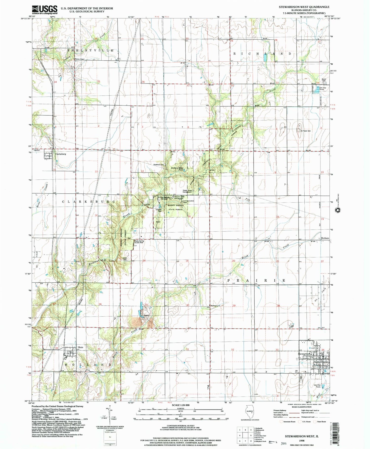
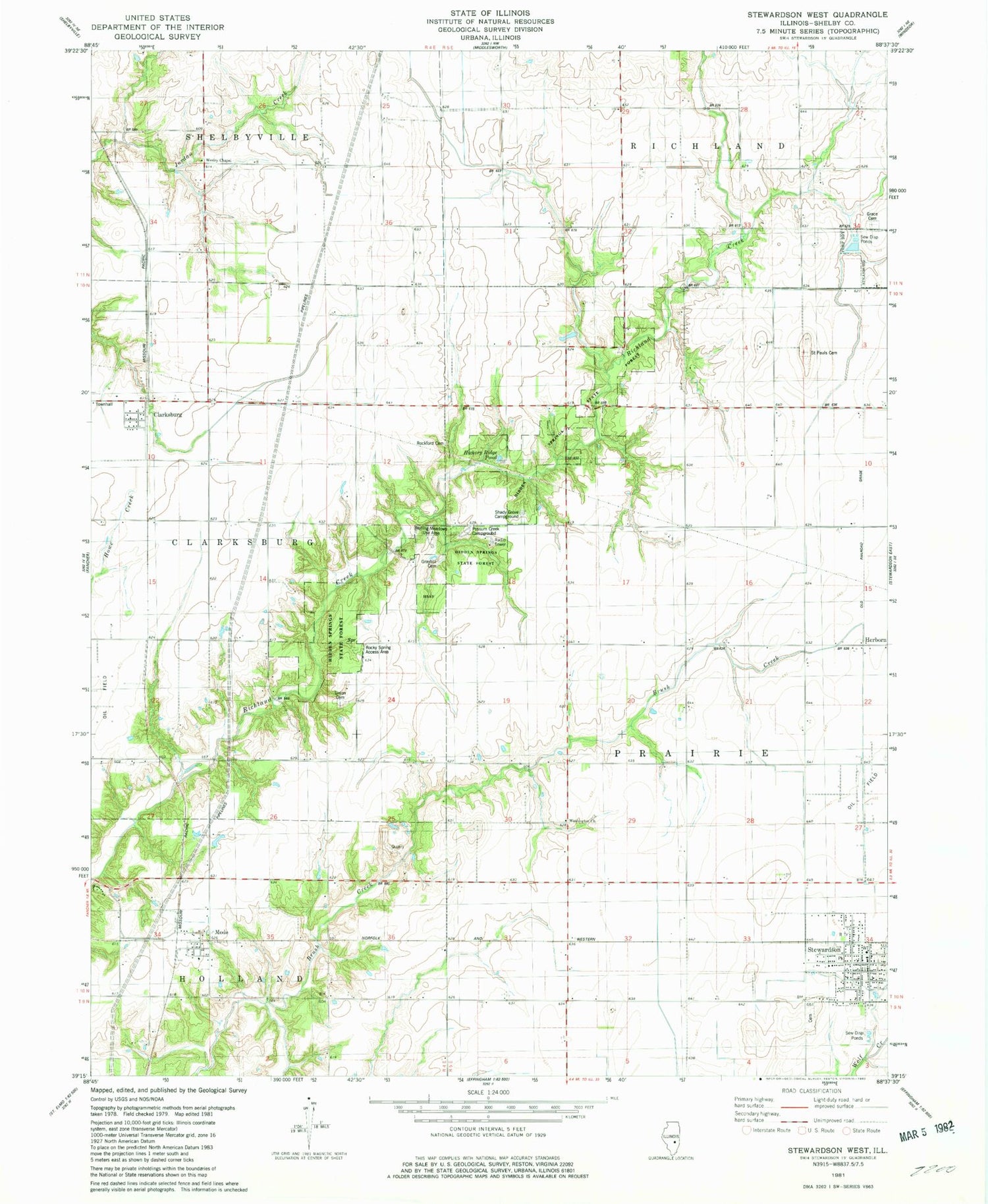
Classic USGS Stewardson West Illinois 7.5'x7.5' Topo Map
Couldn't load pickup availability
Historical USGS topographic quad map of Stewardson West in the state of Illinois. Map scale may vary for some years, but is generally around 1:24,000. Print size is approximately 24" x 27"
This quadrangle is in the following counties: Shelby.
The map contains contour lines, roads, rivers, towns, and lakes. Printed on high-quality waterproof paper with UV fade-resistant inks, and shipped rolled.
Contains the following named places: Bass Lake, Bass Lake Dam, Brush Creek Quarry, Clarksburg, Clarksburg Townhall, East Salem School, Grace Cemetery, Graybill Cemetery, Herborn, Hickory Ridge Pond, Hidden Springs State Forest, Holland School, Mode, Mode Post Office, Possum Creek Campground, Rockford Cemetery, Rockford Church, Rockford School, Rocky Spring Access Area, Rolling Meadows Use Area, Saint Paul Cemetery, Seventh Day Adventist Church, Shady Grove Campground, Stewardson, Stewardson Cemetery, Stewardson Fire and Ambulance Protection District, Stewardson Post Office, Stewardson United Methodist Church, Township of Prairie, Union Cemetery, Union Church, Village of Stewardson, Washington Church, Wesley Chapel, Whitlatch School, ZIP Codes: 62444, 62465