MyTopo
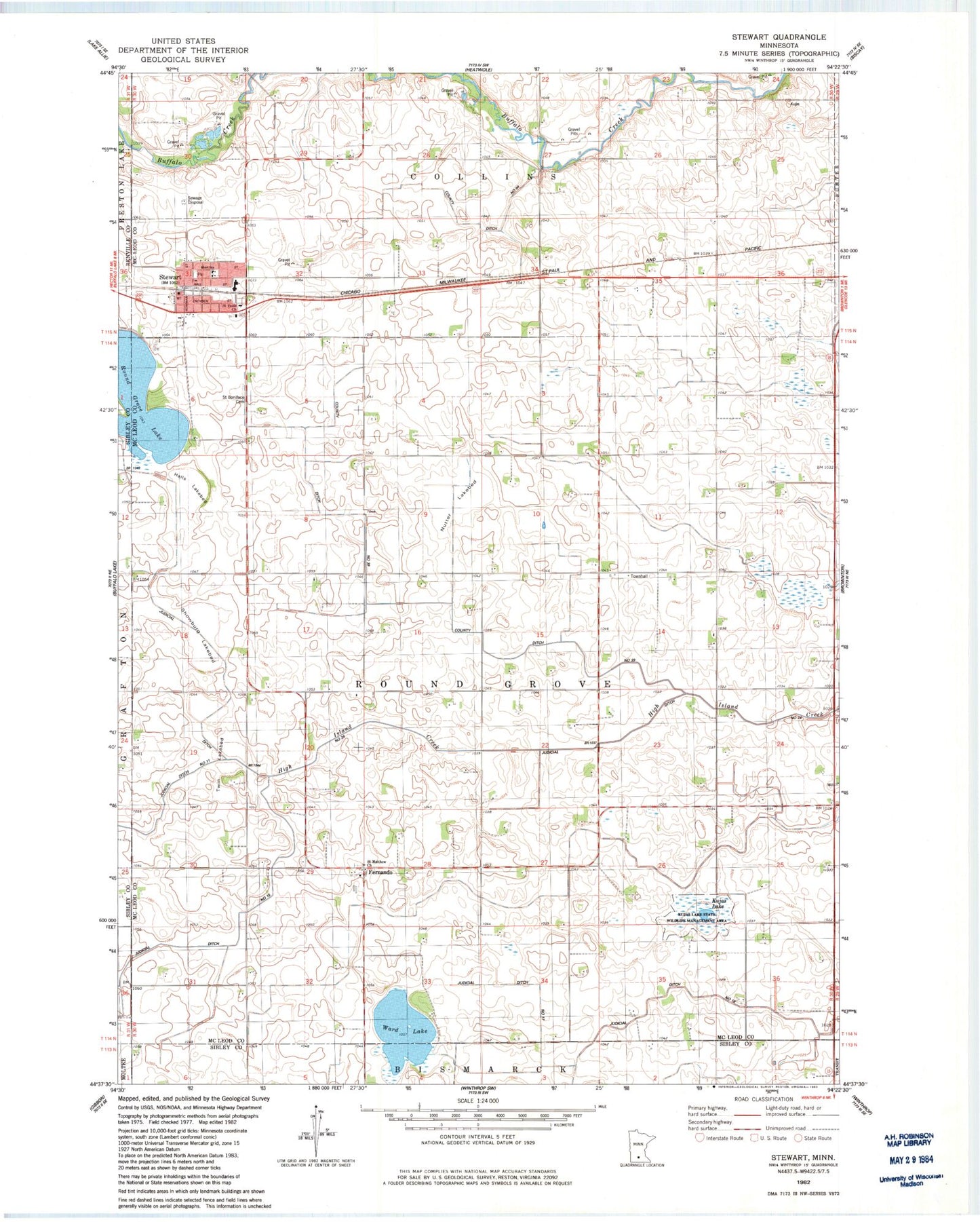
Classic USGS Stewart Minnesota 7.5'x7.5' Topo Map
Couldn't load pickup availability
Historical USGS topographic quad map of Stewart in the state of Minnesota. Map scale may vary for some years, but is generally around 1:24,000. Print size is approximately 24" x 27"
This quadrangle is in the following counties: McLeod, Renville, Sibley.
The map contains contour lines, roads, rivers, towns, and lakes. Printed on high-quality waterproof paper with UV fade-resistant inks, and shipped rolled.
Contains the following named places: City of Stewart, County Ditch Number Sixtyfour, County Ditch Number Thirtynine, Draeger Cemetery, Fernando, Fernando Post Office, Glencoe Regional Health Services Center, Halls Lakebed, Judicial Ditch Number Fifteen, Judicial Ditch Number Seventeen, Kujas Lake, Kujas Lake State Wildlife Management Area, Nutter Lakebed, Remus Trailer Lots, Round Grove Cemetery, Round Grove Lake, Round Grove Lake Dam, Saint Boniface Cemetery, Saint Matthew Church, Saint Matthew's Cemetery, Showburg Lakebed, Stewart, Stewart Fire Department, Stewart Police Department, Stewart Post Office, Stewart Village Hall, Township of Round Grove, Twin Lakebed, Ward Lake, ZIP Code: 55385