MyTopo
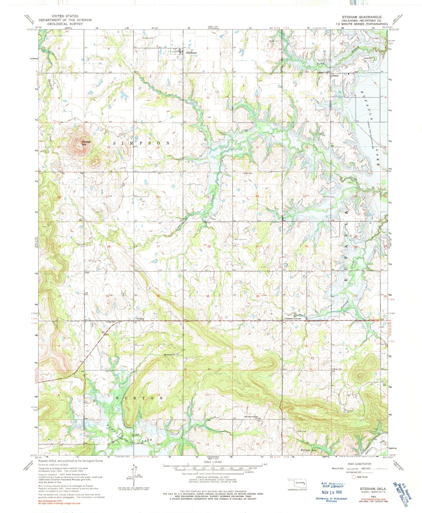
Classic USGS Stidham Oklahoma 7.5'x7.5' Topo Map
Couldn't load pickup availability
Historical USGS topographic quad map of Stidham in the state of Oklahoma. Map scale may vary for some years, but is generally around 1:24,000. Print size is approximately 24" x 27"
This quadrangle is in the following counties: McIntosh.
The map contains contour lines, roads, rivers, towns, and lakes. Printed on high-quality waterproof paper with UV fade-resistant inks, and shipped rolled.
Contains the following named places: Artussee Indian Church, Badger Hill, Carters Corner, Charles Cemetery, Eufaula Division, Evans Cemetery, Fame, Fame Cemetery, Hutton Cemetery, McIntosh County, Moore Cemetery, Muskogee Church, Polk Cemetery, Remsey Cemetery, Scott Cemetery, Stidham, Town of Stidham, Township of Simpson, Vivian, Vivian Area Fire Protection Association Headquarters, Vivian Area Fire Protection Association Oak Grove, Vivian Church, Washington Cemetery, ZIP Code: 74432