MyTopo
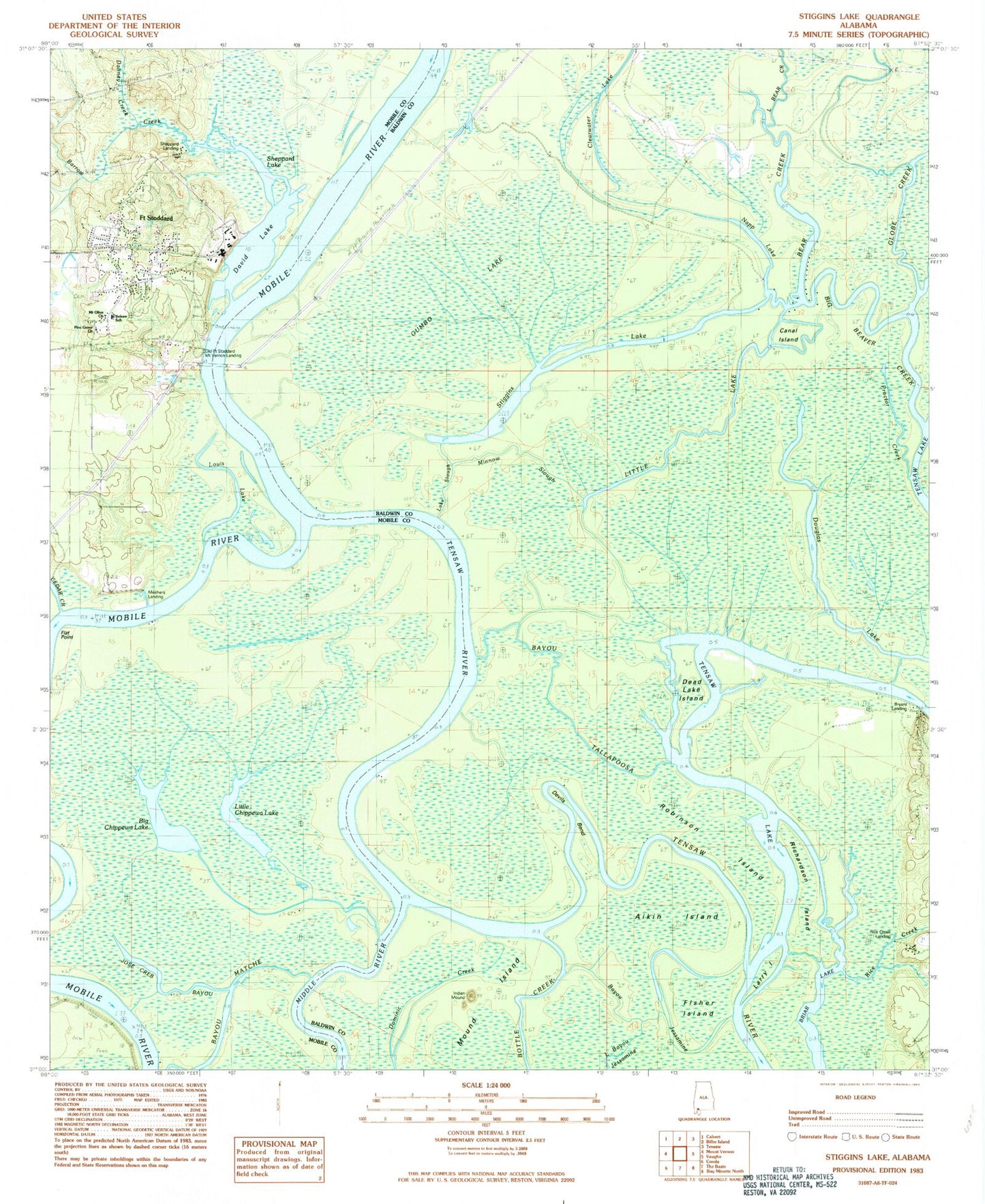
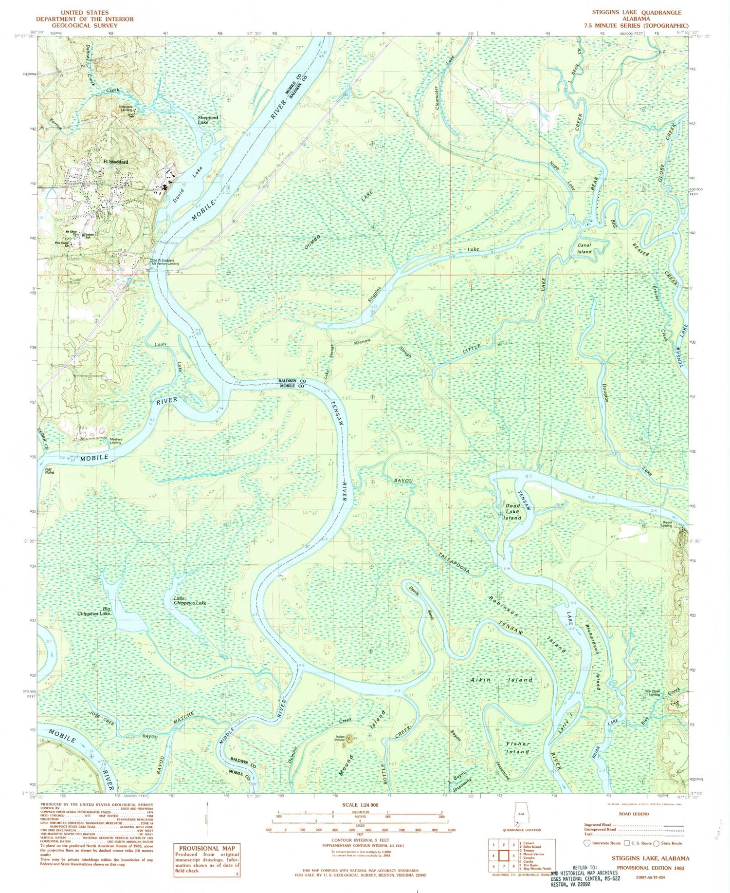
Classic USGS Stiggins Lake Alabama 7.5'x7.5' Topo Map
Couldn't load pickup availability
Historical USGS topographic quad map of Stiggins Lake in the state of Alabama. Typical map scale is 1:24,000, but may vary for certain years, if available. Print size: 24" x 27"
This quadrangle is in the following counties: Baldwin, Mobile.
The map contains contour lines, roads, rivers, towns, and lakes. Printed on high-quality waterproof paper with UV fade-resistant inks, and shipped rolled.
Contains the following named places: Borrow Creek, Aikin Island, Bayou Jessamine, Bayou Tallapoosa, Bear Creek, Big Beaver Creek, Briar Lake, Canal Island, Cedar Creek, Clearwater Lake, Dabney Creek, David Lake, Deadlake Island, Devils Bend, Douglas Lake, Fisher Island, Globe Creek, Gumbo Lake, Jose Creb Bayou, Lake Slough, Larry Island, Little Lake, Louis Lake, Minnow Slough, Morning Star Church, Napp Lake, Proctor Creek, Rice Creek, Richardson Island, Robinson Island, Sheppard Lake, Sisters Creek, Stiggins Lake, Tensaw Lake, Union Church, Mount Vernon Crossing (historical), Shephard Landing, Beaver Dam Creek, Belsaw School, Flat Point, Mary Ida Point, Meahers Landing, Mount Olive Primitive Baptist Church, Pine Grove Church, Promise Land Landing, Sheppard Landing, Movico Oil Field, Bryant Landing, Old Fort Stoddard Mount Vernon Landing, Rice Creek Landing, Bayou Matche, Big Chippewa Lake, Little Chippewa Lake, Fort Stoddard, First Church, Free Church, Church of God Pentecostal, Apostolic Overcoming Holiness Church of God, Morning Star Cemetery, Mobile County Health Department Mount Vernon Clinic, Mount Vernon Community Center, Mount Vernon Police Department