MyTopo
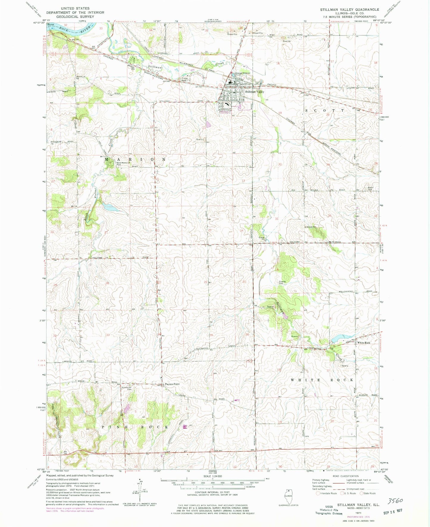
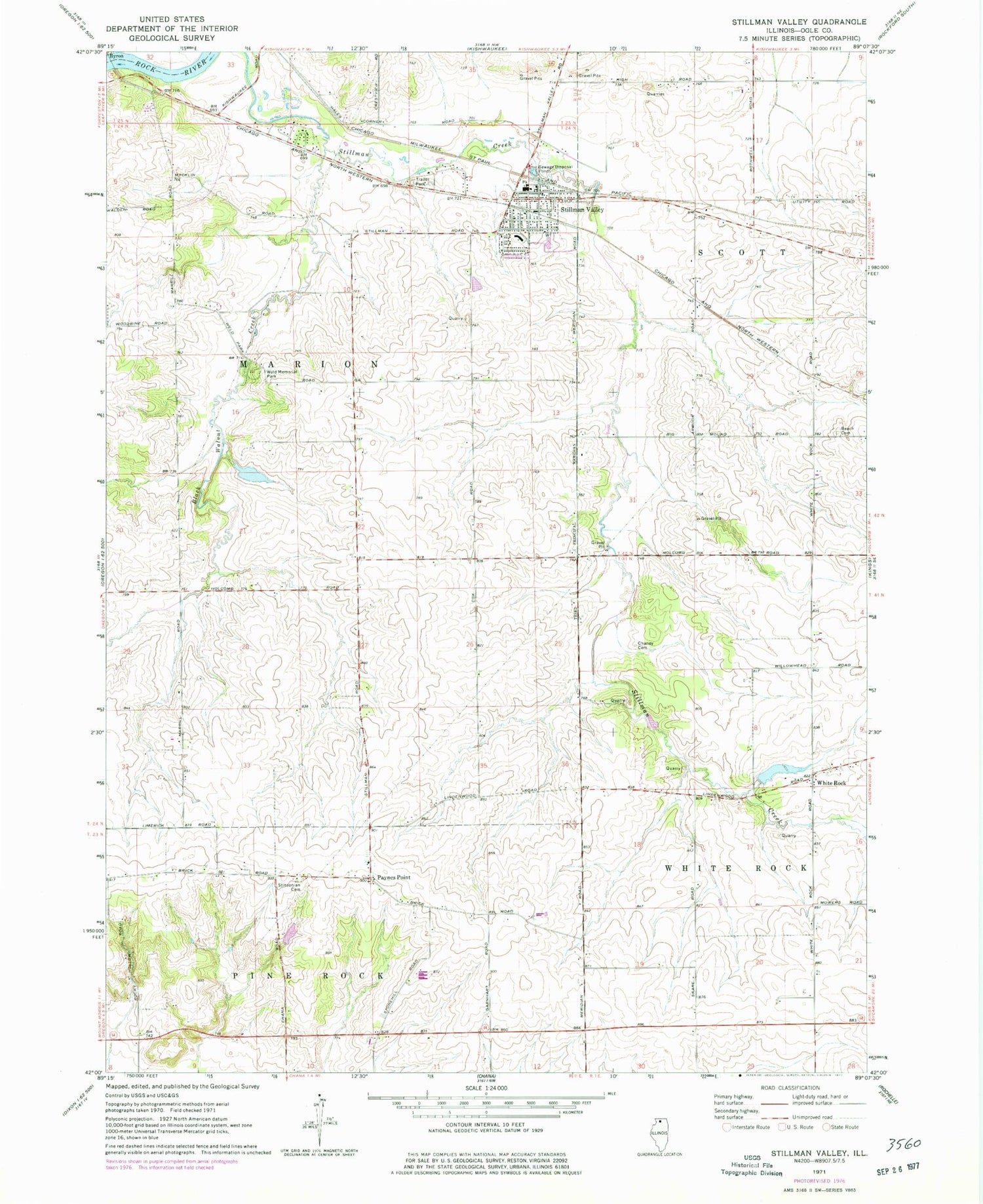
Classic USGS Stillman Valley Illinois 7.5'x7.5' Topo Map
Couldn't load pickup availability
Historical USGS topographic quad map of Stillman Valley in the state of Illinois. Map scale may vary for some years, but is generally around 1:24,000. Print size is approximately 24" x 27"
This quadrangle is in the following counties: Ogle.
The map contains contour lines, roads, rivers, towns, and lakes. Printed on high-quality waterproof paper with UV fade-resistant inks, and shipped rolled.
Contains the following named places: Beach Cemetery, Beach Cemetery Prairie Nature Preserve, Beach School, Black Walnut Creek, Black Walnut School, Bybee Farm, Chaney Cemetery, Emmanuel Lutheran Cemetery, Hidden Valley Lake, Hidden Valley Lake Dam, Highland Elementary School, Marrill School, Meridian Junior High School, Meridian School, Mount Pleasant Cemetery, Paynes Point, Simerick School, Slagle School, Stillman Fire Protection District, Stillman Valley, Stillman Valley Cemetery, Stillman Valley High School, Stillman Valley Post Office, Stinsonian Cemetery, Township of Marion, Traina Pond, Traina Pond Dam, Village of Stillman Valley, Von Glen Acres, Walnut Pond, Walnut Pond Dam, Weld Memorial Park, White Rock, Wilbur School, Youngs School, ZIP Code: 61084