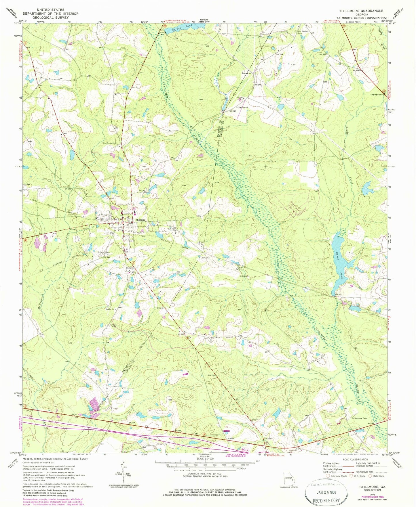
MyTopo
Classic USGS Stillmore Georgia 7.5'x7.5' Topo Map
Couldn't load pickup availability
Historical USGS topographic quad map of Stillmore in the state of Georgia. Map scale may vary for some years, but is generally around 1:24,000. Print size is approximately 24" x 27"
This quadrangle is in the following counties: Candler, Emanuel.
The map contains contour lines, roads, rivers, towns, and lakes. Printed on high-quality waterproof paper with UV fade-resistant inks, and shipped rolled.
Contains the following named places: Brantley Trapnell Lake, Brantley Trapnell Lake Dam, Canoe, Canoe Pond, Canoe Pond Dam, City of Stillmore, Cooper Lake, Cooper Lake Dam, Cowart Cemetery, Cowarts Mill Pond, Durden Pond, Durdens Pond Dam, Emanuel County Volunteer Fire Department Stillmore Station, Emmit Bridge, Lewis Lake, Lewis Lake Dam, McCullough Creek, Mill Creek, Oak Grove Cemetery, Old Beulah Cemetery, Reedy Creek, Saint Marys Church, Saint Matthew Cemetery, Stillmore, Stillmore Cemetery, Stillmore Fire Department, Stillmore Police Department Headquarters, Stillmore Post Office, Strawfield Bridge, Warren Cemetery, ZIP Code: 30464