MyTopo
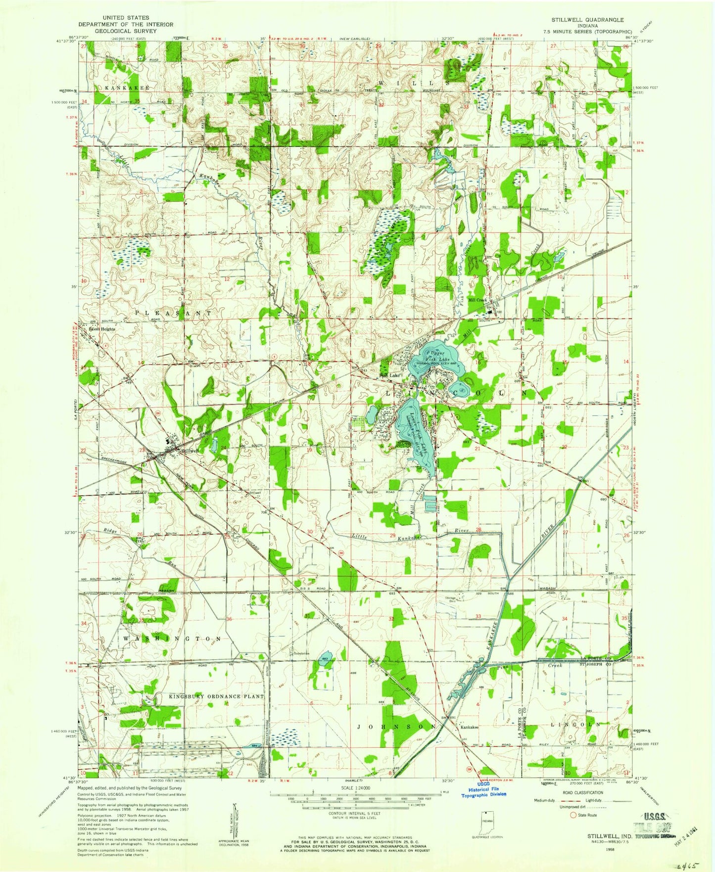
Classic USGS Stillwell Indiana 7.5'x7.5' Topo Map
Couldn't load pickup availability
Historical USGS topographic quad map of Stillwell in the state of Indiana. Map scale may vary for some years, but is generally around 1:24,000. Print size is approximately 24" x 27"
This quadrangle is in the following counties: LaPorte, St. Joseph.
The map contains contour lines, roads, rivers, towns, and lakes. Printed on high-quality waterproof paper with UV fade-resistant inks, and shipped rolled.
Contains the following named places: Barringer Ditch, Breckenridge Ditch, Fish Creek, Fish Lake, Fish Lake Census Designated Place, Hamlet, Kankakee, Kingsbury State Fish and Game Area, Lincoln Township Volunteer Fire Department, Little Kankakee River, Lower Fish Lake, Mill Creek, Mill Creek Elementary School, Mill Creek Post Office, Oak Grove Church, Pleasant Township Fire Department, Ridge Run, Salem Heights, Stillwell, Stillwell Elementary School, Township of Lincoln, Upper Fish Lake, ZIP Code: 46365