MyTopo
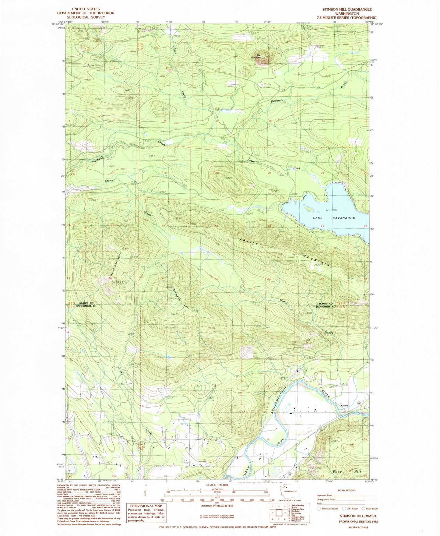
Classic USGS Stimson Hill Washington 7.5'x7.5' Topo Map
Couldn't load pickup availability
Historical USGS topographic quad map of Stimson Hill in the state of Washington. Map scale may vary for some years, but is generally around 1:24,000. Print size is approximately 24" x 27"
This quadrangle is in the following counties: Skagit, Snohomish.
The map contains contour lines, roads, rivers, towns, and lakes. Printed on high-quality waterproof paper with UV fade-resistant inks, and shipped rolled.
Contains the following named places: Alexander Trail, Bald Mountain, Bear Creek, Bryant Hill, Cicero, Frailey Mountain Truck Trail, Frailey Ponds, Grandview Recreation Center, Grant Creek, Lake Cavanaugh, Lake Cavanaugh Census Designated Place, Lake Creek, Mount Cavanaugh, Mount Washington Trail, North County Fire / Emergency Medical Services Station 92 Grandview, North Fork Dairy, Spar Tree Trail, Stimson Hill, Strawder Dairy, Williams Airpatch