MyTopo
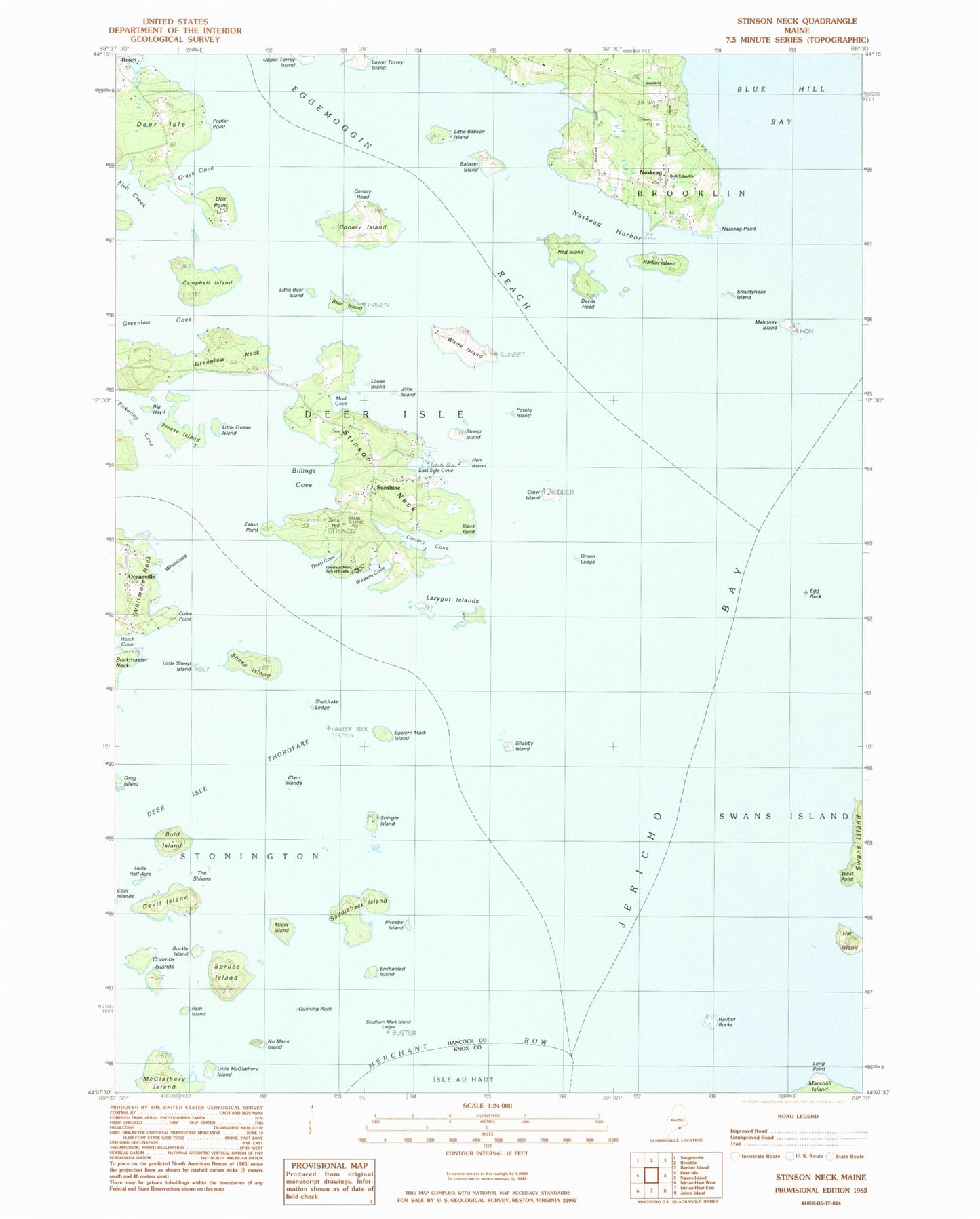
Classic USGS Stinson Neck Maine 7.5'x7.5' Topo Map
Couldn't load pickup availability
Historical USGS topographic quad map of Stinson Neck in the state of Maine. Typical map scale is 1:24,000, but may vary for certain years, if available. Print size: 24" x 27"
This quadrangle is in the following counties: Hancock, Knox.
The map contains contour lines, roads, rivers, towns, and lakes. Printed on high-quality waterproof paper with UV fade-resistant inks, and shipped rolled.
Contains the following named places: Babson Island, Bear Island, Bold Island, Buckle Island, Campbell Island, Clam Island, Coles Point, Conary Cove, Conary Island, Coombs Islands, Coot Islands, Crow Island, Deep Cove, Deer Island Thorofare, Devil Island, Devils Head, Eastern Mark Island, Egg Rock, Enchanted Island, Fish Creek, Green Ledge, Greenlaw Neck, Gunning Rock, Halibut Rocks, Harbor Island, Hat Island, Hells Half Acre, Hen Island, Hog Island, Jericho Bay, Jims Hill, Little Babson Island, Little McGlathery Island, Little Sheep Island, Long Point, Mahoney Island, Millet Island, Naskeag, Naskeag Harbor, Naskeag Point, No Mans Island, Oak Point, Oceanville, Phoebe Island, Pickering Cove, Poplar Point, Ram Island, Reach, Saddleback Island, Shabby Island, Sheep Island, Sheep Island, Sheep Island Ledge, Sheldrake Ledge, Shingle Island, Smuttynose Island, Spruce Island, Stinson Neck, Sunshine, The Shivers, West Point, Western Cove, White Island, Grog Island, Conary Head, Gray Cove, Lazygut Island, Whaleback Ledge, Channel Rock, The Boulders, Potato Island, Jims Island, Little Freese Island, Little Bear Island, Mud Cove, Louse Island, Beth Eden Church, Sellers Island, Sunken Egg Rock, Bold Island Ledges, Buckmaster Ledge, Door Lege, Big Hay Island, Eaton Point, Billings Cove, East Side Cove, Black Point, Haystack Mountains School of Crafts, Southern Mark Island, West Halibut Rock, Lower Torrey Island, Freese Island, Conary Ledge, East Mark Island Ledge, Hanus Ledge, Haskell Ledge, Hat Island Ledge, Hay Ledge, Haycock Rock, Lazygut Ledge, Long Ledge, Mahoney Ledge, Potato Ledge, Rudder Rock, Sheep Rock, Sheldrake Ledge, The Triangles, The Woodbury, Haystack Mountain School of Crafts Library, Sunshine Campground, Whitmore Cemetery, Coles Point Cemetery