MyTopo
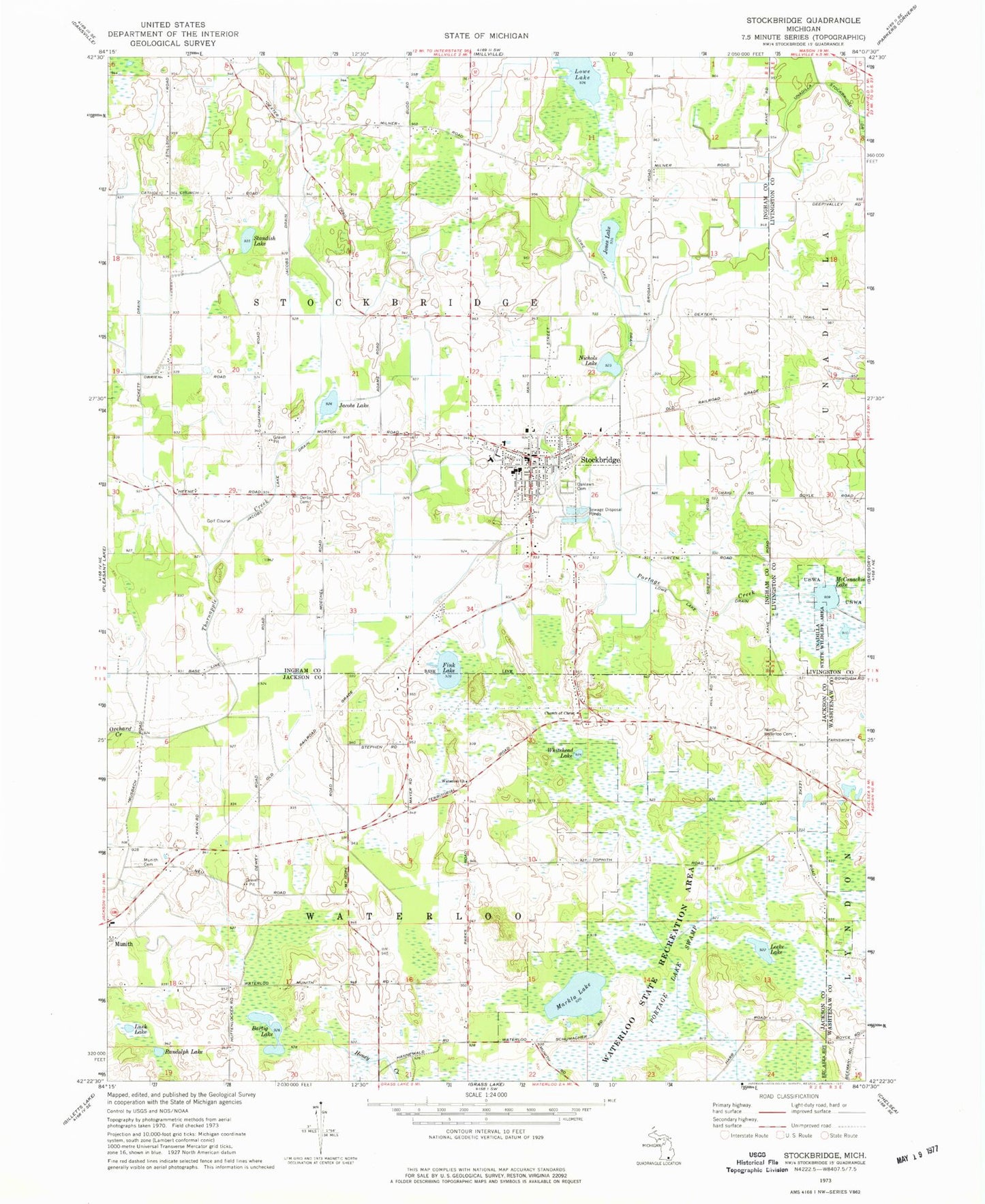
Classic USGS Stockbridge Michigan 7.5'x7.5' Topo Map
Couldn't load pickup availability
Historical USGS topographic quad map of Stockbridge in the state of Michigan. Map scale may vary for some years, but is generally around 1:24,000. Print size is approximately 24" x 27"
This quadrangle is in the following counties: Ingham, Jackson, Livingston, Washtenaw.
The map contains contour lines, roads, rivers, towns, and lakes. Printed on high-quality waterproof paper with UV fade-resistant inks, and shipped rolled.
Contains the following named places: Bartig Lake, Derby Cemetery, Emma Smith Elementary School, Fink Lake, First Baptist Church, First Presbyterian Church, Heritage Elementary School, Heritage School, Highest Praise Worship Center, Jacobs Drain, Jacobs Lake, Jacobs Lake Drain, Jeruel Baptist Church, Jones Lake, Leeke Lake, Lowe Drain, Lowe Lake, Lusk Lake, Markla Lake, McConachie Lake, Munith Cemetery, Nichols Lake, North Waterloo Cemetery, Oaklawn Cemetery, Pickett Drain, Portage Lake Swamp, Randolph Lake, Standish Lake, Stockbridge, Stockbridge Area Emergency Services Authority, Stockbridge Area Emergency Services Authority Fire Department, Stockbridge Fire Department, Stockbridge High School, Stockbridge Library, Stockbridge Middle School, Stockbridge Police Department, Stockbridge Post Office, Stockbridge Station, Stockbridge Town Hall Historical Marker, Stockbridge United Methodist Church, Thornapple Creek, Township of Stockbridge, Village of Stockbridge, Waterloo Church, Waterloo Farm Museum, Whitehead Lake, Willow Creek Golf Course, ZIP Code: 49285