MyTopo
Classic USGS Stockdale Ohio 7.5'x7.5' Topo Map
Couldn't load pickup availability
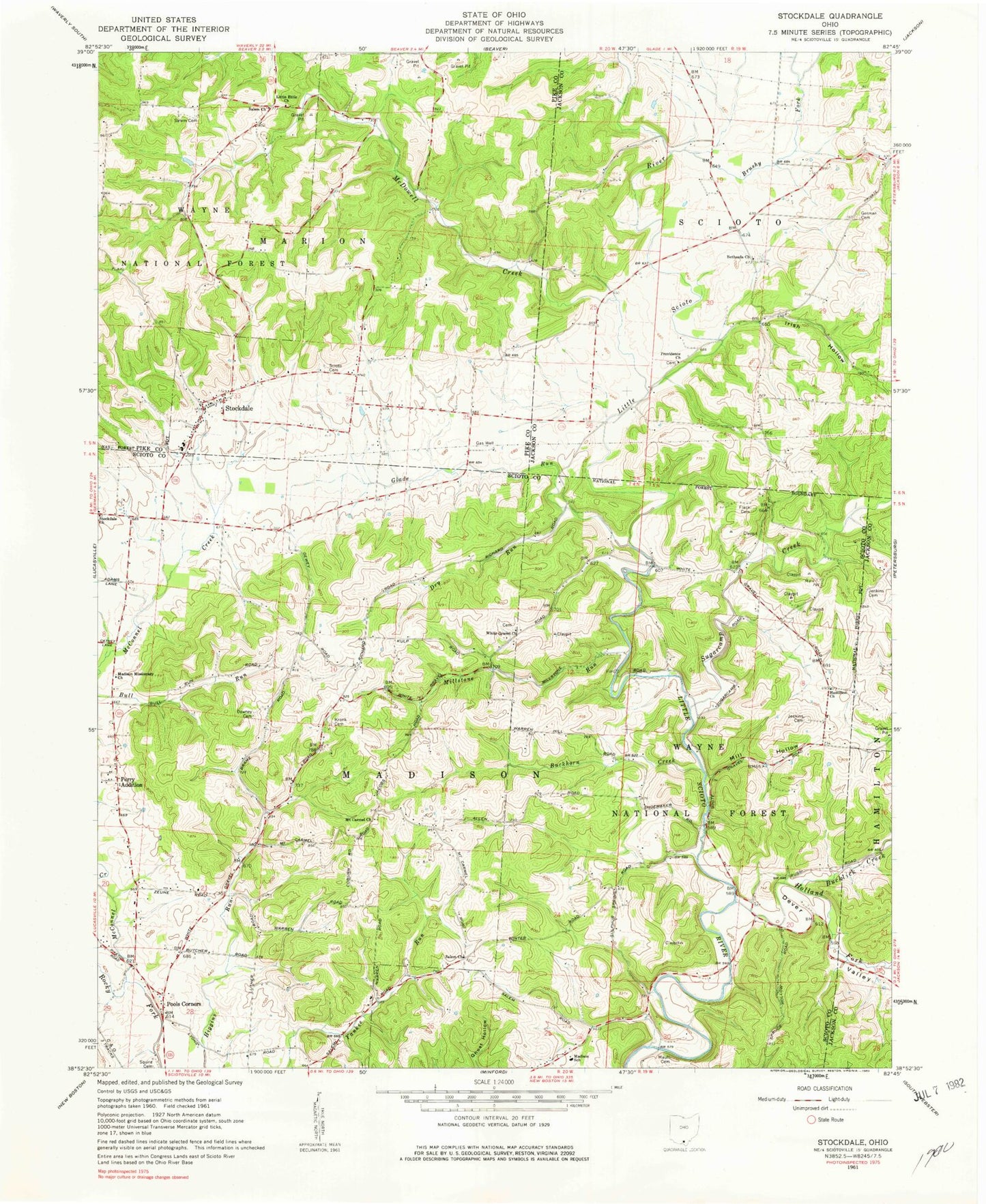
Historical USGS topographic quad map of Stockdale in the state of Ohio. Map scale may vary for some years, but is generally around 1:24,000. Print size is approximately 24" x 27"
This quadrangle is in the following counties: Jackson, Pike, Scioto.
The map contains contour lines, roads, rivers, towns, and lakes. Printed on high-quality waterproof paper with UV fade-resistant inks, and shipped rolled.
Contains the following named places: Bethesda Cemetery, Bethesda Chapel Freewill Baptist Church, Brown Farm, Brushy Fork, Buckhorn Creek, Bucklick Creek, Cordle Dairy, Dever Valley, Dewey School, Downey Cemetery, Dry Run, Flack Cemetery, German Cemetery, Glade Run, Glade School, Hamilton Church, Holland Fork, Irish Hollow, Jenkins Cemetery, Johnson Road Bridge, Kronk Cemetery, Little Ettie Baptist Church, Little Ettie Cemetery, Madison Missionary Church, Madison School, Massie, Massie Post Office, Mault Cemetery, McConnel Creek, McDowell Creek, Mill Hollow, Millstone Run, Mount Carmel Church, Mount Carmel School, Perry Addition, Pools Corners, Providence Cemetery, Providence Church, Salem Cemetery, Salem Church, Salem School, Scioto Cemetery, Stockdale, Stockdale Cemetery, Stockdale Census Designated Place, Stockdale Church, Stockdale Elementary School, Stockdale Post Office, Stockdale Volunteer Fire Department, Sugarcamp Creek, Township of Madison, Township of Marion, White Gravel Cemetery, White Gravel Church, White Gravel School, ZIP Code: 45653