MyTopo
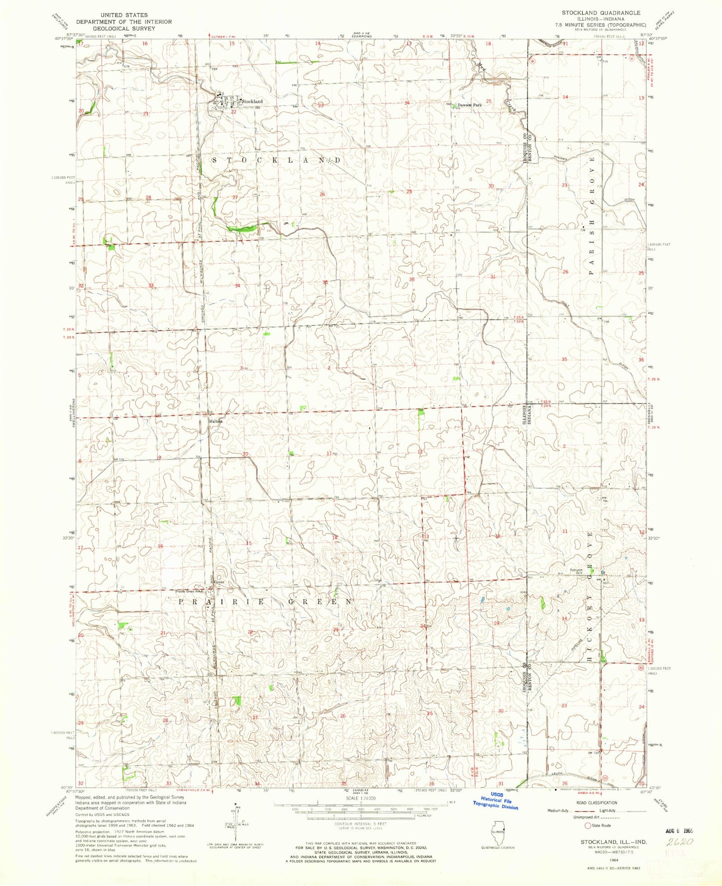
Classic USGS Stockland Illinois 7.5'x7.5' Topo Map
Couldn't load pickup availability
Historical USGS topographic quad map of Stockland in the states of Illinois, Indiana. Map scale may vary for some years, but is generally around 1:24,000. Print size is approximately 24" x 27"
This quadrangle is in the following counties: Benton, Iroquois.
The map contains contour lines, roads, rivers, towns, and lakes. Printed on high-quality waterproof paper with UV fade-resistant inks, and shipped rolled.
Contains the following named places: Christian Church, Dawson Park, Glass School, Greer, Hallock, Kult Ditch, Maple Grove School, Marlowe School, Pleasant Hill School, Prairie Green School, Stichnoth RLA Airport, Stockland, Stockland Fire Protection District, Stockland Post Office, Totheroh Cemetery, Township of Prairie Green, Wichman Airport, Willow Spring School