MyTopo
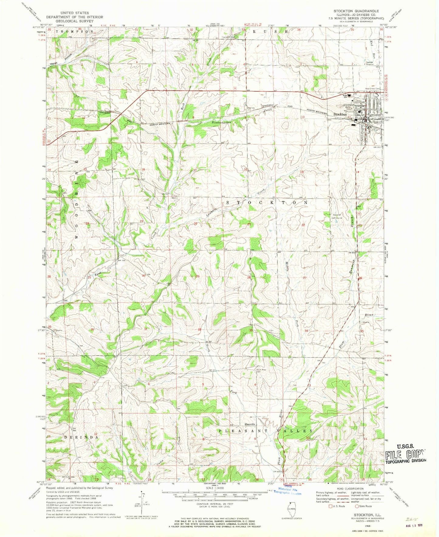
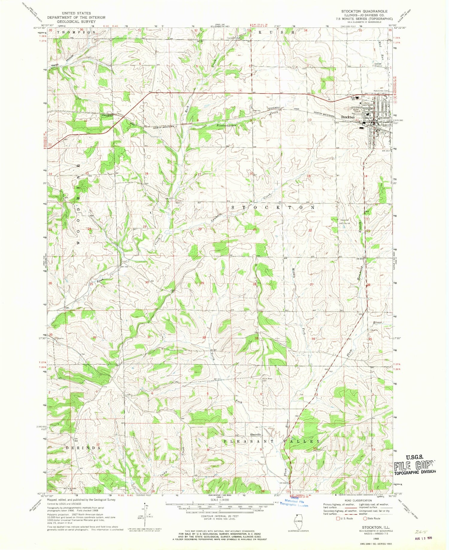
Classic USGS Stockton Illinois 7.5'x7.5' Topo Map
Couldn't load pickup availability
Historical USGS topographic quad map of Stockton in the state of Illinois. Map scale may vary for some years, but is generally around 1:24,000. Print size is approximately 24" x 27"
This quadrangle is in the following counties: Jo Daviess.
The map contains contour lines, roads, rivers, towns, and lakes. Printed on high-quality waterproof paper with UV fade-resistant inks, and shipped rolled.
Contains the following named places: Calvary United Methodist Church, Country Air Mobile Home Estates, Derinda Post Office, Elmoville, Hammond Branch, Holy Cross Cemetery, Holy Cross Church, J and J Mobile Home Park, Lawhorn Creek, Middle Fork Plum River, Millershone Quarry, Montrose School, Mount Juliet School, North Fork Plum River, Pitcherville, Plum River Catholic Cemetery, Rindesbacher Creek, Rush Post Office, Saint John Church, Spring Valley School, Stockton, Stockton Center School, Stockton Church of the Nazarene, Stockton Community Ambulance, Stockton Elementary School, Stockton Fire and Rescue, Stockton Golf Course, Stockton High School, Stockton Police Department, Stockton Post Office, Township of Stockton, Unitarian Universalist Church, Village of Stockton, Wesley United Methodist Church, West Point School, Winters Post Office, Yankee Hollow Post Office, Yankee Hollow School, ZIP Code: 61085