MyTopo
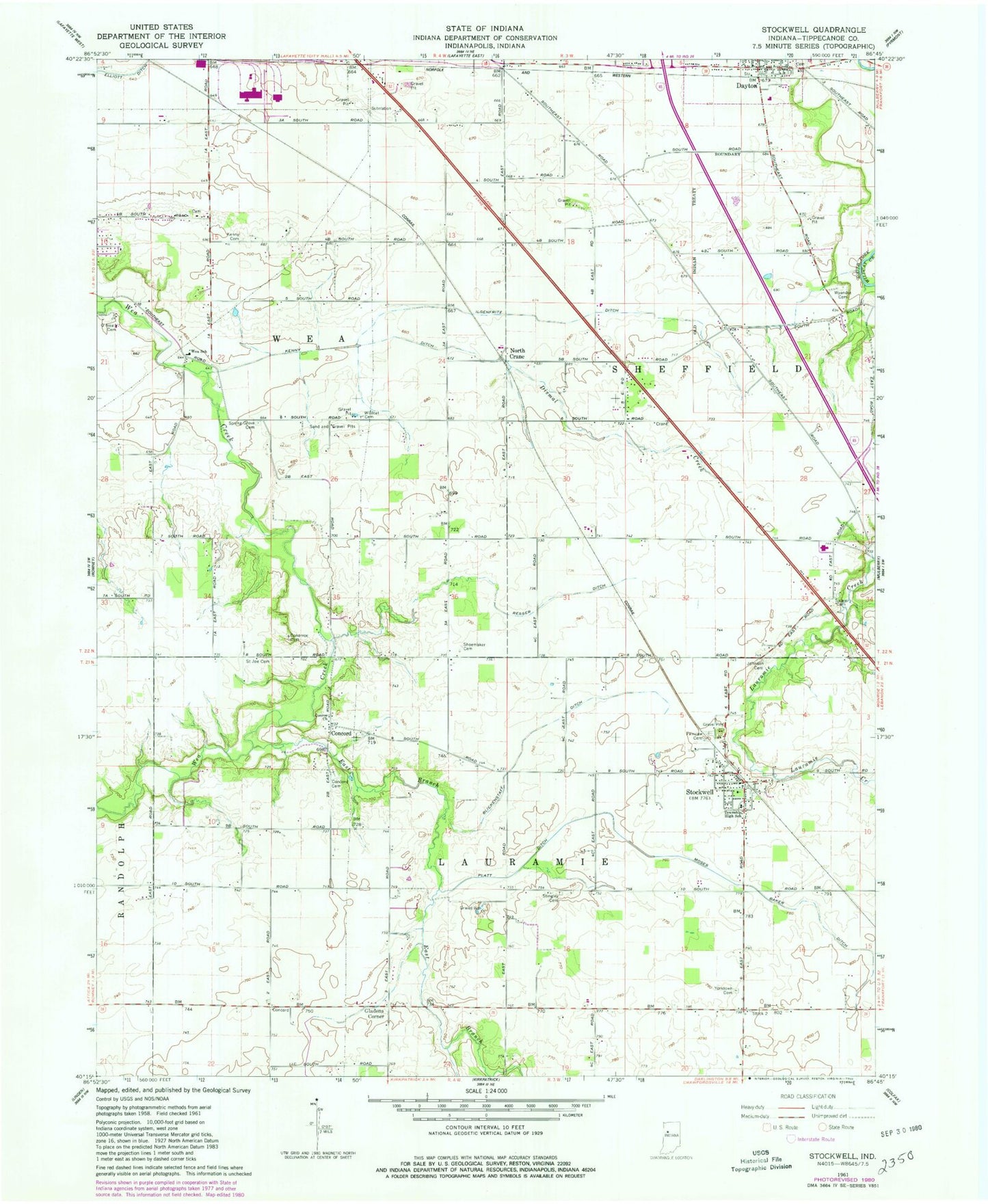
Classic USGS Stockwell Indiana 7.5'x7.5' Topo Map
Couldn't load pickup availability
Historical USGS topographic quad map of Stockwell in the state of Indiana. Map scale may vary for some years, but is generally around 1:24,000. Print size is approximately 24" x 27"
This quadrangle is in the following counties: Tippecanoe.
The map contains contour lines, roads, rivers, towns, and lakes. Printed on high-quality waterproof paper with UV fade-resistant inks, and shipped rolled.
Contains the following named places: Blickenstaff Ditch, Conarroe Cemetery, Concord, Concord Cemetery, Conroe Church, Dayton, Dayton Police Department, Dayton Post Office, Dismal Creek, East Branch Wea Creek, Fairview Cemetery, Felix Airport, Gladens Corner, Ilgenfritz Ditch, Johnson Cemetery, Kenny Cemetery, Kenny Ditch, Lauramie Township Fire Department, Moses Baker Ditch, North Crane, O'Neall Cemetery, Platt Ditch, Resser Ditch, Saint Joe Cemetery, Salem Cemetery, Shoemaker Cemetery, Spring Grove Cemetery, Stingley Cemetery, Stockwell, Stockwell Census Designated Place, Stockwell Post Office, Timber House Airport, Township of Lauramie, Township of Sheffield, Township of Wea, Wea School, Wea Township Community Fire Department, Wildcat Cemetery, Wyandot Cemetery, Wyandotte Airport, Yorktown Cemetery, ZIP Code: 47983