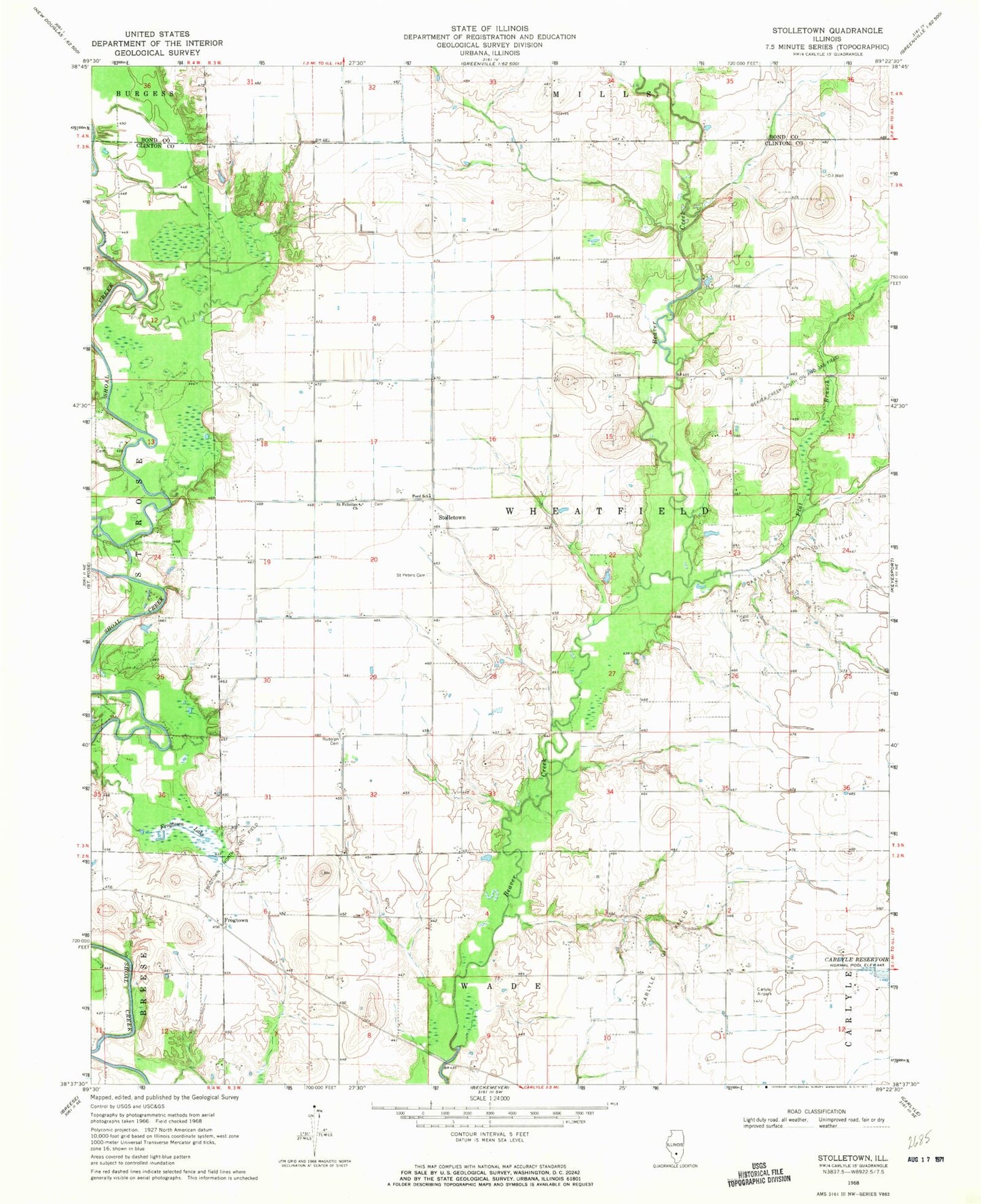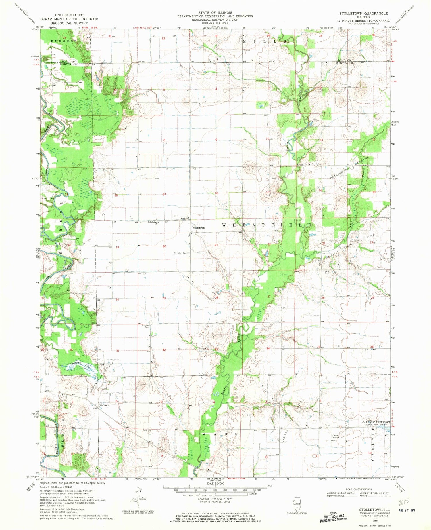
MyTopo
Classic USGS Stolletown Illinois 7.5'x7.5' Topo Map
Couldn't load pickup availability
Historical USGS topographic quad map of Stolletown in the state of Illinois. Map scale may vary for some years, but is generally around 1:24,000. Print size is approximately 24" x 27"
This quadrangle is in the following counties: Bond, Clinton.
The map contains contour lines, roads, rivers, towns, and lakes. Printed on high-quality waterproof paper with UV fade-resistant inks, and shipped rolled.
Contains the following named places: Beckemeyer Dairy Farm, Big Lake, Carlyle Airpark, Carlyle North Oil Field, Carlyle Oil Field, Diekemper Dairy, Flat Branch, Ford School, Frogtown, Frogtown Lake, Frogtown North Oil Field, Hull School, Kell School, Keyesport Pit, Lower Ford School, Miller School, Rudolph Cemetery, Saint Felicitas Cemetery, Saint Felicitas Church, Saint Peter Cemetery, SchwierJohn School, Shoal Creek Cemetery, Sparks Post Office, Stolletown, The Mound Church, The Mound School, Township of Wheatfield, Weinheimer Cemetery, Wheatfield Township Fire Protection District, Yingst Cemetery