MyTopo
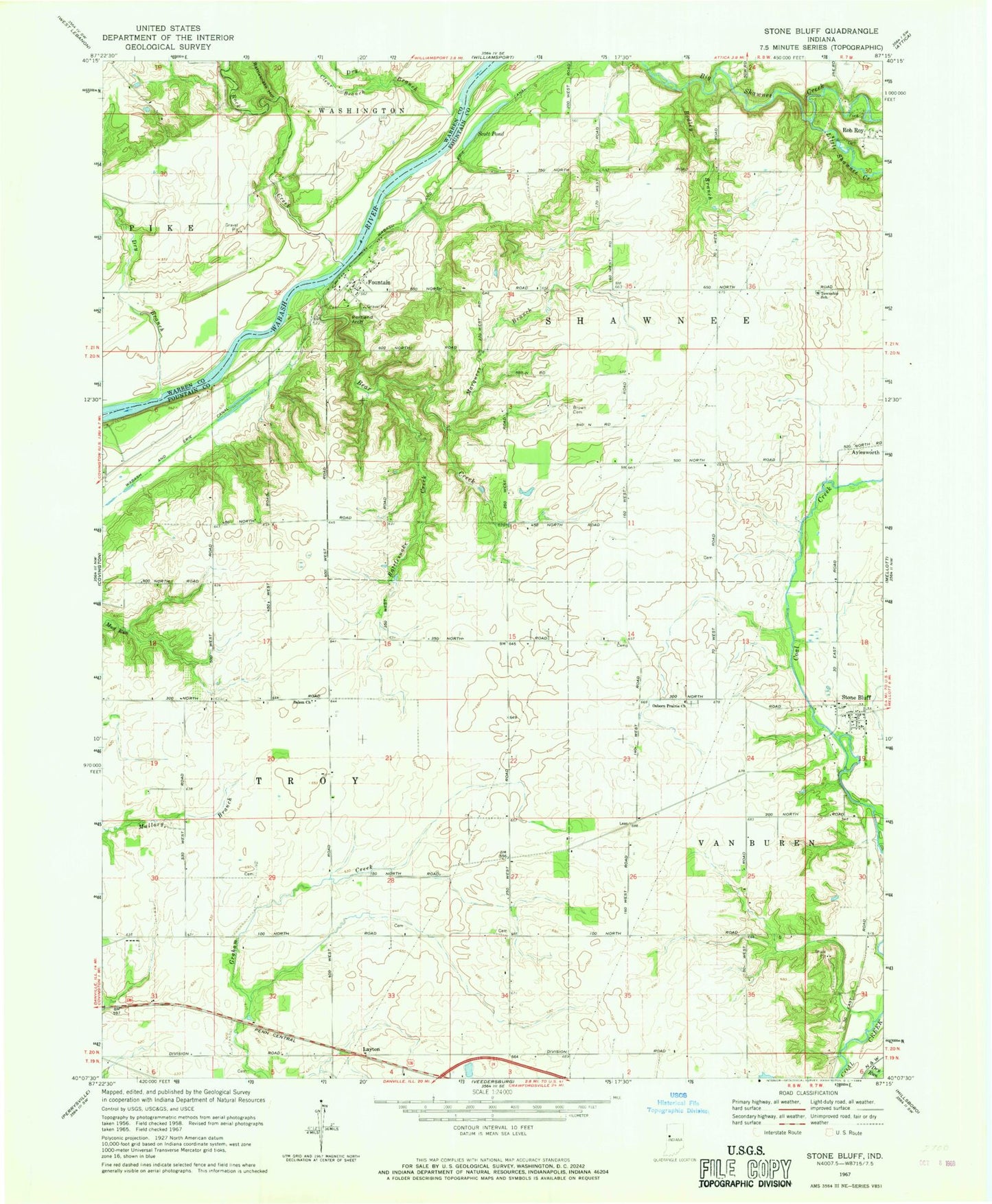
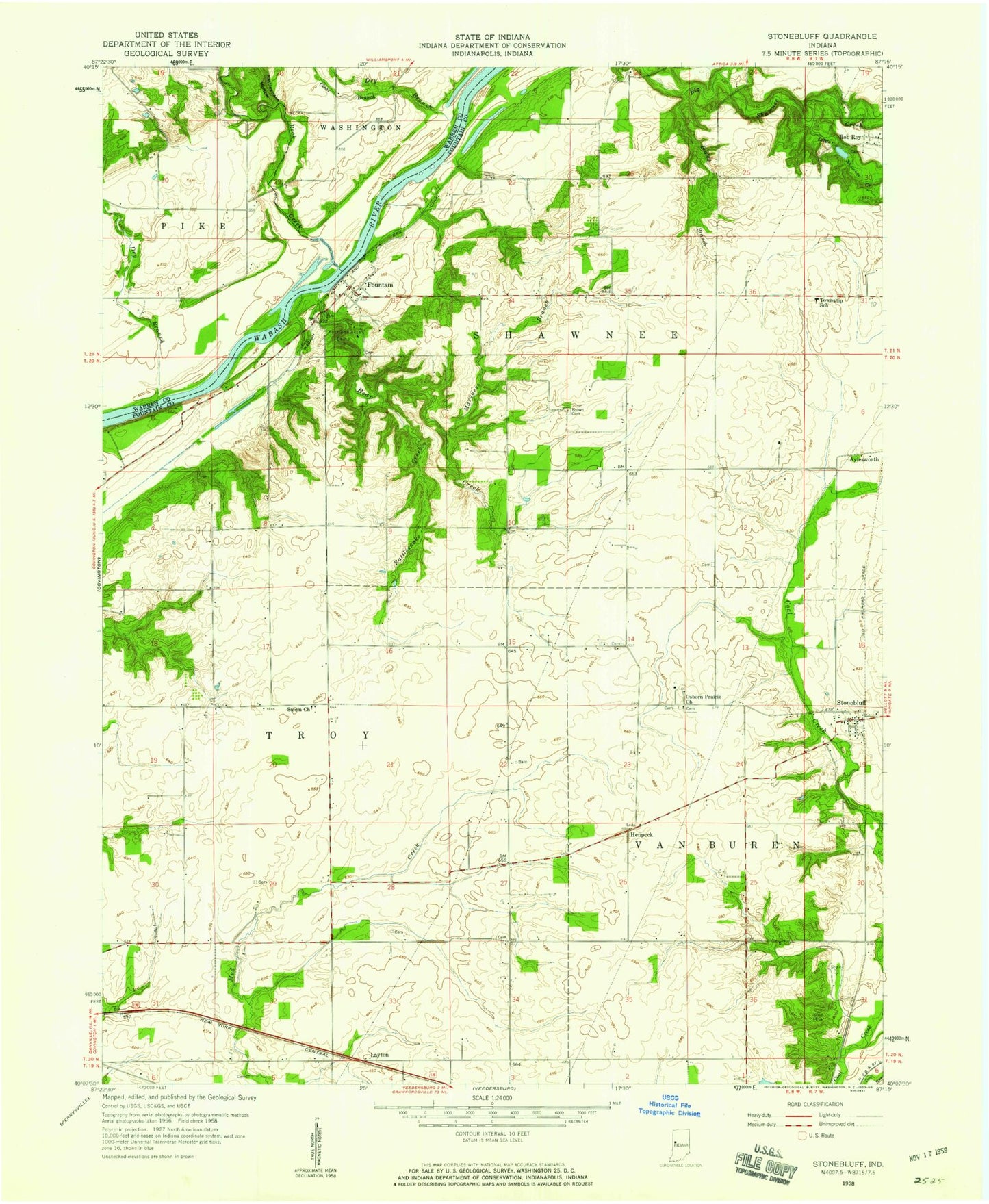
Classic USGS Stone Bluff Indiana 7.5'x7.5' Topo Map
Couldn't load pickup availability
Historical USGS topographic quad map of Stone Bluff in the state of Indiana. Map scale may vary for some years, but is generally around 1:24,000. Print size is approximately 24" x 27"
This quadrangle is in the following counties: Fountain, Warren.
The map contains contour lines, roads, rivers, towns, and lakes. Printed on high-quality waterproof paper with UV fade-resistant inks, and shipped rolled.
Contains the following named places: Bear Creek, Bodley Branch, Brown Cemetery, Clear Branch, Dry Branch, Fountain, Gary Johnson Field, Layton, Little Shawnee Creek, Marquess Branch, Osborn Prairie Church, Portland Arch, Rattlesnake Creek, Rattlesnake Hollow, Rock Creek, Salem Church, Scott Pond, Stone Bluff, Township of Shawnee, Township of Troy, Township of Van Buren