
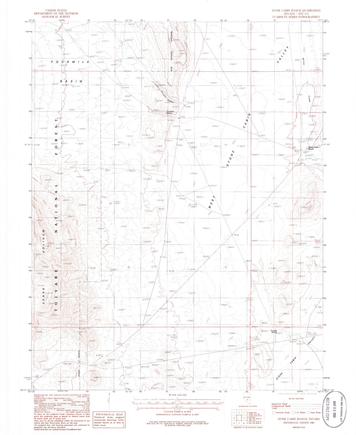
MyTopo
Classic USGS Stone Cabin Ranch Nevada 7.5'x7.5' Topo Map
Regular price
$16.95
Regular price
Sale price
$16.95
Unit price
per
Couldn't load pickup availability
Historical USGS topographic quad map of Stone Cabin Ranch in the state of Nevada. Map scale may vary for some years, but is generally around 1:24,000. Print size is approximately 24" x 27"
This quadrangle is in the following counties: Nye.
The map contains contour lines, roads, rivers, towns, and lakes. Printed on high-quality waterproof paper with UV fade-resistant inks, and shipped rolled.
Contains the following named places: Clark Station, Fivemile Ranch, Fivemile Spring, Fourmile Basin, Fourmile Spring, Fresno, Little Georges Canyon, Ralston Valley Division, Saulsbury Summit, Stone Cabin Ranch, West Stone Cabin Valley, Willow Creek


