MyTopo
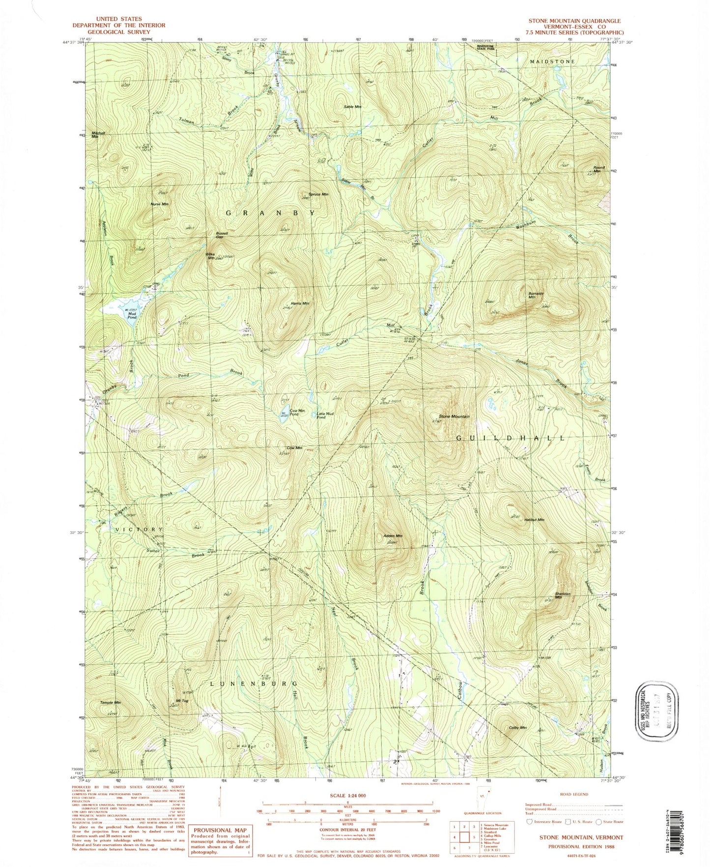
Classic USGS Stone Mountain Vermont 7.5'x7.5' Topo Map
Couldn't load pickup availability
Historical USGS topographic quad map of Stone Mountain in the state of Vermont. Typical map scale is 1:24,000, but may vary for certain years, if available. Print size: 24" x 27"
This quadrangle is in the following counties: Essex.
The map contains contour lines, roads, rivers, towns, and lakes. Printed on high-quality waterproof paper with UV fade-resistant inks, and shipped rolled.
Contains the following named places: Adden Mountain, Applelon Brook, Burnside Mountain, Buzzell Gap, Colby Mountain, Cow Mountain, Cow Mountain Pond, Halibut Mountain, Hall Brook, Harris Mountain, Little Cow Pond, Mount Tug, Mud Pond, Nurse Mountain, Pond Brook, Round Mountain, Sable Mountain, Sable Mountain Brook, Sheridan Mountain, Spruce Mountain, Stone Mountain, Stony Brook, Suitor Brook, Temple Mountain, Tolman Brook, Wilke Brook, Wilke Mountain, Town of Granby, Town of Guildhall, Boyce Cemetery, Spaulding Cemetery, Stuart Cemetery