MyTopo
Classic USGS Stonefort Illinois 7.5'x7.5' Topo Map
Couldn't load pickup availability
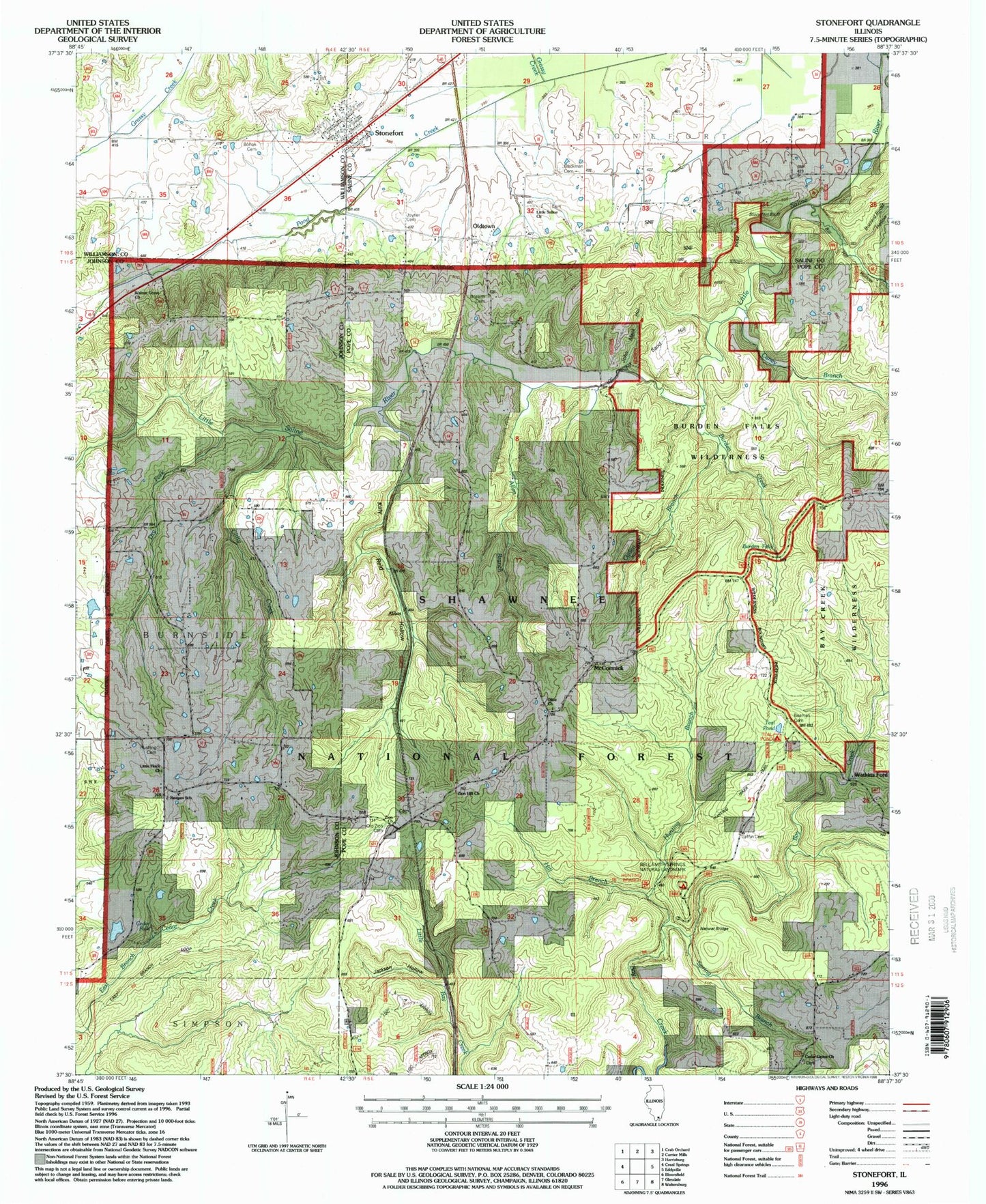
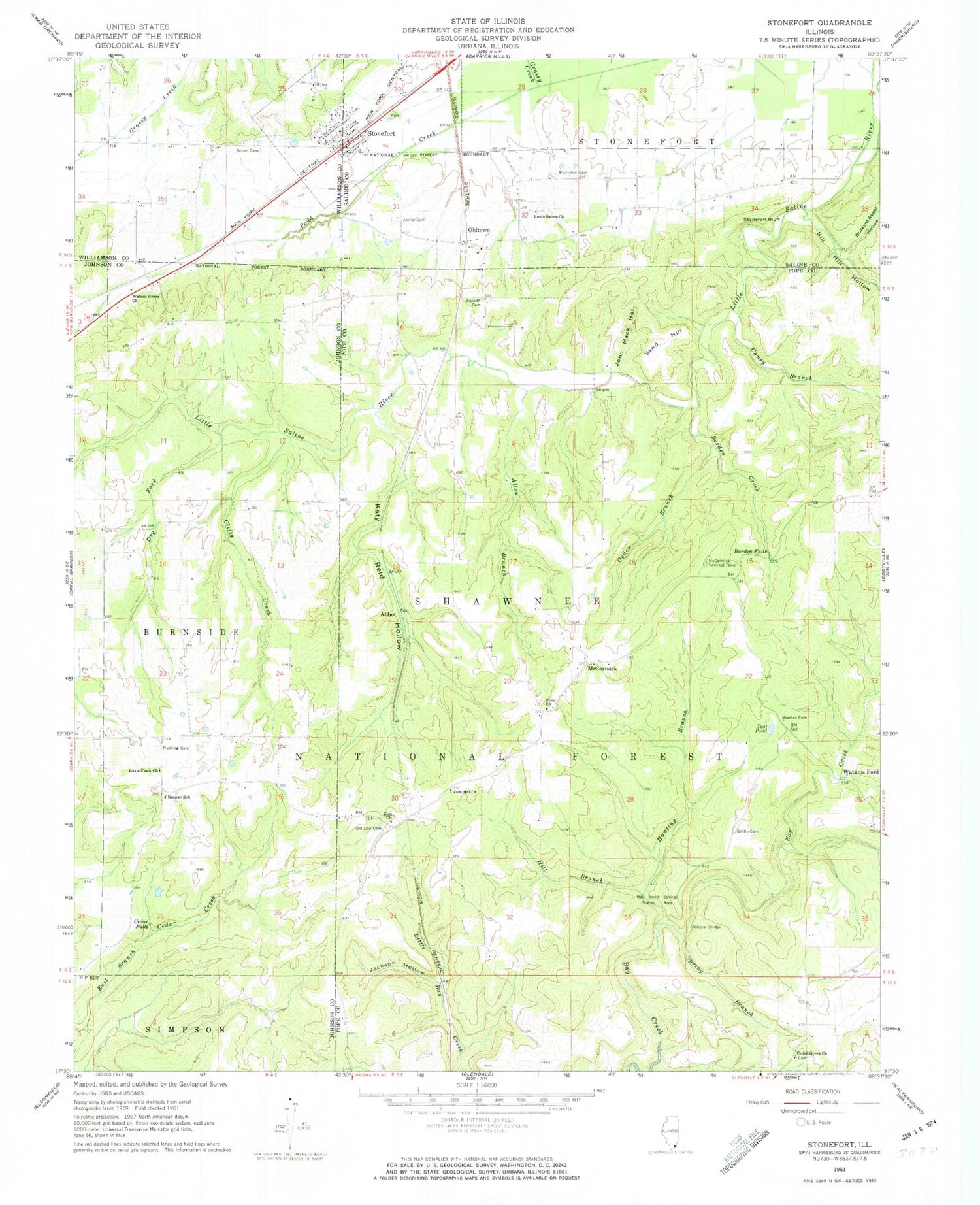
Historical USGS topographic quad map of Stonefort in the state of Illinois. Typical map scale is 1:24,000, but may vary for certain years, if available. Print size: 24" x 27"
This quadrangle is in the following counties: Johnson, Pope, Saline, Williamson.
The map contains contour lines, roads, rivers, towns, and lakes. Printed on high-quality waterproof paper with UV fade-resistant inks, and shipped rolled.
Contains the following named places: Township of Stonefort, Teal Pond Campground, Redbud Campground, Abbot, Allen Branch, Beames Cemetery, Bill Hill Hollow, Blackman Cemetery, Bolton Trammell Cemetery, Bozarth Cemetery, Burden Creek, Burden Falls, Buzzard Roost Hollow, Caney Branch, Cedar Falls, Cedar Grove Church, Clifty Creek, Dry Fork, Grassy Creek, Griffin Cemetery, Hill Branch, Hunting Branch, Jackson Hollow, John Mack Hollow, Joyner Cemetery, Katy Reid Hollow, Little Flock Church, Little Saline Church, McCormick, McCormick Lookout Tower, Ogden Branch, Old Zion Cemetery, Oldtown, Olive Church, Reagan School, Rushing Cemetery, Sand Hill, Spring Branch, Stonefort, Stonefort Bluff, Teal Pond, Walnut Grove Church, Watkins Ford, Zion Church, Zion Hill Church, Bell Smith Springs National Natural Landmark, Allen Branch School (historical), Cedar Grove School (historical), Mount Carmel Church (historical), Wooten School (historical), Pleasant Valley School (historical), Walnut Grove School (historical), Cedar Grove Cemetery, Waltons Branch, Zion Cemetery, Oldtown School (historical), Burden Falls Wilderness, Village of Stonefort, Stonefort Fire and Rescue, Bell Smith Natural Bridge, Stonefort Post Office