MyTopo
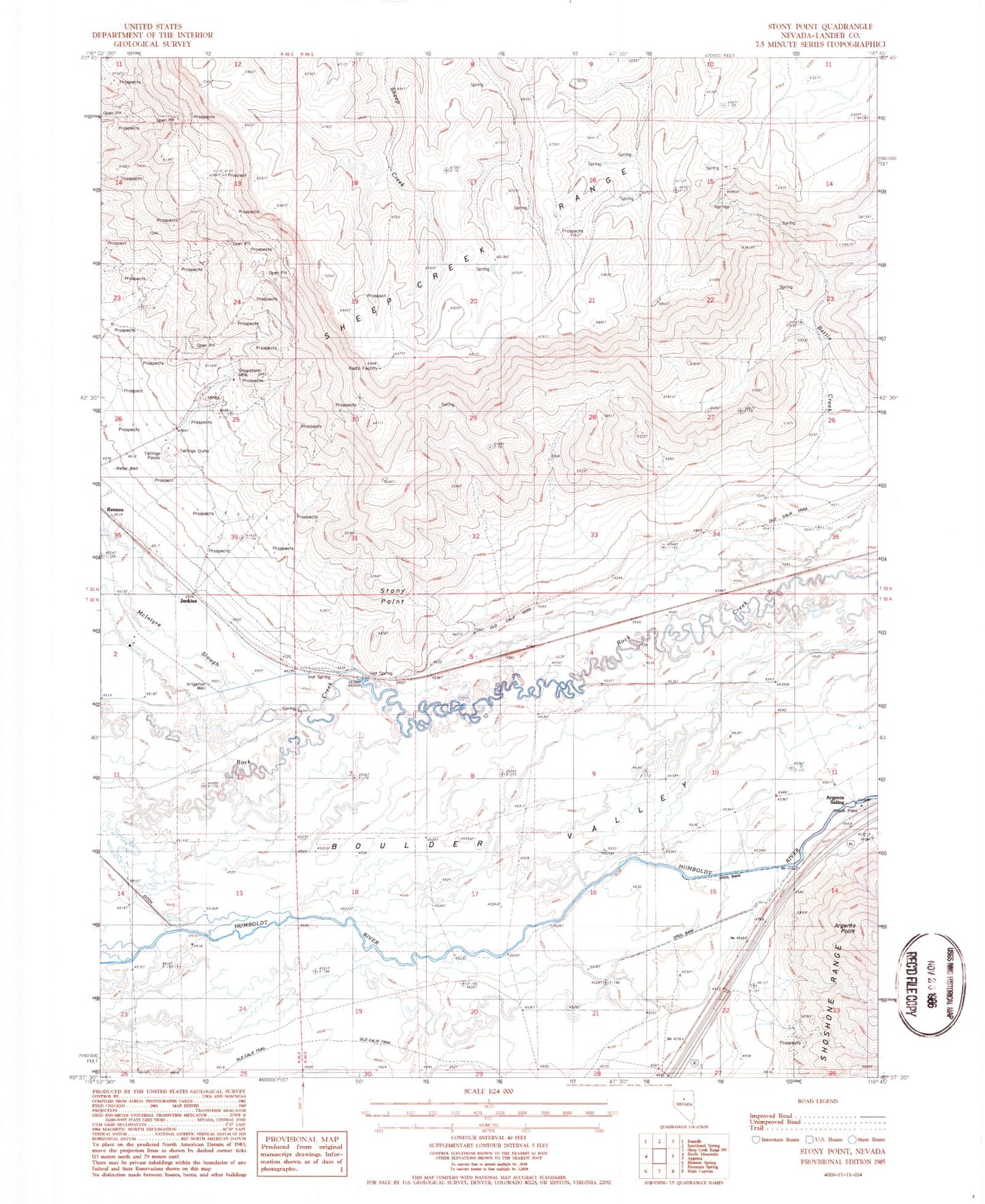
Classic USGS Stony Point Nevada 7.5'x7.5' Topo Map
Regular price
$16.95
Regular price
Sale price
$16.95
Unit price
per
Couldn't load pickup availability
Historical USGS topographic quad map of Stony Point in the state of Nevada. Map scale may vary for some years, but is generally around 1:24,000. Print size is approximately 24" x 27"
This quadrangle is in the following counties: Lander.
The map contains contour lines, roads, rivers, towns, and lakes. Printed on high-quality waterproof paper with UV fade-resistant inks, and shipped rolled.
Contains the following named places: Argenta Ranch, Argenta Siding, Battle Creek, Blossom Ranch, Boulder Valley, Hot Springs, Jenkins, Jenkins Ranch, North Battle Mountain Mining Area, Shoshone Mesa, Snowstorm Mine, Stony Point, Stony Point Meadow, T-S Ditch