MyTopo
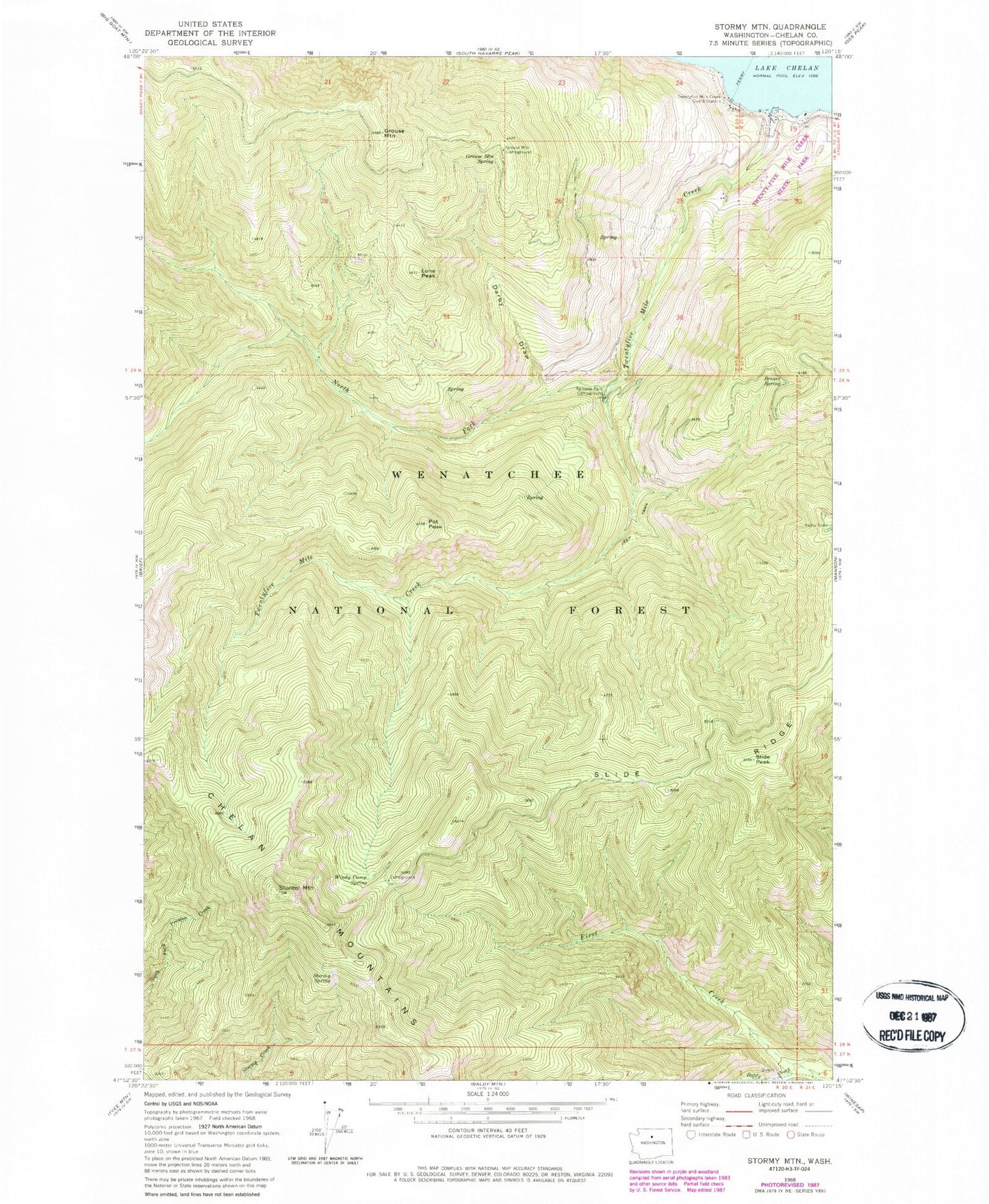
Classic USGS Stormy Mountain Washington 7.5'x7.5' Topo Map
Couldn't load pickup availability
Historical USGS topographic quad map of Stormy Mountain in the state of Washington. Map scale may vary for some years, but is generally around 1:24,000. Print size is approximately 24" x 27"
This quadrangle is in the following counties: Chelan.
The map contains contour lines, roads, rivers, towns, and lakes. Printed on high-quality waterproof paper with UV fade-resistant inks, and shipped rolled.
Contains the following named places: Baldy Creek, Beaver Spring, Chelan Division, Darby Draw, Devils Backbone Trailbike Loop Trail, Grouse Mountain, Grouse Mountain Campground, Grouse Mountain Spring, Lone Peak, Lone Peak Campground, North Fork Thirtyfive Mile Creek, Pot Peak, Ramona Park Campground, Slide Peak, Slide Ridge, Stormy Mountain, Stormy Spring, Twenty Five Mile Creek Ferry Landing, Twentyfive Mile Creek, Twentyfive Mile Creek Guard Station, Twenty-Five Mile Creek State Park, Windy Camp, Windy Camp Spring