MyTopo
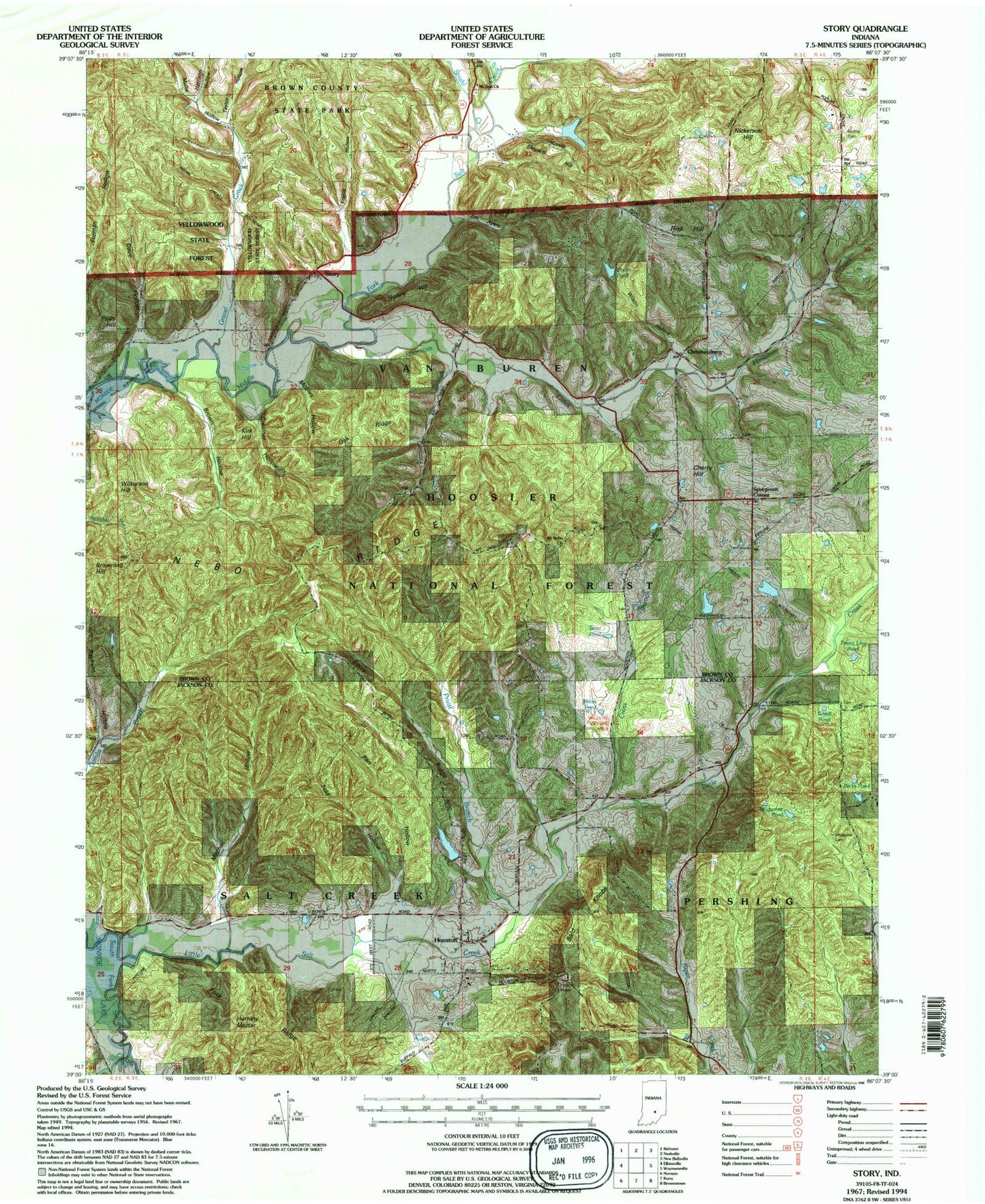
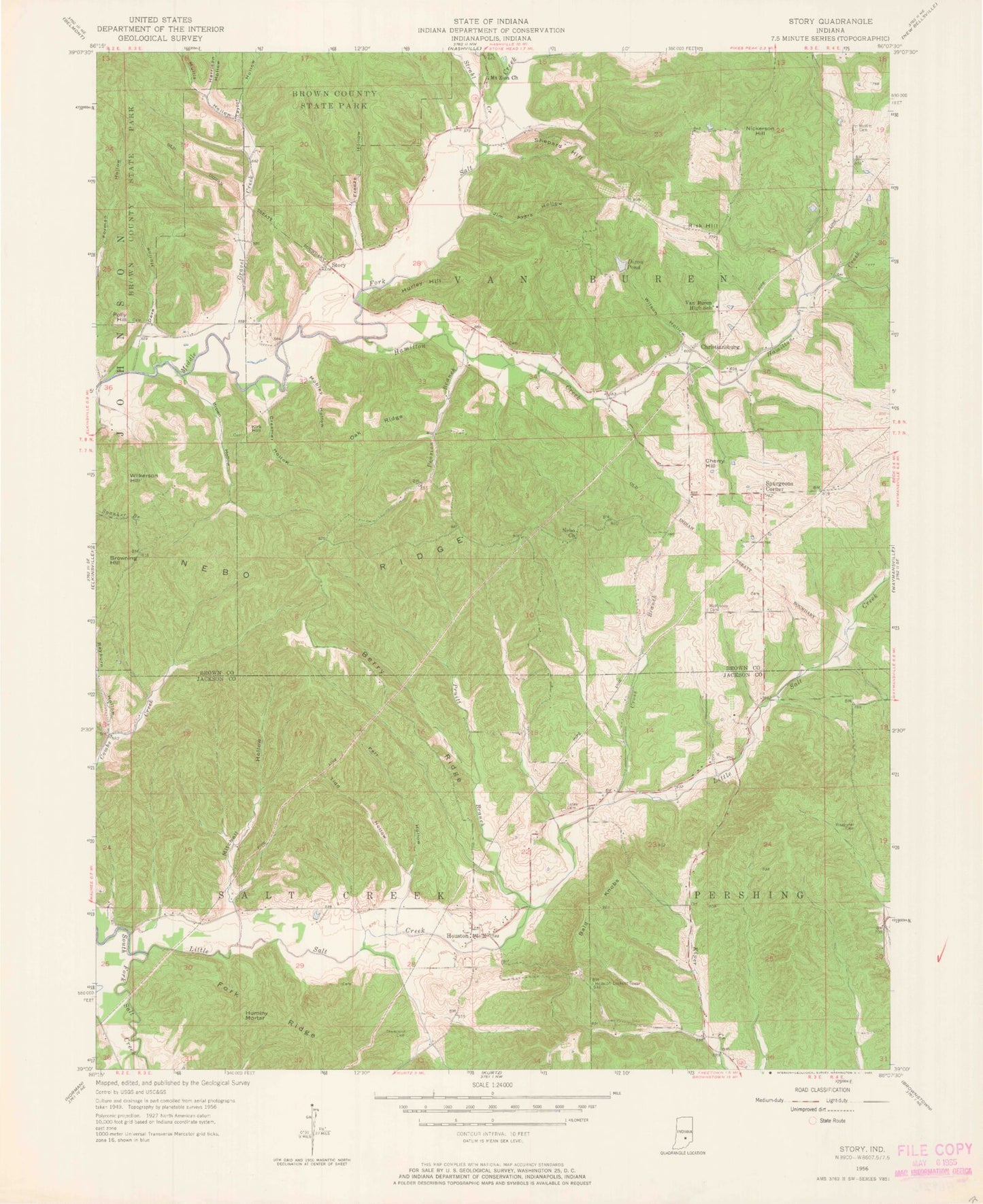
Classic USGS Story Indiana 7.5'x7.5' Topo Map
Couldn't load pickup availability
Historical USGS topographic quad map of Story in the state of Indiana. Typical map scale is 1:24,000, but may vary for certain years, if available. Print size: 24" x 27"
This quadrangle is in the following counties: Brown, Jackson.
The map contains contour lines, roads, rivers, towns, and lakes. Printed on high-quality waterproof paper with UV fade-resistant inks, and shipped rolled.
Contains the following named places: Berry Branch Lake Dam, Bald Knobs, Berry Ridge, Brown Hollow, Cherry Hill, Christiansburg, Creamer Hollow, Cross Branch, Dave Hollow, Dixon Pond, Fork Ridge, Freeze Hollow, Gravel Creek, Hamilton Creek, Harrison Hollow, Hilltop Camp, Hominy Mortar, Houston, Hurley Hill, Jim Ayers Hollow, Kirk Hill, Little Salt Creek, Lutes Cemetery, McKinney Cemetery, Mitchell Hollow, Mobley Hollow, Melott Cemetery, Mount Nebo Church, Mount Zion Church, Mullis Hollow, Nebo Ridge, Nickerson Hill, Oak Ridge, Parr Hollow, Pension Branch, Polly Hill, Pruitt Branch, Rayburn Hollow, Risk Hill, Runt Run, Shepard Hill, Spurgeons Corner, Story, Strahl Creek, Taylor Hollow, Thompson Cemetery, Tidd Hollow, Wilkerson Hill, Wilson Hollow, Beck Pond, Scholl Pond, Treaty Line Pond, Goodwin Lake Dam, Goodwin Lake, Berry Branch Lake, Cherry Hill Airport, Buffalo (historical), Harris Pond, Waggoner Cemetery, Township of Salt Creek, Township of Van Buren