MyTopo
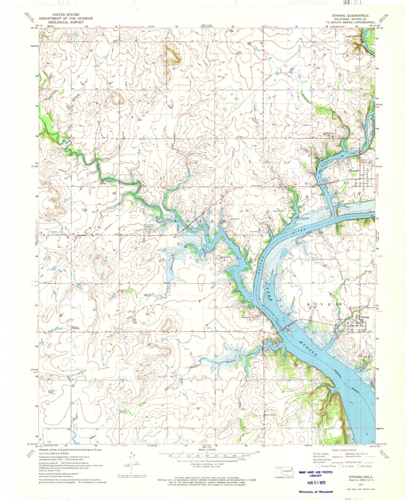
Classic USGS Strang Oklahoma 7.5'x7.5' Topo Map
Couldn't load pickup availability
Historical USGS topographic quad map of Strang in the state of Oklahoma. Map scale may vary for some years, but is generally around 1:24,000. Print size is approximately 24" x 27"
This quadrangle is in the following counties: Mayes.
The map contains contour lines, roads, rivers, towns, and lakes. Printed on high-quality waterproof paper with UV fade-resistant inks, and shipped rolled.
Contains the following named places: Armstrong Branch, Benge Branch, Benge Cemetery, Big Cabin Creek, Cabin Creek Fire Department, City of Adair Waterworks, Elm Creek, Ghormley Cemetery, Grand Isle Airport, Granny Branch, Greenbriar Church, Pensacola, Rock Creek, Rock Creek Church, Stearmans Roost Airport, Strang, Strang Community Fire Department, Strang Police Department, Strang Post Office, Town of Pensacola, Town of Strang, Township of Adair, Utopia Church