MyTopo
Classic USGS Stratford SE California 7.5'x7.5' Topo Map
Regular price
$16.95
Regular price
Sale price
$16.95
Unit price
per
Couldn't load pickup availability
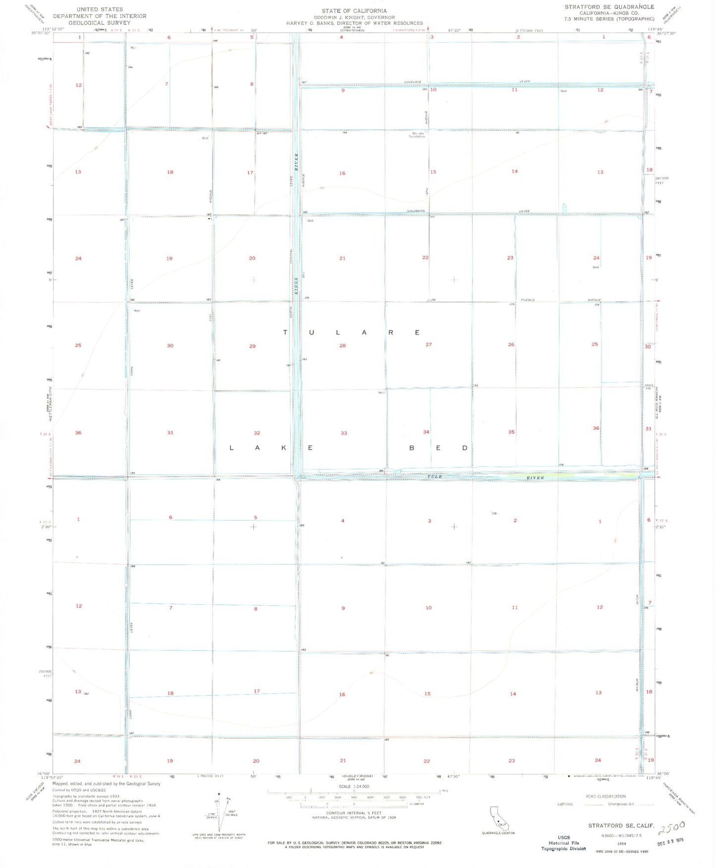
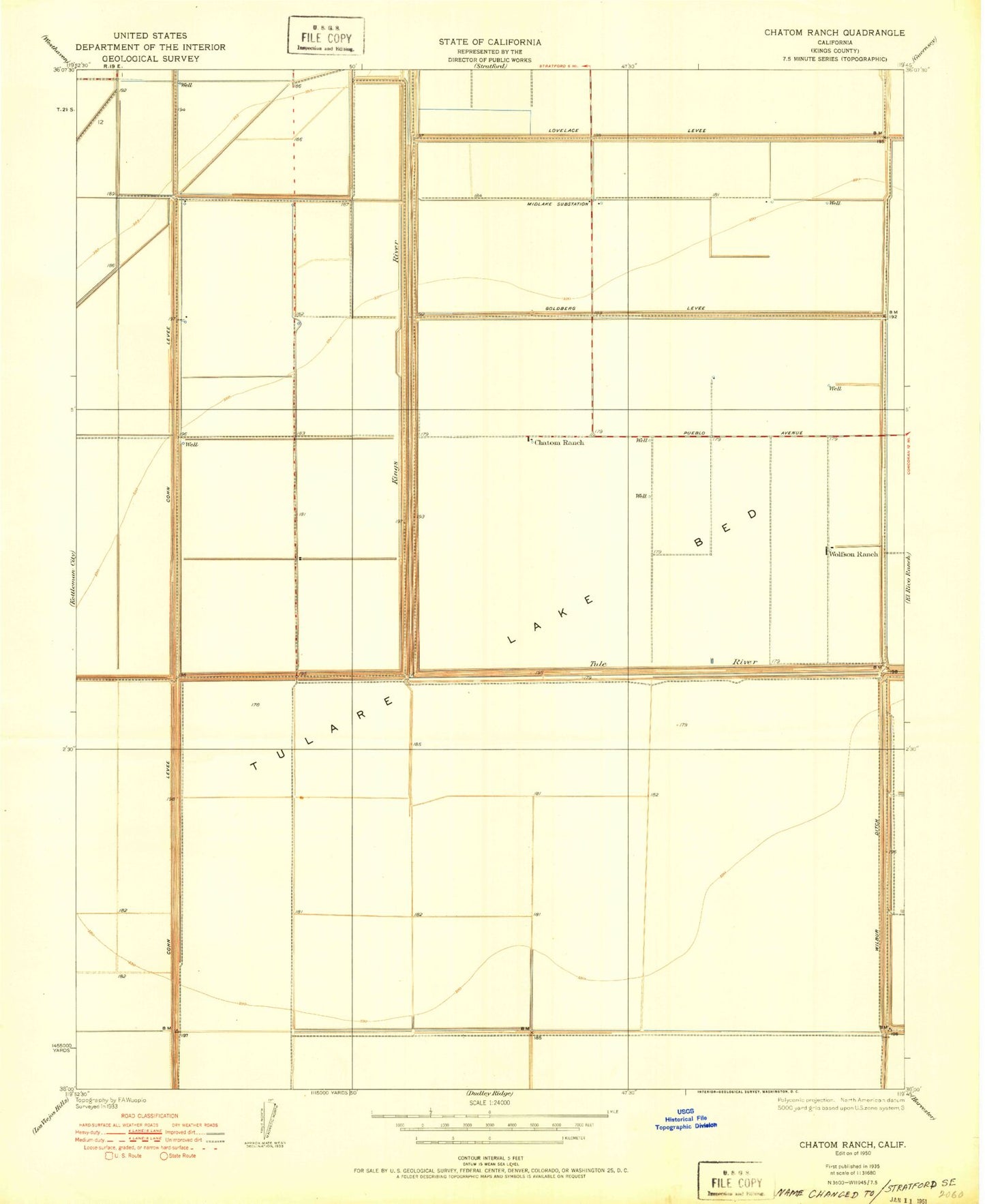
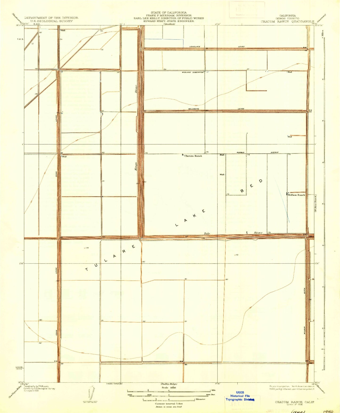
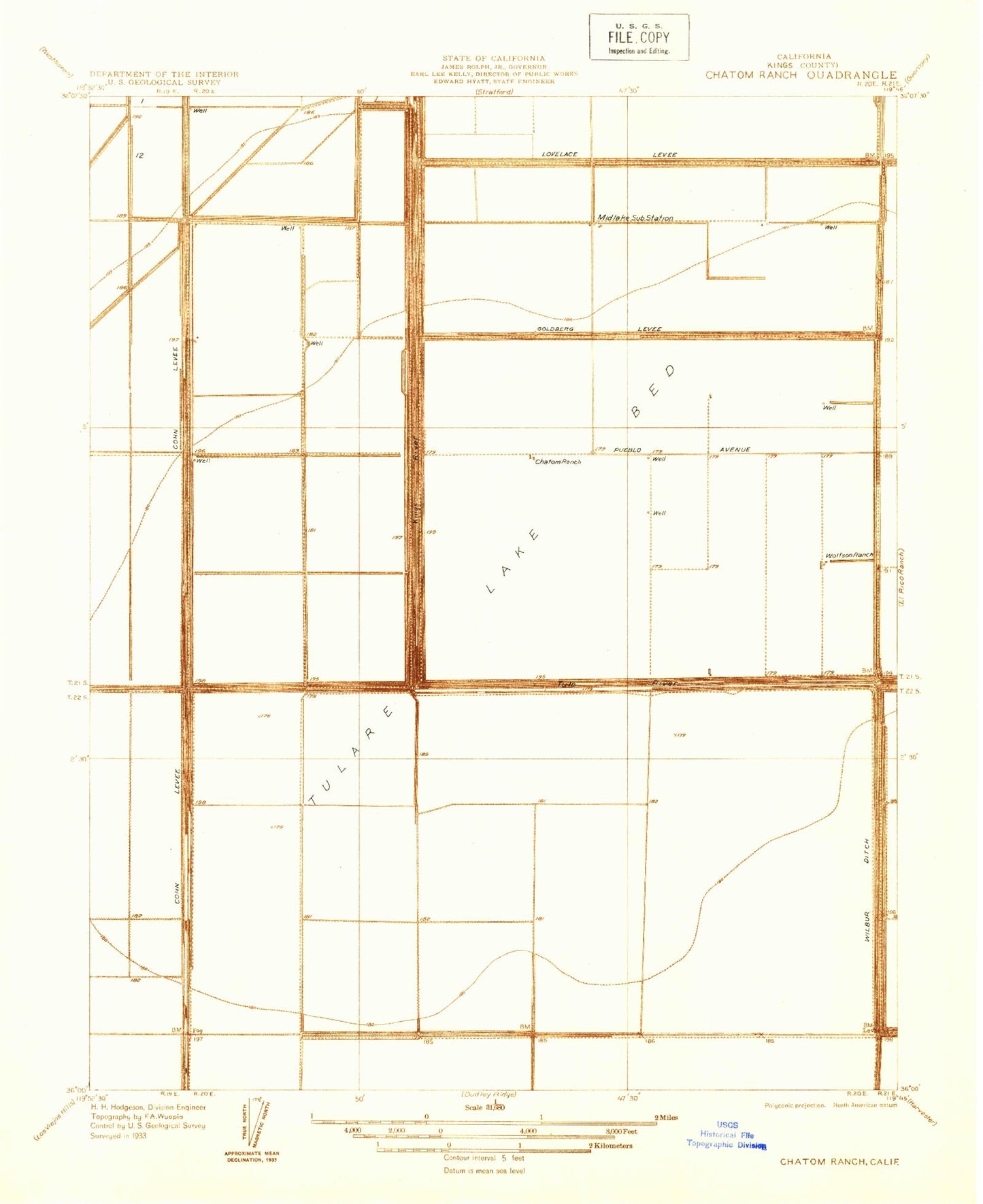
Historical USGS topographic quad map of Stratford SE in the state of California. Map scale may vary for some years, but is generally around 1:24,000. Print size is approximately 24" x 27"
This quadrangle is in the following counties: Kings.
The map contains contour lines, roads, rivers, towns, and lakes. Printed on high-quality waterproof paper with UV fade-resistant inks, and shipped rolled.
Contains the following named places: Chatom Ranch, Cohn Levee, Goldberg Levee, Kings County, Kings River, Lovelace Levee, Midlake Substation, North Central Levee, Stratford Division, Tulare Lake Bed, Tule River, Wolfson Ranch