MyTopo
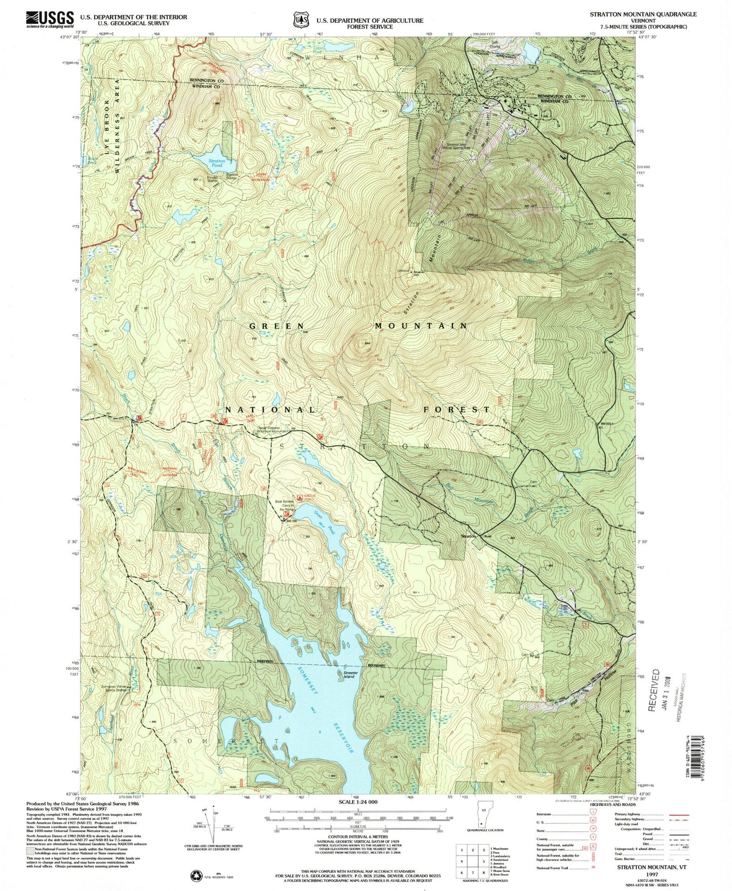
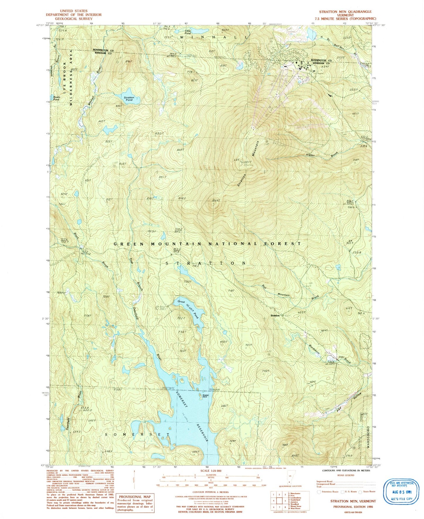
Classic USGS Stratton Mountain Vermont 7.5'x7.5' Topo Map
Couldn't load pickup availability
Historical USGS topographic quad map of Stratton Mountain in the state of Vermont. Typical map scale is 1:24,000, but may vary for certain years, if available. Print size: 24" x 27"
This quadrangle is in the following counties: Bennington, Windham.
The map contains contour lines, roads, rivers, towns, and lakes. Printed on high-quality waterproof paper with UV fade-resistant inks, and shipped rolled.
Contains the following named places: Ball Cemetery, Black Brook, Daniel Webster Historical Monument, Deerfield Trail, Eddy Cemetery, Grout Pond, Little Pond, North Cemetery, Pike Cemetery, School Number 5, Somerset Reservoir, Stratton, Stratton Mountain, Stratton Mountain Camp, Stratton Pond, Streeter Island, Willis Cemetery, Willis Ross Camp, Stratton Mountain Winter Sports Area, Bigelow Shelter, Grout Pond Recreation Site, Stratton View Shelter, Vondell Shelter, Cooridor 7, Webster Shelter, Stratton Lookout Tower, Town of Stratton, Gulf Brook Reservoir Dam, Gulf Brook Reservoir, Stratton Mountain Lake Dam, Stratton Mountain Lake, Stratton Mountain, Stratton Mountain Country Club, Chapel of the Snows, North Cemetery, Stratton Mountain Volunteer Fire Company, Stratton Mountain Volunteer Fire Company - Town Garage, Stratton Mountain School, Stratton Mountain Census Designated Place