
MyTopo
Classic USGS Strawberry Reservoir NE Utah 7.5'x7.5' Topo Map
Couldn't load pickup availability
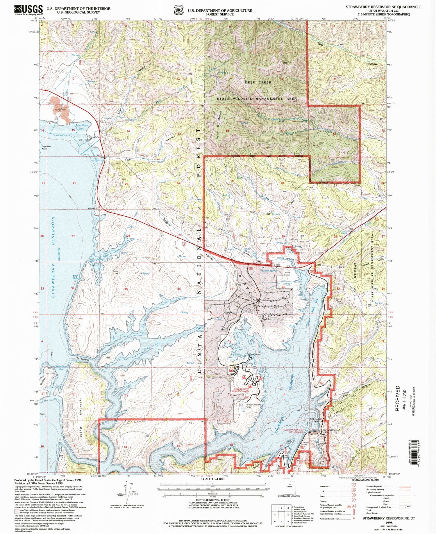
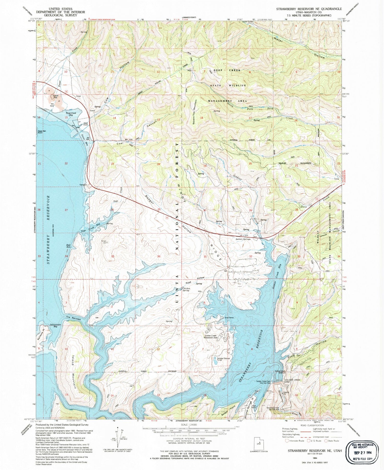
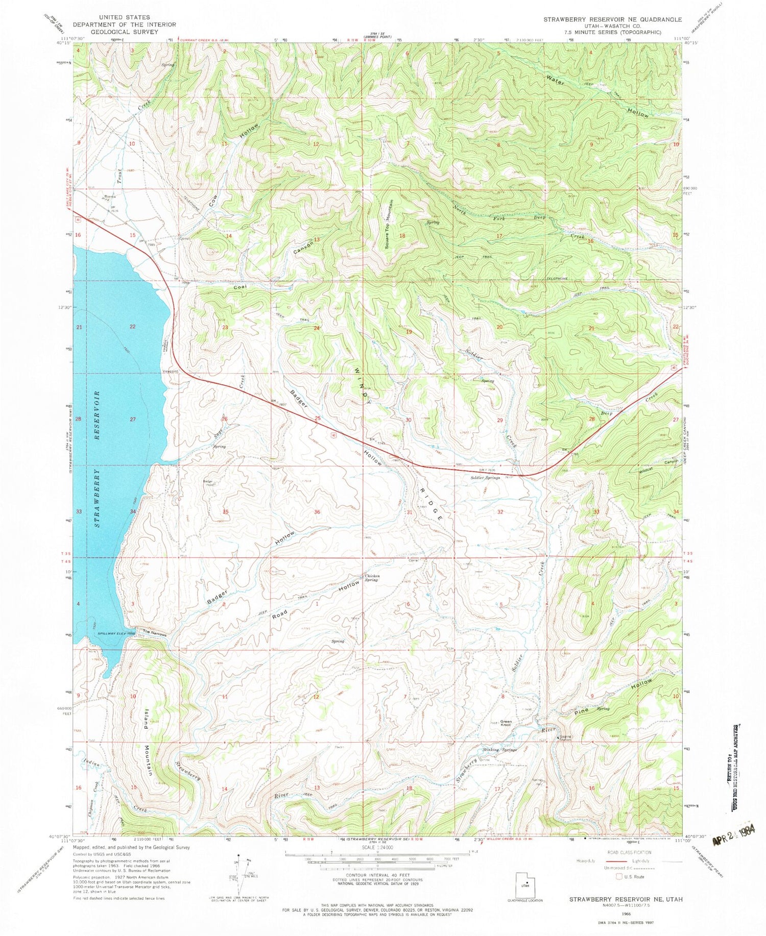
Historical USGS topographic quad map of Strawberry Reservoir NE in the state of Utah. Typical map scale is 1:24,000, but may vary for certain years, if available. Print size: 24" x 27"
This quadrangle is in the following counties: Wasatch.
The map contains contour lines, roads, rivers, towns, and lakes. Printed on high-quality waterproof paper with UV fade-resistant inks, and shipped rolled.
Contains the following named places: Badger Hollow, Chicken Spring, Chipman Creek, Coal Canyon, Cow Hollow, Green Knoll, Island Mountain, Pine Hollow, Road Hollow, Sage Creek, Soldier Creek, Soldier Springs, Square Top Mountain, Stinking Springs, The Narrows, Trout Creek, Windy Ridge, Soldier Creek Dam, Badger Point Campground, Diving Rock Fisherman Access, Soldier Creek Bay Fisherman Access, Soldier Creek Campground, Soldier Creek Campground Loop Trail, Soldier Creek Dam Day Use Area, Soldier Creek Recreation Complex, Sage Creek Fisherman Access, Soldier Creek Overlook, Strawberry Dam (historical), Strawberry River Day Use Area, West Portal Fisherman Access, Water Hollow Tunnel, West Portal Water Hollow Tunnel, Uintah and Ouray Division, Badger Hollow, Chicken Spring, Chipman Creek, Coal Canyon, Cow Hollow, Green Knoll, Island Mountain, Pine Hollow, Road Hollow, Sage Creek, Soldier Creek, Soldier Springs, Square Top Mountain, Stinking Springs, The Narrows, Trout Creek, Windy Ridge, Soldier Creek Dam, Badger Point Campground, Diving Rock Fisherman Access, Soldier Creek Bay Fisherman Access, Soldier Creek Campground, Soldier Creek Campground Loop Trail, Soldier Creek Dam Day Use Area, Soldier Creek Recreation Complex, Sage Creek Fisherman Access, Soldier Creek Overlook, Strawberry Dam (historical), Strawberry River Day Use Area, West Portal Fisherman Access, Water Hollow Tunnel, West Portal Water Hollow Tunnel, Uintah and Ouray Division


