MyTopo
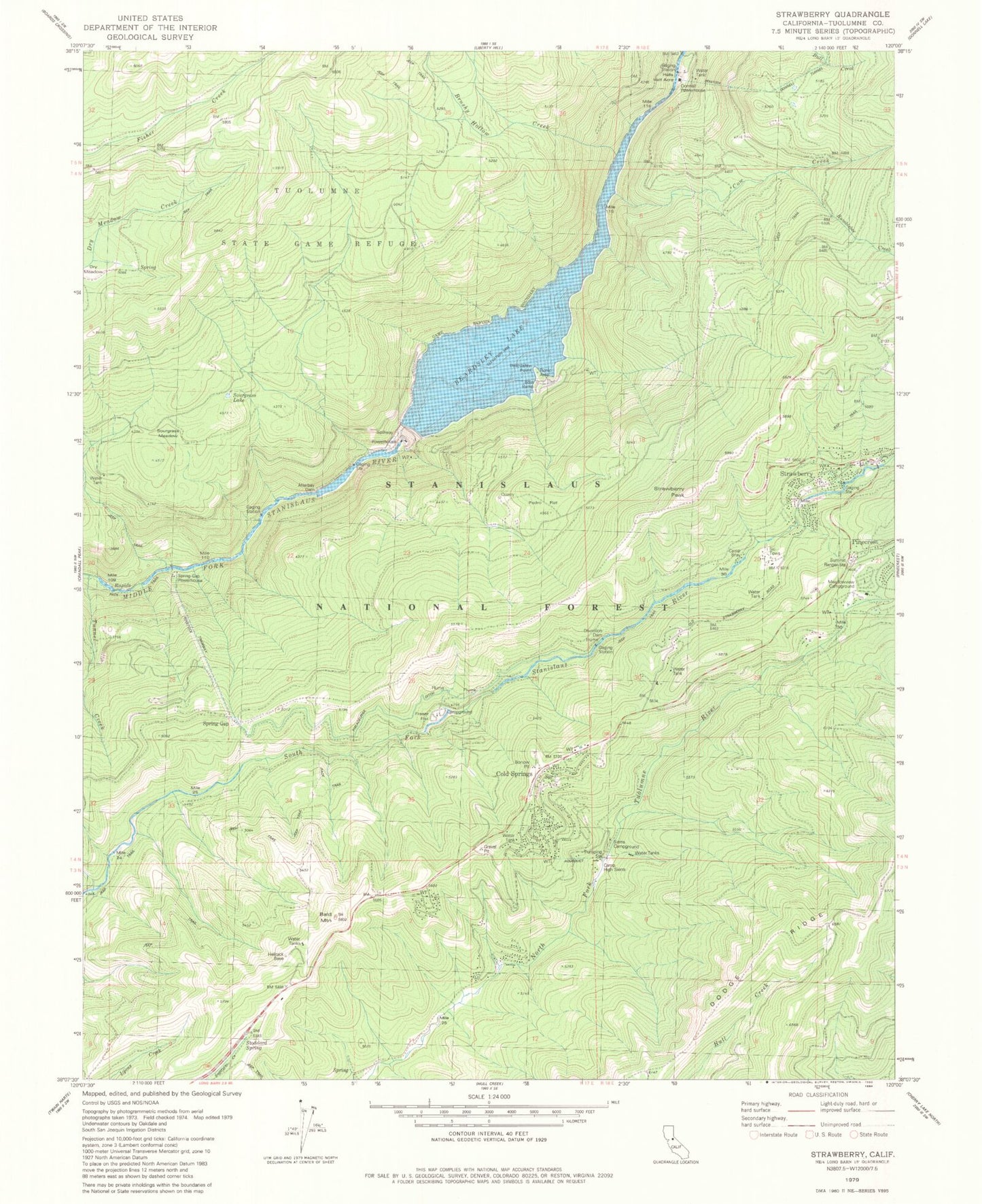
Classic USGS Strawberry California 7.5'x7.5' Topo Map
Couldn't load pickup availability
Historical USGS topographic quad map of Strawberry in the state of California. Typical map scale is 1:24,000, but may vary for certain years, if available. Print size: 24" x 27"
This quadrangle is in the following counties: Tuolumne.
The map contains contour lines, roads, rivers, towns, and lakes. Printed on high-quality waterproof paper with UV fade-resistant inks, and shipped rolled.
Contains the following named places: Afterbay Dam, Bald Mountain, Beardsley Point, Brushy Hollow Creek, Bumblebee Creek, Camp Bray, Camp High Sierra, Cow Creek, Dry Meadow, Fraser Flat, Hells Half Acre, Helltack Base, Leland Creek, Meadowview Campground, Pedro Flat, Philadelphia Ditch, Sierra Campground, Sourgrass Lake, Sourgrass Meadow, Stoddard Spring, Strawberry Peak, Beardsley Lake, Stanislaus National Forest, Beardsley Dam, Beardsley Point Picnic Area, Pinecrest Treatment Plant, Strawberry Forestry Division Fire Station, Strawberry Work Center, Baptist Camp, California Alumni Camp, Bald Mountain Heliport, Donnell Powerhouse, Spring Gap Powerhouse, Chinaman Creek, Cold Springs, Spring Gap, Strawberry, Summit Ranger Station, Camp Sylvester, Pinecrest Elementary School, Strawberry Fire Protection District, Tuolumne County Fire Department Station 55 Pinecrest, Cold Springs Census Designated Place, Strawberry Census Designated Place