MyTopo
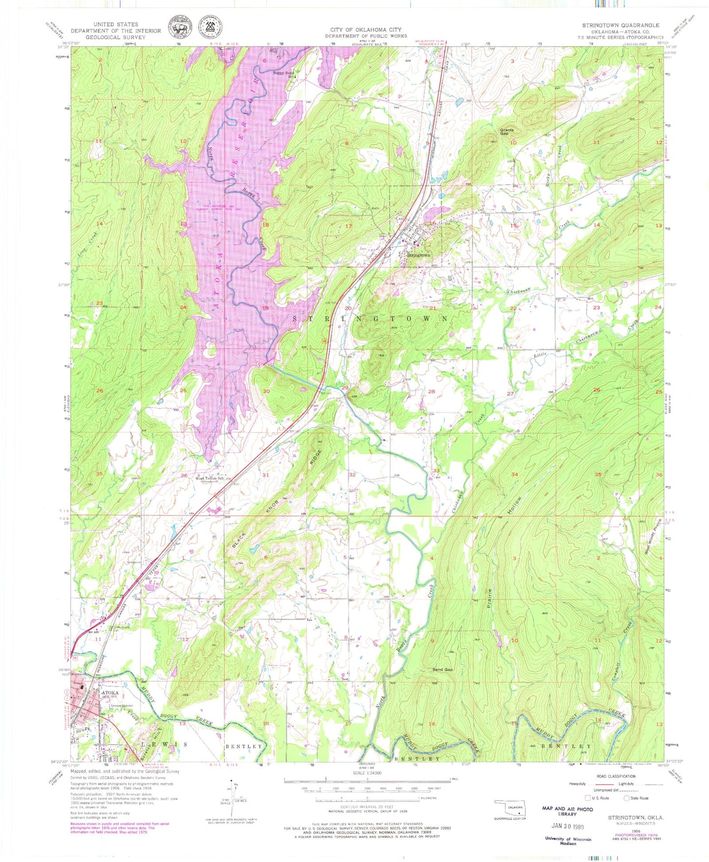
Classic USGS Stringtown Oklahoma 7.5'x7.5' Topo Map
Couldn't load pickup availability
Historical USGS topographic quad map of Stringtown in the state of Oklahoma. Map scale may vary for some years, but is generally around 1:24,000. Print size is approximately 24" x 27"
This quadrangle is in the following counties: Atoka.
The map contains contour lines, roads, rivers, towns, and lakes. Printed on high-quality waterproof paper with UV fade-resistant inks, and shipped rolled.
Contains the following named places: Atoka Fire Department Station 1, Atoka Post Office, Atoka Reservoir, Atoka Reservoir Dam, Black Knob Ridge, Boggy Bend Cemetery, Boggy Bend Ford, Boggy Bend School, Camel Creek, Campbell Creek, Chickasaw Creek, Confederate Cemetery, County District 10, Grants Gap, Green Hill Cemetery, Katy Lake, Little Chickasaw Creek, McKinney Cemetery, Mill Creek, Mount Olive Cemetery, Mount Olive Church, North Boggy Creek, Prairie Hollow, Rocky Creek, Sand Gap, Sandy Creek, Stringtown, Stringtown Cemetery, Stringtown Elementary School, Stringtown Fire Department, Stringtown High School, Stringtown Police Department, Stringtown Post Office, Town of Stringtown, Township of Stringtown, Wells Street Cemetery, West Tellico School, West Windy Prairie