MyTopo
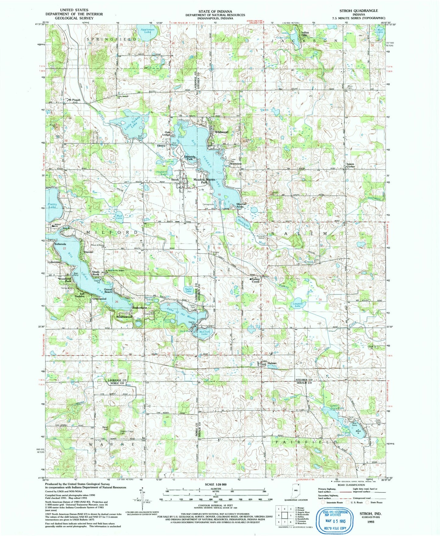
Classic USGS Stroh Indiana 7.5'x7.5' Topo Map
Couldn't load pickup availability
Historical USGS topographic quad map of Stroh in the state of Indiana. Map scale may vary for some years, but is generally around 1:24,000. Print size is approximately 24" x 27"
This quadrangle is in the following counties: DeKalb, LaGrange, Noble, Steuben.
The map contains contour lines, roads, rivers, towns, and lakes. Printed on high-quality waterproof paper with UV fade-resistant inks, and shipped rolled.
Contains the following named places: Appleman Lake, Big Long Lake, Big Turkey Lake, Block Cemetery, Block Island, Camp Lakewood, Church of God, Duck Pond, Elmira, Goose Pond, Gravel Beach, Greenwood, Hartzel, Hayward Lake, Helmer, Helmer United Baptist Church, Helmer United Methodist Church, Helmer Volunteer Fire Department, Henry Lake, Hutchins Ditch, Indian Hills, Indianola, Lake Arrowhead, Lake Bethel Cemetery, Lake Bethel Church, Lake of the Woods, Lakeside Park, Lakeview, Limekiln Lake, Little Turkey Lake, Lower Story Lake, M and M Dairy Farm, Maumee Ditch, McClish Lake, Meadow Shores Park, Mount Pisgah, Mud Creek, Mud Lake, Oak Lodge, Pretty Lake, Prince of Peace Lutheran Church, Ramblewood, Reed Cemetery, Saint Mary of the Angels Church, Salem Center, Salem Center School, Salem Center Volunteer Fire Department, Sand Hill, Shady Nook, Sha-Get Acres, Spectacle Lakes, Story Lake, Stroh, Stroh Church of Christ, Stroh Post Office, Stroh United Baptist Church, Stroh Volunteer Fire Department, Stump Ditch, Tall Timbers, Taylor Lake, The Basin, Timberhurst, Township of Salem, Turkey Creek, Uhl Ditch, Upper Story Lake, Weston Chapel Cemetery, Westview, Wildwood, Woodland Park, Wright Cemetery, ZIP Code: 46747