MyTopo
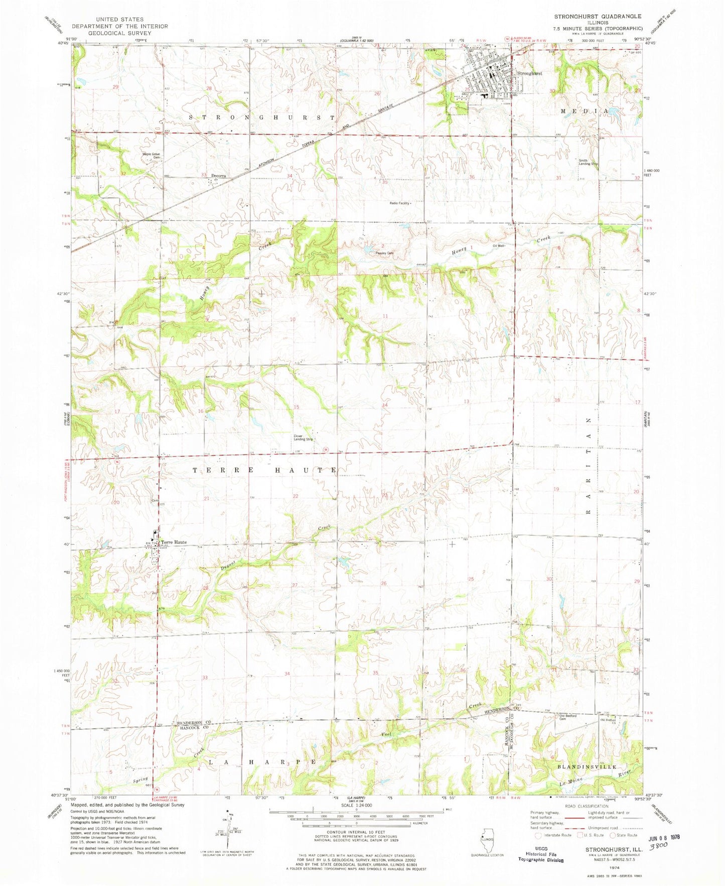
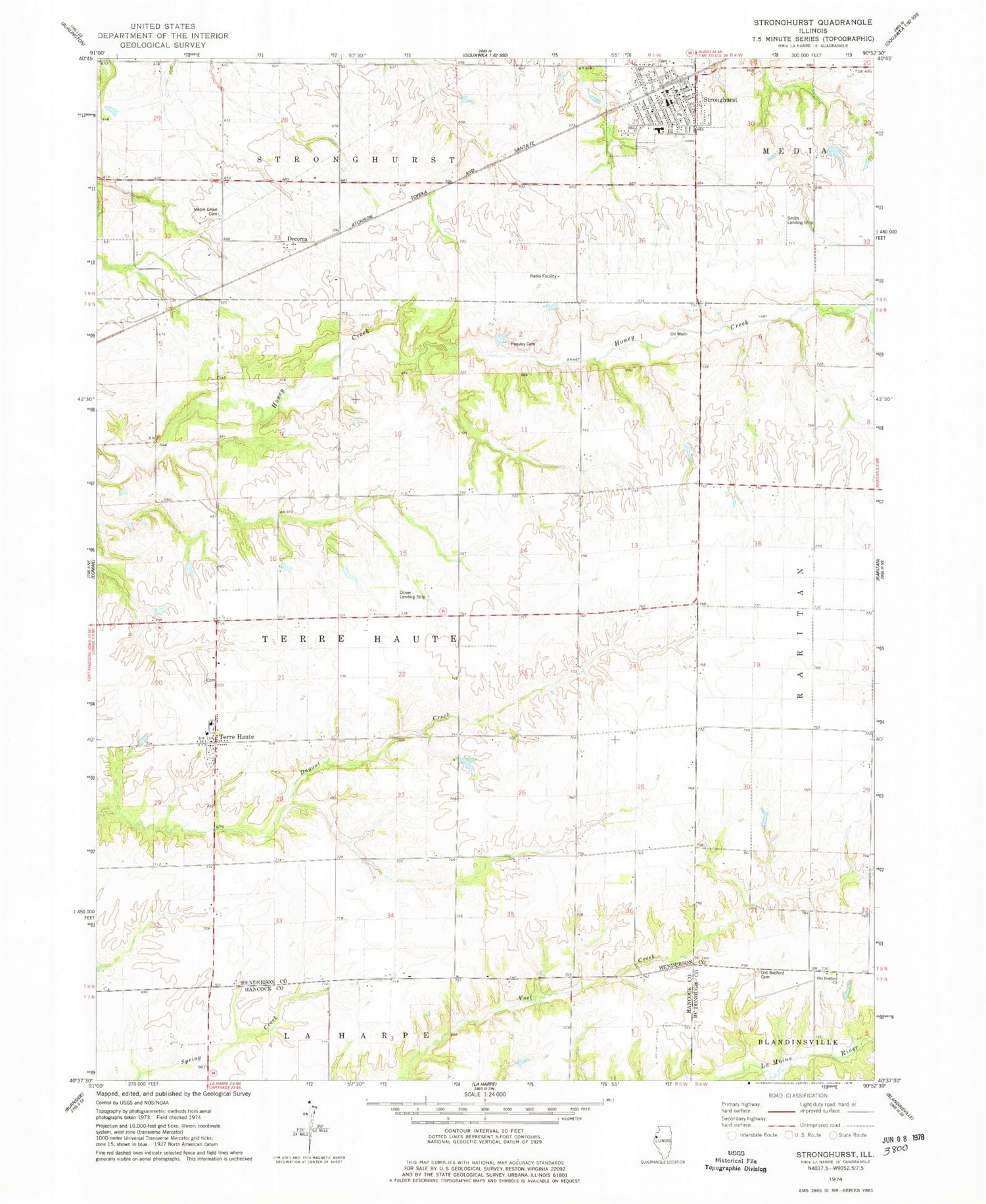
Classic USGS Stronghurst Illinois 7.5'x7.5' Topo Map
Couldn't load pickup availability
Historical USGS topographic quad map of Stronghurst in the state of Illinois. Map scale may vary for some years, but is generally around 1:24,000. Print size is approximately 24" x 27"
This quadrangle is in the following counties: Hancock, Henderson, McDonough.
The map contains contour lines, roads, rivers, towns, and lakes. Printed on high-quality waterproof paper with UV fade-resistant inks, and shipped rolled.
Contains the following named places: Bedford School, Chandler School, Clover Landing Strip, Cork School, Decorra, Fitz School, Henderson School, La Harpe Fire Protection District Station 2, Maple Grove Cemetery, Maple Grove School, Media - Stronghurst - Terre Haute Fire Protection District Station 1, Neff Airport, Old Bedford Cemetery, Old Bedford Christian Church, Peasley Cemetery, Peasley School, South Henderson County Ambulance Service, South Prairie School, South School, Southern Elementary School, Southern High School, Stine School, Stronghurst, Stronghurst Post Office, Terre Haute, Terre Haute Cemetery, Township of Terre Haute, Village of Stronghurst, ZIP Code: 61480