MyTopo
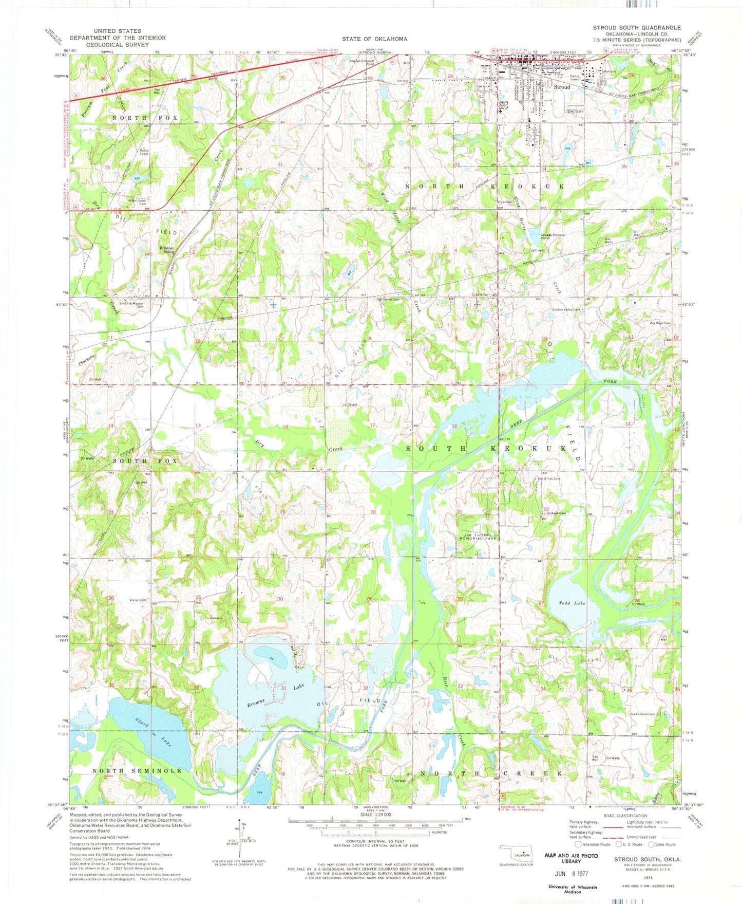
Classic USGS Stroud South Oklahoma 7.5'x7.5' Topo Map
Couldn't load pickup availability
Historical USGS topographic quad map of Stroud South in the state of Oklahoma. Map scale may vary for some years, but is generally around 1:24,000. Print size is approximately 24" x 27"
This quadrangle is in the following counties: Lincoln.
The map contains contour lines, roads, rivers, towns, and lakes. Printed on high-quality waterproof paper with UV fade-resistant inks, and shipped rolled.
Contains the following named places: Arbor Grove Cemetery, Barby Creek, Brinkley Siding, Browns Lake, Chuckaho Creek, Clark Lake, Deer Creek, Dosie Creek, Dry Creek, First Christian Church, Godwin Cemetery, Golden Valley Cemetery, Gray Horse Creek, Jim Thorpe Memorial Park, Key West, Key West Cemetery, Mercy Regional Ambulance Squad, Methodist Church, Oak Grove Cemetery, Oknoname 08108 Dam, Oknoname 08108 Reservoir, Oknoname 08110 Dam, Oknoname 08110 Reservoir, Oknoname 08111 Dam, Oknoname 08111 Reservoir, Rock Island Cemetery, Sac and Fox Nation Fire Department, Sac and Fox Nation Police Department, Sac and Fox Tribal Cemetery, Smith - Messer Cemetery, Stroud, Stroud Cemetery, Stroud Fire Department, Stroud Police Department, Stroud Post Office, Stroud Regional Medical Center, Todd Lake, Township of South Keokuk, Victor Cemetery, Wild Horse Creek, ZIP Code: 74079