MyTopo
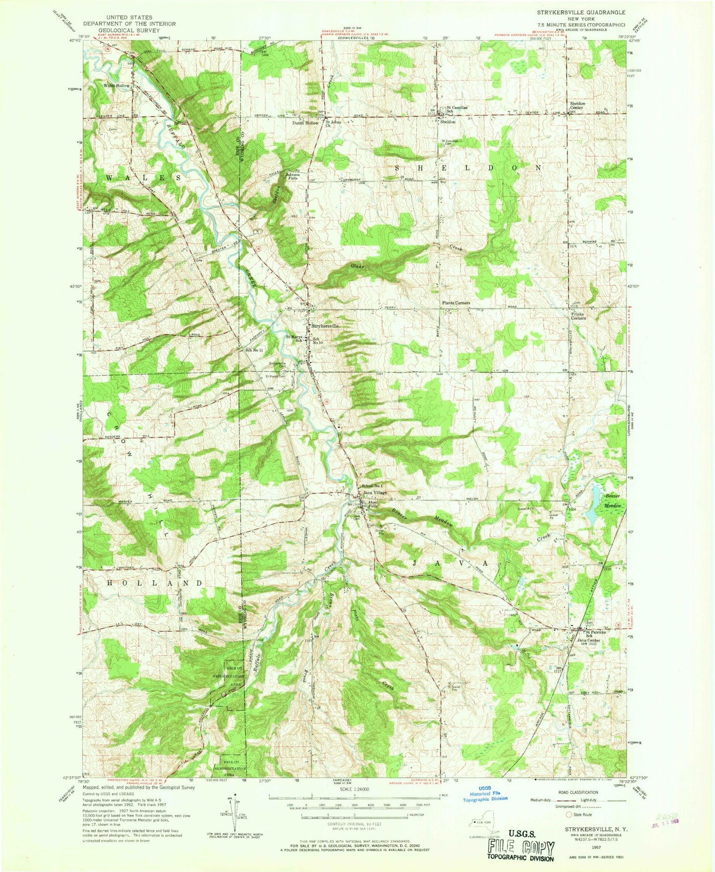
Classic USGS Strykersville New York 7.5'x7.5' Topo Map
Couldn't load pickup availability
Historical USGS topographic quad map of Strykersville in the state of New York. Map scale may vary for some years, but is generally around 1:24,000. Print size is approximately 24" x 27"
This quadrangle is in the following counties: Erie, Wyoming.
The map contains contour lines, roads, rivers, towns, and lakes. Printed on high-quality waterproof paper with UV fade-resistant inks, and shipped rolled.
Contains the following named places: Angel Falls, Beaver Meadow, Beaver Meadow Creek, Beaver Meadow Family Campground, Bloecher Farm Airport, Brown Brook, Crow Hill, Dutch Hollow, Erie County Reforestation Area, Fontaine Farm, Frinks Corner, Frink's Corners Cemetery, Glade Creek, Java Center, Java Center Post Office, Java Village, Java Village Cemetery, Java Village Post Office, Johnson Falls, North Java Volunteer Fire Department Station 2, Pingrey Dairy Farm, Plants Corner, Plato Brook Farms, Plato Creek, Saint Caecilias School, Saint Cecilia's Cemetery, Saint Cecilia's Roman Catholic Church, Saint Cecilias South Cemetery, Saint John's Cemetery, Saint John's United Church of Christ, Saint Marys Cemetery, Saint Marys School, Saint Patrick's Cemetery, Saint Patrick's Church, Saint Patricks School, School Number 1, School Number 10, School Number 11, Sheldon, Sheldon Center, Sheldon Creek, Sheldon Volunteer Fire Company, Strykersville, Strykersville Cemetery, Strykersville Census Designated Place, Strykersville Pioneer Cemetery, Strykersville Post Office, Strykersville Volunteer Fire Company, Town of Java, Town of Sheldon, Vista View Farms, Wales Hollow, Wales Hollow Lutheran Church, ZIP Codes: 14082, 14145