MyTopo
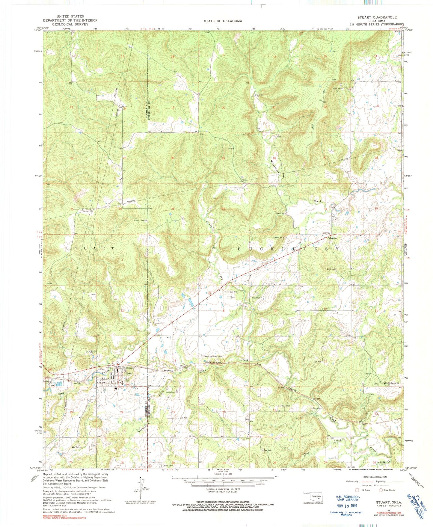
Classic USGS Stuart Oklahoma 7.5'x7.5' Topo Map
Couldn't load pickup availability
Historical USGS topographic quad map of Stuart in the state of Oklahoma. Map scale may vary for some years, but is generally around 1:24,000. Print size is approximately 24" x 27"
This quadrangle is in the following counties: Hughes, Pittsburg.
The map contains contour lines, roads, rivers, towns, and lakes. Printed on high-quality waterproof paper with UV fade-resistant inks, and shipped rolled.
Contains the following named places: Cabaniss, Coon Creek, Double Spring Church, Hegwood Creek, Hominy Creek, Oknoname 121002 Dam, Oknoname 121002 Reservoir, Pryor Cemetery, Sandy Creek, Stuart, Stuart Elementary School, Stuart Fire Department, Stuart High School, Stuart Post Office, Town of Stuart, White Chimney Cemetery