MyTopo
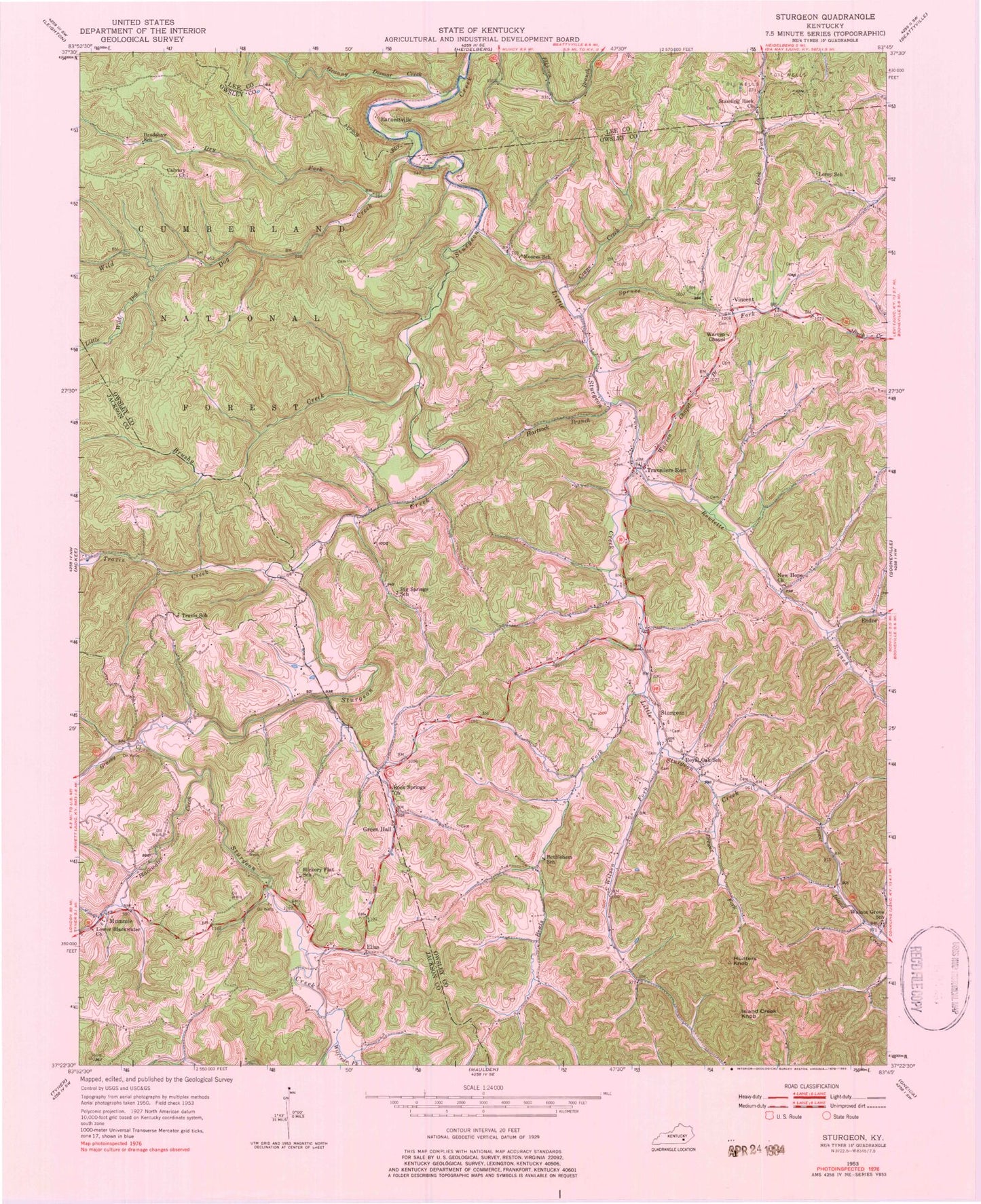
Classic USGS Sturgeon Kentucky 7.5'x7.5' Topo Map
Couldn't load pickup availability
Historical USGS topographic quad map of Sturgeon in the state of Kentucky. Map scale may vary for some years, but is generally around 1:24,000. Print size is approximately 24" x 27"
This quadrangle is in the following counties: Jackson, Lee, Owsley.
The map contains contour lines, roads, rivers, towns, and lakes. Printed on high-quality waterproof paper with UV fade-resistant inks, and shipped rolled.
Contains the following named places: Beals Fork, Bethlehem School, Big Spring Neighborhood, Big Springs School, Blackwater Creek, Blackwater School, Botner Cemetery, Botner Post Office, Bradshaw School, Brewer Fork, Brewer Neighborhood, Brewer Post Office, Brushy Creek, Calvary Church, Cannon Chapel, Chadwell Post Office, Crane Creek, Dry Fork, Earnestville, Earnestville Post Office, Elias, Elias Post Office, Endee, Endee Post Office, Granny Dismal Creek, Grassy Creek, Green Hall, Green Hall Post Office, Greenhill Post Office, Hartsock Branch, Hickory Flat, Hickory Flat School, High Rock, Hunters Knob, Island Creek Knob, John Tyler Brewer Cemetery, Leroy School, Little Sturgeon Creek, Little Wild Dog Creek, Lower Blackwater Baptist Church, Lynch Post Office, Mills Branch, Moores School, Moors Neighborhood, Mummie, Mummie Post Office, Needmore Neighborhood, Needmore School, New Hope Church, Powell Post Office, Rock Spring Neighborhood, Rock Springs Church, Rowlette Branch, Royal Oak Church, Royal Oak School, Spruce Fork, Standing Rock Church, Sturgeon, Sturgeon Consolidate School, Sturgeon Division, Sturgeon Post Office, Travelers Rest Post Office, Travellers Rest, Travis, Travis Church, Travis Creek, Travis School, Vincent, Vincent Post Office, Vincent Volunteer Fire Department, Walnut Grove School, Warren Chapel, Warren Chapel Branch, Wild Dog Creek, Wilfreds Fork, Wilson Fork, Wolf Pen Creek