MyTopo
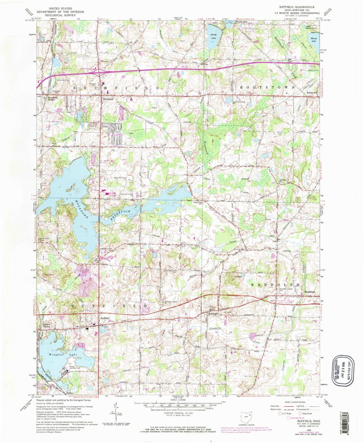
Classic USGS Suffield Ohio 7.5'x7.5' Topo Map
Couldn't load pickup availability
Historical USGS topographic quad map of Suffield in the state of Ohio. Map scale may vary for some years, but is generally around 1:24,000. Print size is approximately 24" x 27"
This quadrangle is in the following counties: Portage.
The map contains contour lines, roads, rivers, towns, and lakes. Printed on high-quality waterproof paper with UV fade-resistant inks, and shipped rolled.
Contains the following named places: Bacon Hill, Brimfield, Brimfield Census Designated Place, Brimfield Elementary School, Brimfield Fire Department, Brimfield Plaza Shopping Center, Brimfield Post Office, Brimfield Station, Brimfield Township Police Department, Brimfield Water Treatment Plant, Bunkers Corners, Central Elementary School, Congress Lake Outlet, Cranberry Creek, East Lawn Cemetery, Feeder Canal, Field High School, Field Junior High School, Five Corners, German Reformed Cemetery, Green Hills Golf Course, Hilltown, Hudson Ditch, Little Mussy Lake, Mogadore Reservoir, Muzzy Lake, North Dyke Cemetery, Paradise Lake Golf Course, Potter Creek, Randolph Acres Mobile Home Park, Randolph Hillside Cemetery, Restland Cemetery, Sackett Field, Saint Joseph, Saint Joseph Cemetery, Saint Joseph Post Office, Saint Michaels Cemetery, Saint Peters Cemetery, Saint Peters Church, Sandy Lake, Sober Pit, Suffield, Suffield Census Designated Place, Suffield Elementary School, Suffield Post Office, Suffield Station, Suffield Township Fire Department, Sunny Hills Golf Course, Thorndyke Cemetery, Township of Brimfield, Township of Suffield, Triangle Lake Bog State Nature Preserve, Upson Meacham Cemetery, Victorian Farms, Wingfoot Lake, Wingfoot Lake Dam, Wingfoot Lake Test Operations Balloonport, WNIR-FM (Kent), ZIP Codes: 44260, 44265