MyTopo
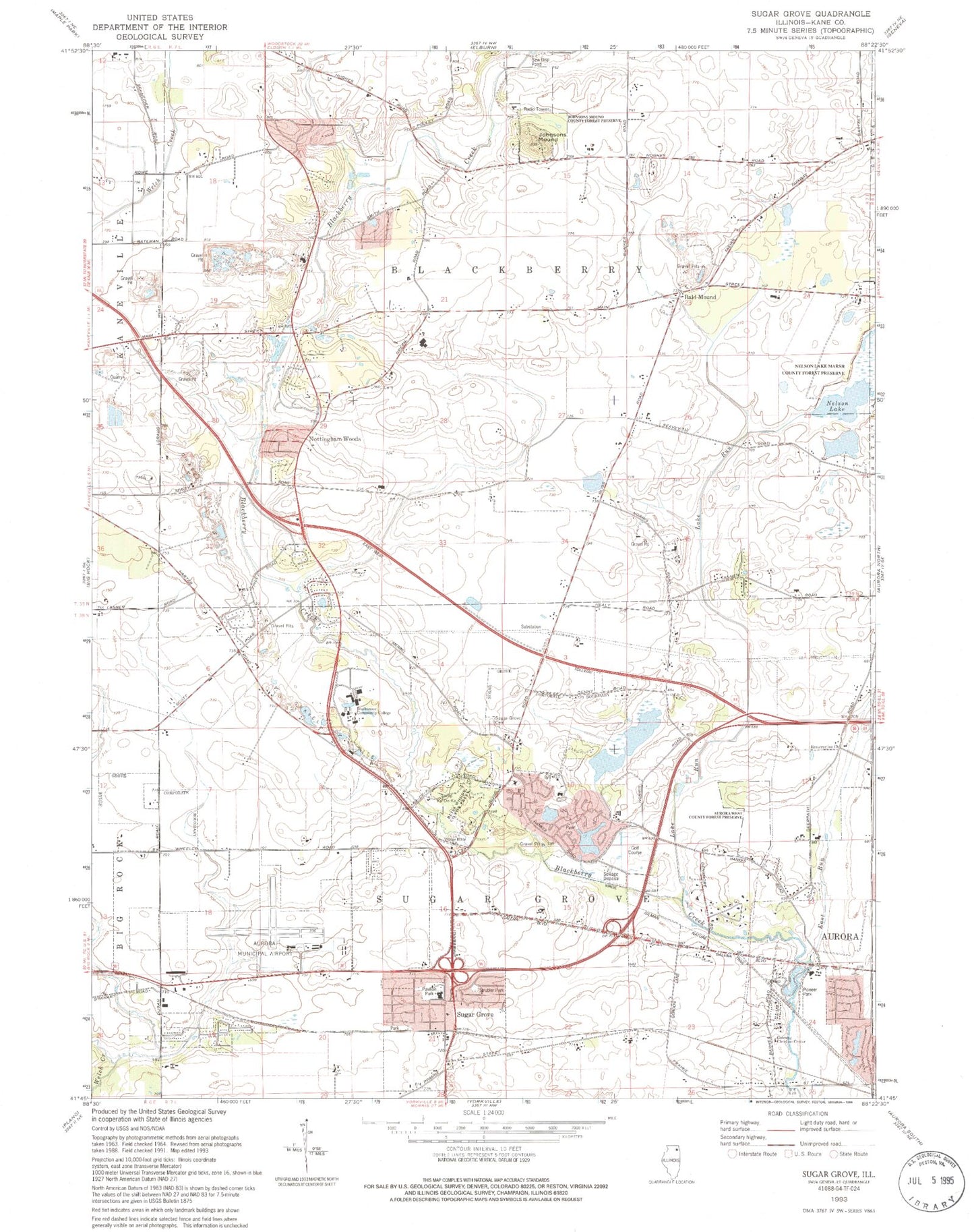
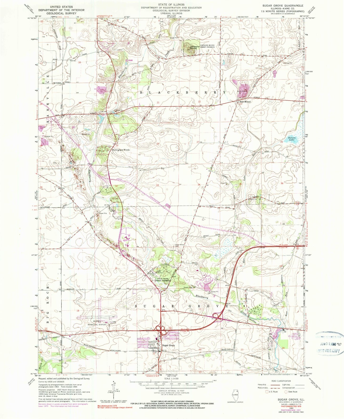
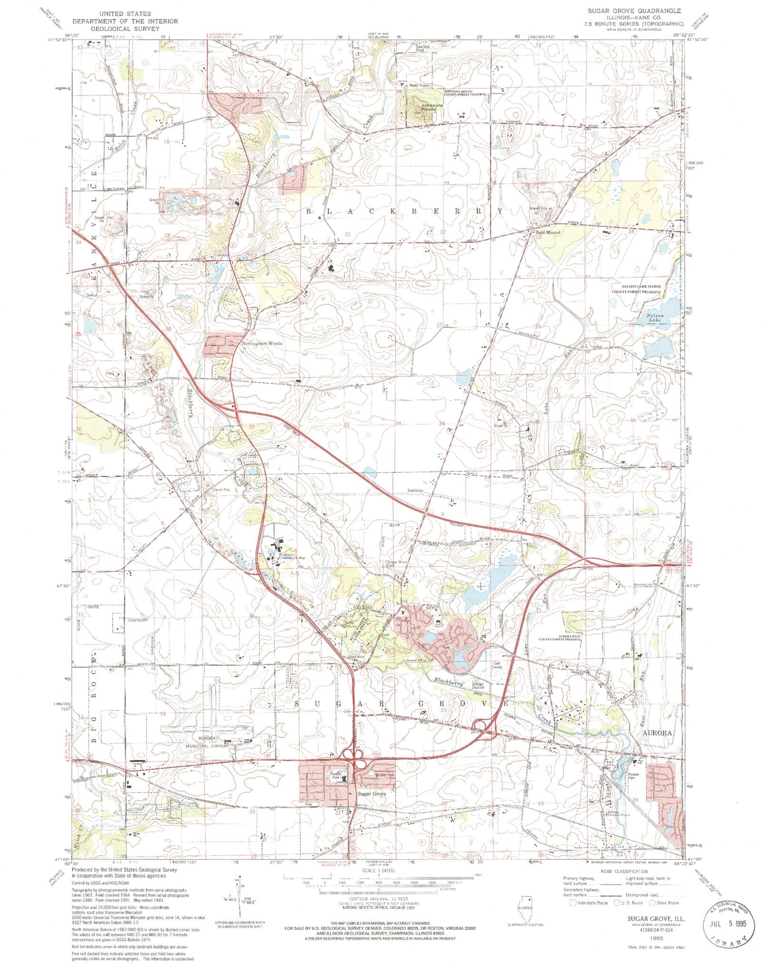
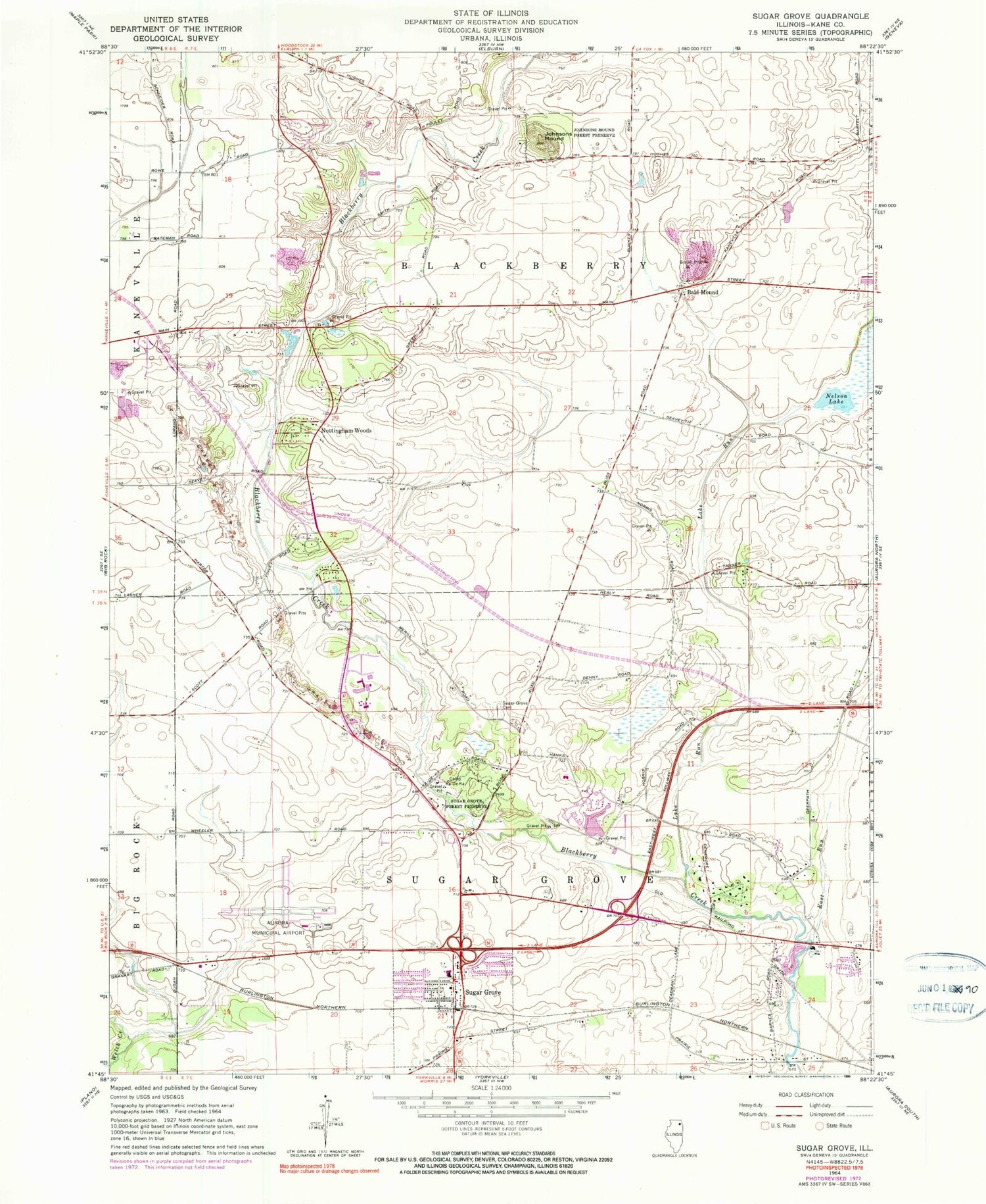
Classic USGS Sugar Grove Illinois 7.5'x7.5' Topo Map
Couldn't load pickup availability
Historical USGS topographic quad map of Sugar Grove in the state of Illinois. Typical map scale is 1:24,000, but may vary for certain years, if available. Print size: 24" x 27"
This quadrangle is in the following counties: Kane.
The map contains contour lines, roads, rivers, towns, and lakes. Printed on high-quality waterproof paper with UV fade-resistant inks, and shipped rolled.
Contains the following named places: Bald Mound, Camp Ka-De-Ka, East Run, Johnsons Mound, Johnsons Mound County Forest Preserve, Lake Run, Nelson Lake, Nottingham Woods, Sugar Grove, Sugar Grove Cemetery, Sugar Grove Forest Preserve, Aurora Municipal Airport, Township of Blackberry, Township of Sugar Grove, Mud Island School (historical), Grouse School (historical), Pavilion Park, Strubler Park, Gateway Christian Center, Pioneer Park, Resurrection Church, Aurora West County Forest Preserve, Leick School (historical), Blackberry Center School (historical), Gould Souders School (historical), Denny School (historical), Bliss Woods County Forest Preserve, Village Bible Church, Waubonsee Community College, Lance - Sounders Family Cemetery, Sugar Grove Post Office, Sugar Grove Public Library, Sugar Grove United Methodist Church, Blackberry Acres, Blackberry Woods, Donny Hill Meadows, Rombury Oaks, Tanner Woods, Timbercrest, Willow Creek, Windenoak, Prestbury Golf Course, Blackberry Farms Historic Site, Blackberry Maples Forest Preserve, Culver Forest Preserve, Hannaford Woods Forest Preserve, Prairie Kame Forest Preserve, Resurrection Lutheran School, Almon Underwood Prairie Nature Preserve, Bliss Woods Nature Preserve, Johnson's Mound Nature Preserve, Nelson Lake Marsh Nature Preserve, Aurora Chain of Lakes Cherry Hills Diversion, East Run North Loop, Elburn Run, Lake Run Main Street Branch, Lake Run Nelson Lake Branch, Lake Run North Of I-88 Overflow, Lake Run North of I-88 Overflow East Branch, Lake Run South of I-88 Diversion, Prestbury Branch, Seavey Road Run, Seavey Road Run Green Road Branch, Seavey Road Run Main Street Branch, Village of Sugar Grove, Duffin Drain, Sugar Grove Branch, Sugar Grove Branch East, Sugar Grove Branch North, Prestbury Census Designated Place, Prestbury, AeroCare Air Ambulance Service, Elburn and Countryside Fire Protection District Station 2, Sugar Grove Township Fire Protection District Station 1, North Aurora - Countryside Fire Protection District Station 2, Sugar Grove Police Department