MyTopo
Classic USGS Sugarloaf Peak Arizona 7.5'x7.5' Topo Map
Regular price
$16.95
Regular price
Sale price
$16.95
Unit price
per
Couldn't load pickup availability
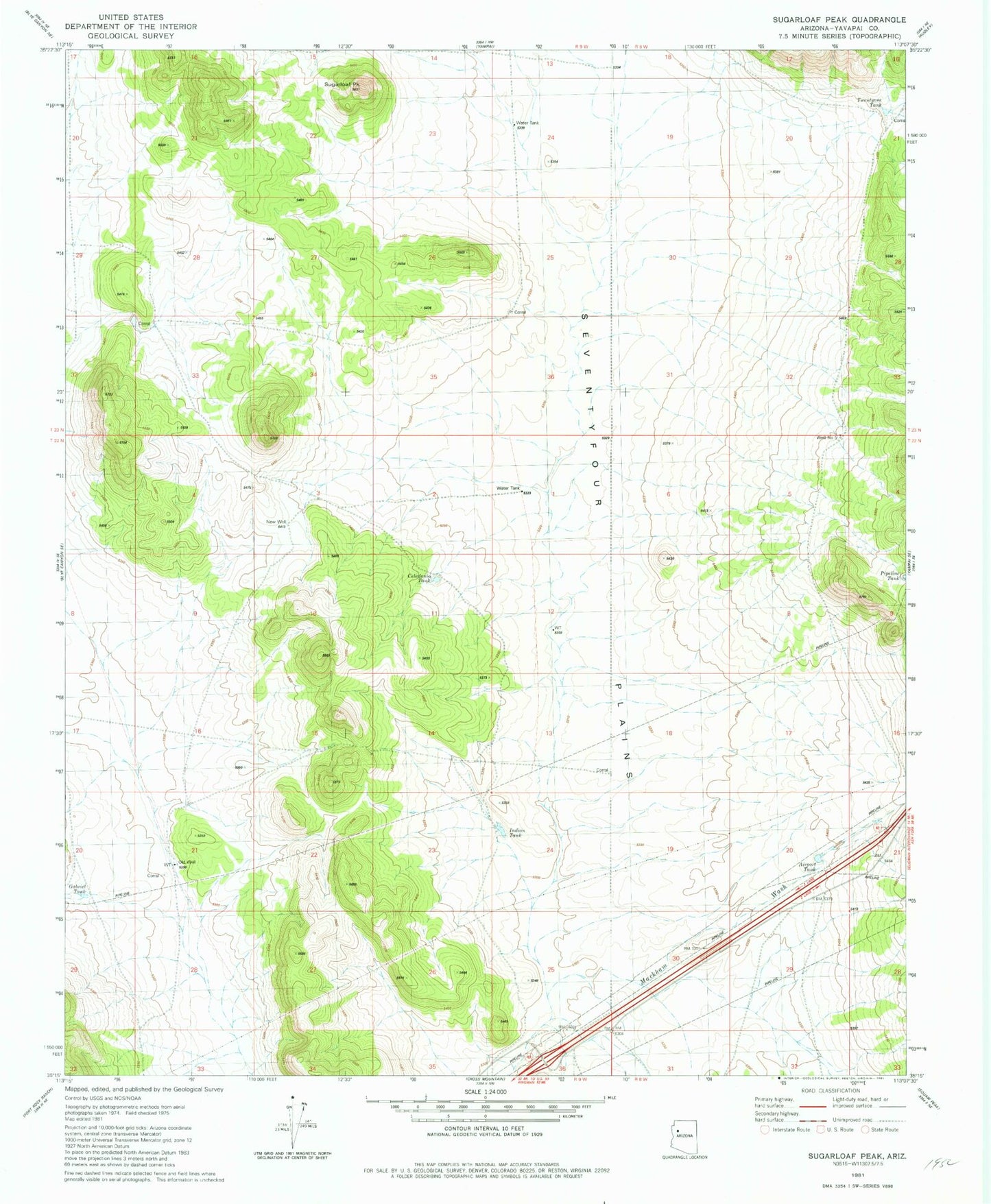
Historical USGS topographic quad map of Sugarloaf Peak in the state of Arizona. Map scale may vary for some years, but is generally around 1:24,000. Print size is approximately 24" x 27"
This quadrangle is in the following counties: Yavapai.
The map contains contour lines, roads, rivers, towns, and lakes. Printed on high-quality waterproof paper with UV fade-resistant inks, and shipped rolled.
Contains the following named places: Airport Tank, Celedonio Tank, Corral Tank, Gabriel Tank, Indian Tank, Markham Wash, New Well, Number Five Trough, Old Well, Pipeline Tank, Seventyfour Plains, Sugarloaf Peak, Twentyone Tank, Well Number Five