MyTopo
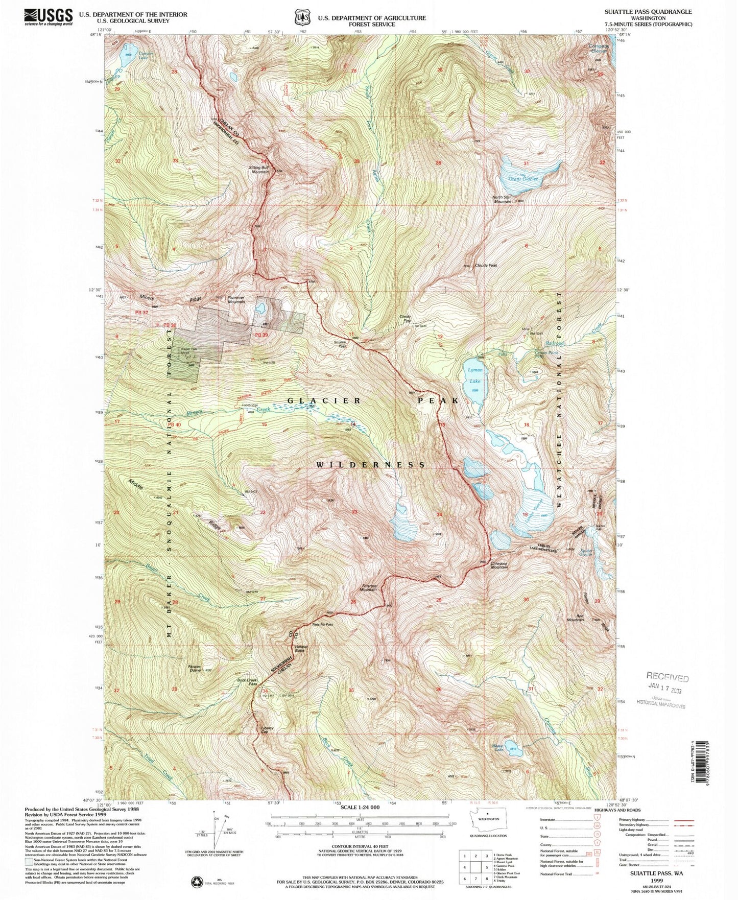
USGS Classic Suiattle Pass Washington 7.5'x7.5' Topo Map
Couldn't load pickup availability
Historical USGS topographic quad map of Suiattle Pass in the state of Washington. Scale: 1:24000. Print size: 24" x 27"
This quadrangle is in the following counties: Chelan, Snohomish.
The map contains contour lines, roads, rivers, towns, lakes, and grids including latitude / longitude and UTM / MGRS. Printed on high-quality waterproof paper with UV fade-resistant inks.
Contains the following named places: Buck Creek Pass, Canyon Lake, Chiwawa Mountain, Cloudy Pass, Cloudy Peak, Crown Point Falls, Flower Dome, Fortress Mountain, Glacier Peak Mines, Grant Glacier, Helmet Butte, Liberty Cap, Lyman Glacier, Lyman Lake, Massie Lake, Middle Ridge, Miners Creek Trail (historical), Miners Ridge, North Star Mountain, Pass No Pass, Phelps Ridge, Plummer Mountain, Red Mountain, Rubin Creek, Sitting Bull Mountain, Spider Glacier, Suiattle Pass, Spider Gap, Lady Camp, Lake Wenatchee Ranger District (historical)