MyTopo
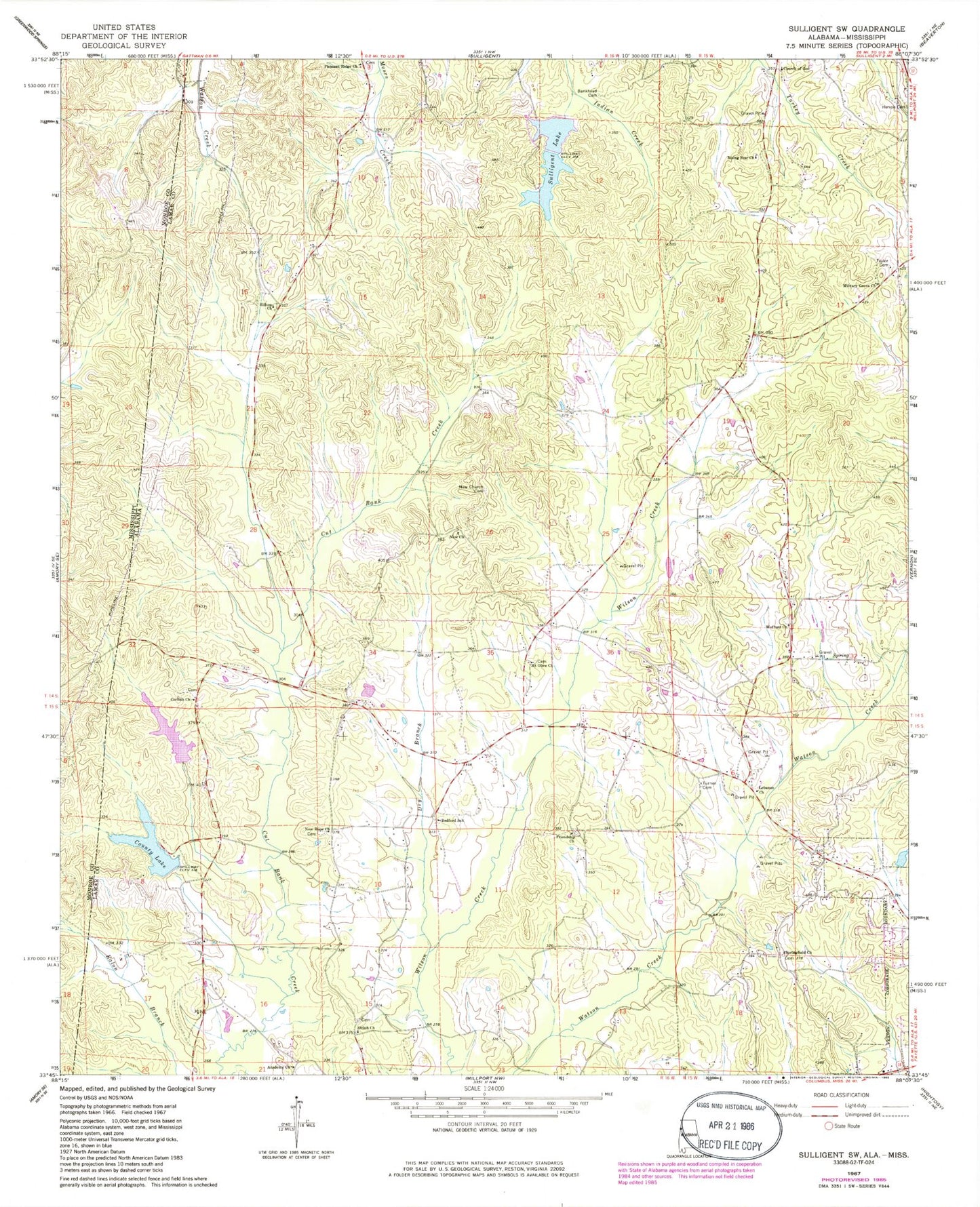
Classic USGS Sulligent SW Alabama 7.5'x7.5' Topo Map
Couldn't load pickup availability
Historical USGS topographic quad map of Sulligent SW in the state of Alabama. Map scale may vary for some years, but is generally around 1:24,000. Print size is approximately 24" x 27"
This quadrangle is in the following counties: Lamar, Monroe.
The map contains contour lines, roads, rivers, towns, and lakes. Printed on high-quality waterproof paper with UV fade-resistant inks, and shipped rolled.
Contains the following named places: Academy Church, B B Box Dam, B B Box Lake, Bankhead Cemetery, Bedford, Bedford School, Church of God, Corinth Cemetery, Corinth Church, County Lake, Dry Branch, Faulkner Lake, Faulkner Lake Dam, Freewill Chapel, Friendship Cemetery, Friendship Church, Herron Cemetery, Hillsdale Dairy, Hilltop Church, Lamar County Public Lake Dam, Lebanon Church, Military Grove Church, Military Grove Gas Field, Mount Olive Cemetery, Mount Olive Church, New Church, New Church Cemetery, New Hope Cemetery, New Hope United Methodist Church, Pleasant Ridge Cemetery, Pleasant Ridge Church, Rising Star Cemetery, Rising Star Church, Shiloh, Shiloh Baptist Church, Shiloh Cemetery, Springfield Cemetery, Springfield Church, Sulligent Dam, Sulligent Lake, Taylor Cemetery, Turner Cemetery, William Phillips Dam at Bedford, William Phillips Lake, Wofford Cemetery, Wofford Church