MyTopo
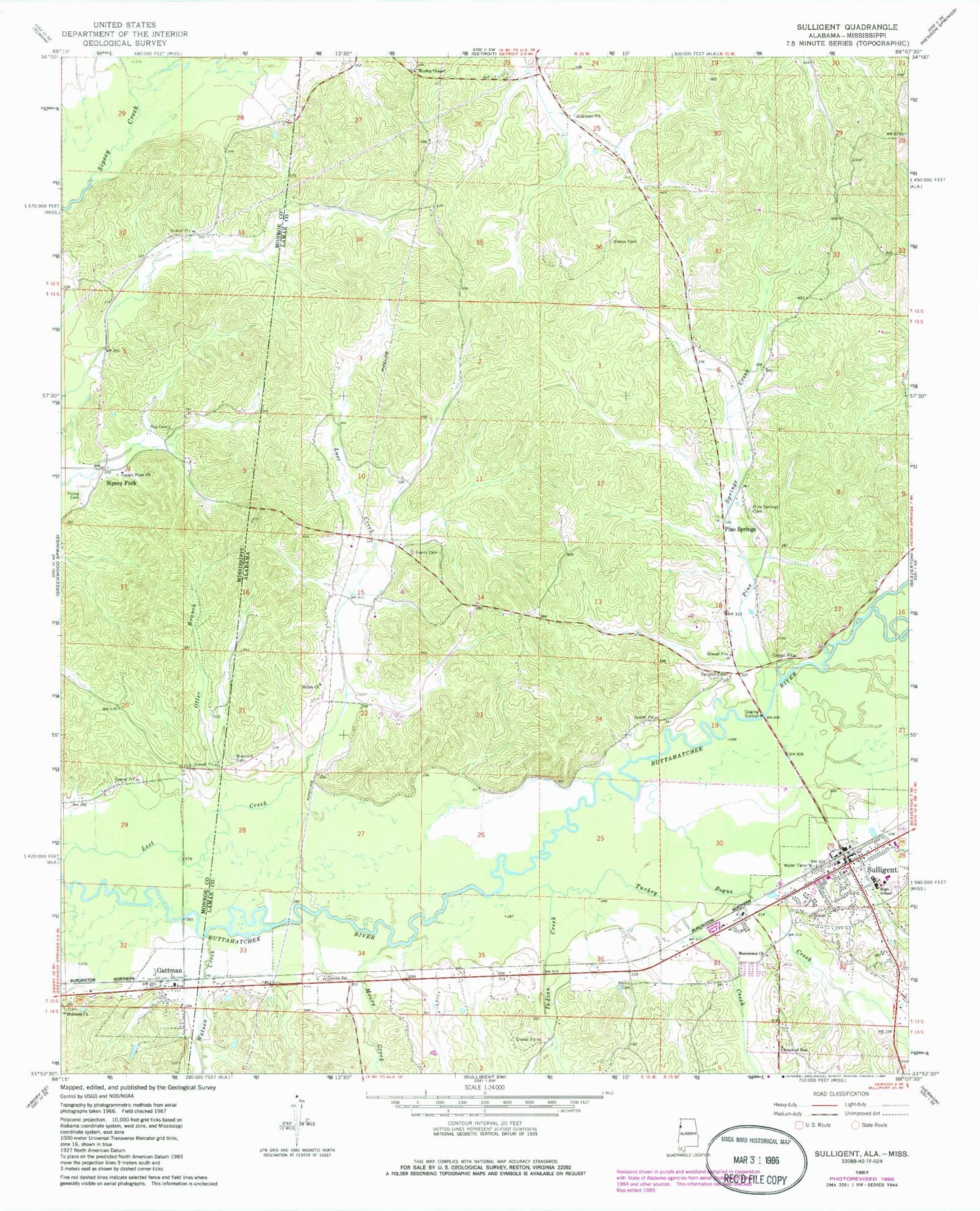
Classic USGS Sulligent Alabama 7.5'x7.5' Topo Map
Couldn't load pickup availability
Historical USGS topographic quad map of Sulligent in the states of Alabama, Mississippi. Map scale may vary for some years, but is generally around 1:24,000. Print size is approximately 24" x 27"
This quadrangle is in the following counties: Lamar, Monroe.
The map contains contour lines, roads, rivers, towns, and lakes. Printed on high-quality waterproof paper with UV fade-resistant inks, and shipped rolled.
Contains the following named places: Almon Cemetery, Blaylock Cemetery, Bogue Creek, Brown Stadium, Center Point Church, Church of God, City of Sulligent, Evans Cemetery, Gattman, Gattman Baptist Church, Gattman Holiness Church, Gattman Post Office, Gattman United Methodist Church, Hollis Cemetery, Indian Creek, Lost Creek, Macedonia Cemetery, Macedonia Primitive Baptist Church, Moors Creek, Otter Branch, Pickle Cemetery, Pine Springs, Pine Springs Cemetery, Pine Springs Creek, Pine Springs Methodist Church, Ray Cemetery, Sandlin Cemetery, Shiloh Church, Sipsey Fork, Sulligent, Sulligent Cemetery, Sulligent High School, Sulligent Police Department, Sulligent Post Office, Sulligent Volunteer Fire Department, Turkey Creek, Village of Gattman, Watson Creek, Wesley Chapel Cemetery, Wesley Chapel Gas Field, Wesley Chapel Methodist Church, ZIP Code: 35586