MyTopo
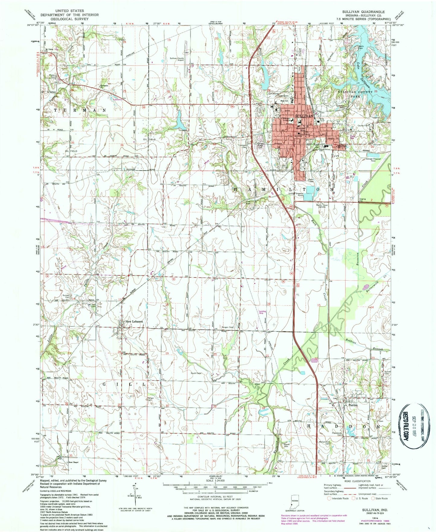
Classic USGS Sullivan Indiana 7.5'x7.5' Topo Map
Couldn't load pickup availability
Historical USGS topographic quad map of Sullivan in the state of Indiana. Map scale may vary for some years, but is generally around 1:24,000. Print size is approximately 24" x 27"
This quadrangle is in the following counties: Sullivan.
The map contains contour lines, roads, rivers, towns, and lakes. Printed on high-quality waterproof paper with UV fade-resistant inks, and shipped rolled.
Contains the following named places: Bible View Church, Boone Cemetery, Buck Creek, Burnett Cemetery, Busseron Dam Number L-1, Busseron Dam Number L-S, Buttermilk Creek, Center Ridge Cemetery, Central Elementary School, City of Sullivan, Coffman Cemetery, Evangelic Church, Gill Township Volunteer Fire Department Station 2, Lake Sullivan, McCammon Cemetery, McClellan Snyder Cemetery, Morgan Cemetery, Mount Tabor Church, Mount Zion Cemetery, New Lebanon, Parson Cemetery, Paxton, Poplar Cemetery, Providence Cemetery, Purcell Cemetery, Robbins Branch, Rose Chapel, South Cemetery, Sullivan, Sullivan City Fire Department Station 1, Sullivan City Fire Department Station 2, Sullivan County, Sullivan County Airport, Sullivan County Ambulance Service, Sullivan County Park, Sullivan County Sheriff's Office, Sullivan High School, Sullivan Junior High School, Sullivan Police Department, Sullivan Post Office, Timmons Cemetery, Township of Hamilton, Walls Cemetery, WNDI-AM (Sullivan), WNDI-FM (Sullivan), ZIP Codes: 47865, 47882