MyTopo
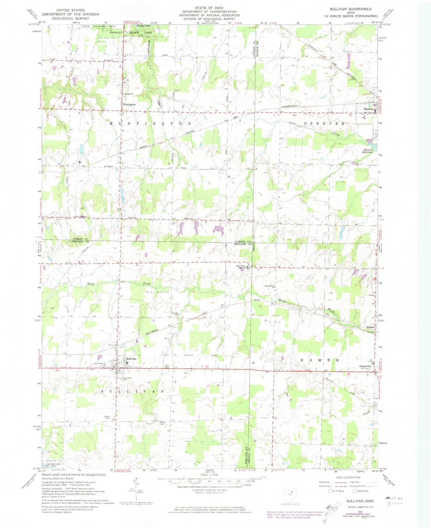
Classic USGS Sullivan Ohio 7.5'x7.5' Topo Map
Couldn't load pickup availability
Historical USGS topographic quad map of Sullivan in the state of Ohio. Map scale may vary for some years, but is generally around 1:24,000. Print size is approximately 24" x 27"
This quadrangle is in the following counties: Ashland, Lorain, Medina.
The map contains contour lines, roads, rivers, towns, and lakes. Printed on high-quality waterproof paper with UV fade-resistant inks, and shipped rolled.
Contains the following named places: Black River High School, Black River Intermediate School, Black River Middle School, Black River Primary School, Centerville, Gould Cemetery, Homer, Homerville, Homerville Post Office, Hubler Cemetery, Huntington, Huntington Center Cemetery, Huntington Post Office, Huntington Public School, Huntington Station, Huntington Township Hall, Loretta Lake, Loretta Lake Dam, Marsh Cemetery, Newtons, Rice Cemetery, Rustic Lake, Rustic Lake Dam, Southview Cemetery, Spencer Reservoir, Sullivan, Sullivan Census Designated Place, Sullivan Post Office, Sullivan Volunteer Fire Department, Sullivan Volunteer Fire Department Station 2, Taylor Lake, Taylor Lake Dam, Township of Homer, Township of Huntington, Township of Sullivan, United Church, West Homer Church, West Main Street Cemetery, ZIP Code: 44880