
MyTopo
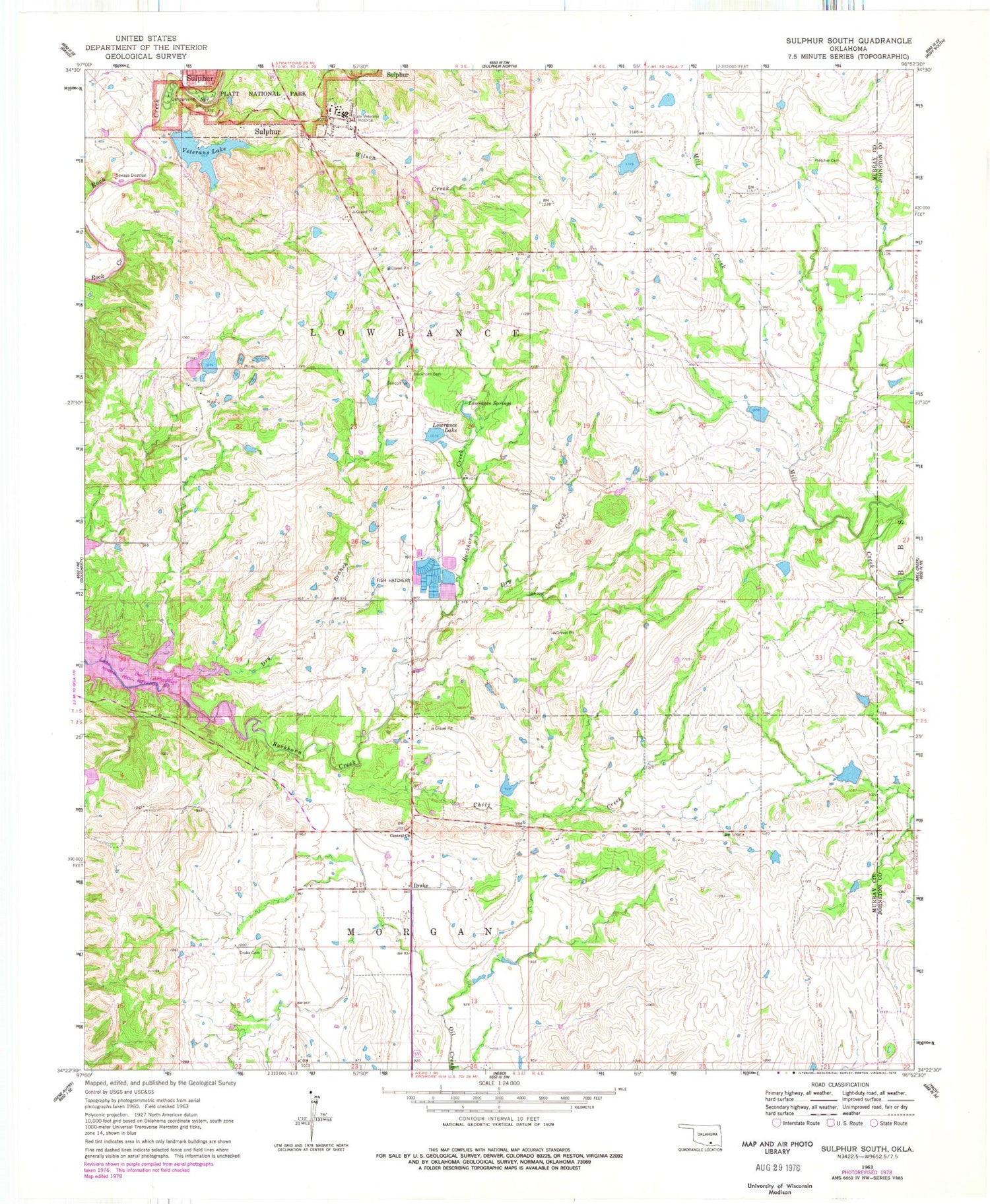
Classic USGS Sulphur South Oklahoma 7.5'x7.5' Topo Map
Couldn't load pickup availability
Historical USGS topographic quad map of Sulphur South in the state of Oklahoma. Typical map scale is 1:24,000, but may vary for certain years, if available. Print size: 24" x 27"
This quadrangle is in the following counties: Johnston, Murray.
The map contains contour lines, roads, rivers, towns, and lakes. Printed on high-quality waterproof paper with UV fade-resistant inks, and shipped rolled.
Contains the following named places: Buckhorn Cemetery, Buckhorn Creek, Central Church, Chili Creek, Drake - Nebo Cemetery, Dry Branch, Dry Creek, Fletcher Cemetery, Lowrance Lake, Lowrance Springs, State Veterans Hospital, Veterans Lake, Wilson Creek, Sulphur Bromide Spring, Drake, Bromide Hill, Bromide Spring, Cliff Bromide Springs, Cliffside Trail, Robbers Roost, Sulphur Asphalt Spring, Mount Airy, Veterans Lake Dam, Mill Creek Watershed 16 Dam, Mill Creek Watershed 16 Reservoir, Mill Creek Watershed 14 Dam, Mill Creek Watershed 14 Reservoir, Mill Creek Watershed 10 Dam, Mill Creek Watershed 10 Reservoir, Mill Creek Watershed 8 Dam, Mill Creek Watershed 8 Reservoir, Township of Lowrance, Township of Morgan, East Murray Division, Cedar Blue Volunteer Fire Department, Rock Prarie Fire Department


