MyTopo
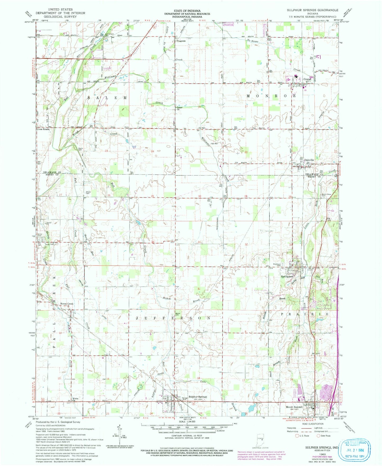
Classic USGS Sulphur Springs Indiana 7.5'x7.5' Topo Map
Couldn't load pickup availability
Historical USGS topographic quad map of Sulphur Springs in the state of Indiana. Map scale may vary for some years, but is generally around 1:24,000. Print size is approximately 24" x 27"
This quadrangle is in the following counties: Delaware, Henry.
The map contains contour lines, roads, rivers, towns, and lakes. Printed on high-quality waterproof paper with UV fade-resistant inks, and shipped rolled.
Contains the following named places: Abshire Ditch, Beech Grove Cemetery, Bethel Brook, Bethel Cemetery, Bowers Cemetery, Cowan, Cross Roads, Hillside Brook, Honey Creek, Jefferson Township Fire Department, Lake Branch, Miller Cemetery, Monroe Township Cowan Volunteer Fire Department, Mount Run, Mount Summit, Mount Summit Post Office, Oakville, Oakville Post Office, Peckinpaugh Ditch, Port Run, Prairie Township Volunteer Fire Department, Progress, Roberts Field, Sharp Cemetery, Sharp Run, Small Branch, Spring Run, Springport, Springport Post Office, Sulphur Drain, Sulphur Springs, Sulphur Springs Elementary School, Sulphur Springs Post Office, Summit Brook, Sunderland Cemetery, Tabor Church, The Last Resort Airport, Town of Mount Summit, Town of Springport, Township of Jefferson, Township of Monroe, Welsh Creek, White Church, Williams Creek, WMDH-FM (New Castle), Woodlawn Cemetery, ZIP Codes: 47361, 47367, 47386, 47388